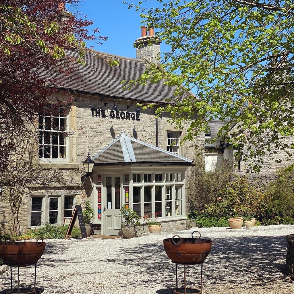
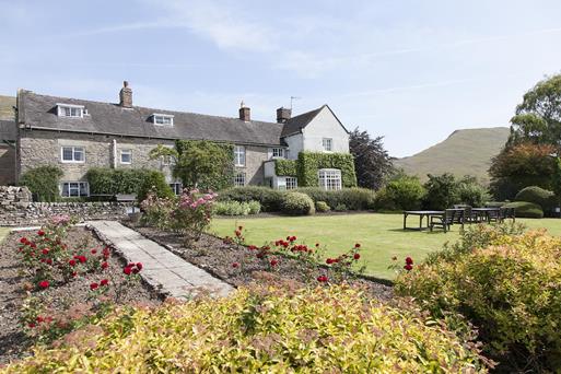


Ash Tree Cottage
Ash Tree Cottage is a 2-bedroom home-from-home with comfortable seating, flat screen TV with sky…

The Upper Dove valley offers pleasant walking above the remnants of a once mighty Norman castle.
Hartington
7.8 miles (12.6kms)
Hartington, lying in the mid-regions of the Dove Valley, is a prosperous village with 18th-century houses and hotels built in local limestone and lined around spacious greens. Its history can be traced back to the Normans, when it was recorded as Hartedun, the centre of the De Ferrier’s Estate. Hartington Hall, now a youth hostel, was first built in 1350, but was substantially rebuilt in 1611. Bonnie Prince Charlie is reputed to have stopped here in 1745 on his march into Derby, where 5,000 Highland troops were amassing to fight for the Jacobite cause. He didn’t know that the Duke of Devonshire had amassed 30,000 loyalists.
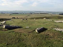
Pilsbury Castle hides from view until the very last moment, but then a grassy ramp swoops down to it from the hillsides. Only the earthworks are now visible; you can see the motte, a man-made mound built to accommodate the wooden keep, and the bailey, a raised embankment that would have had a wooden stockade round it. The castle’s exact history is disputed. It was probably built around 1100 by the Normans, on the site of an Iron Age fort. It may have been a stronghold used earlier by William I to suppress a local rebellion in his ‘Wasting of the North’ campaign. Being in the middle of the De Ferrier Estate it was probably their administrative centre. In the 1200s this function would have been moved to Hartington. Views up the valley are fascinating, with the sharp limestone ridges of the Parkhouse and Chrome Hills in the distance. Now the route descends into Dovedale for the first time, crossing the river into Staffordshire and climbs to a high lane running the length of the dale’s east rim. Note the change in the rock: it’s now the darker gritstone. Now you can see for miles, across the Manifold Valley to The Roaches and Hen Cloud, before Sheen Hill blocks the view. A field path takes the route on its finale, descending along a line of crags with lofty views.
Turn left out of the car park and follow the road, curving right through the centre of the village. Turn left on to Hyde Lane. After half a mile (800m), and just after a large barn, fork left towards Pilsbury and Crowdecote over a stepstile and into fields. Follow waymarkers across three fields, then at the start of the fourth swing left beside a dry-stone wall.
Go through a white-painted gateway and on to a concrete track, which you follow down to a sharp bend. Leave the track here, continuing straight ahead back into fields. Initially stay near the top wall, then across the open hillside. The path is well marked with occasional white-painted posts and crossing stiles.
Meet a track by a clump of trees, go through a gate, cross the track, then maintain your direction on a footpath towards Pilsbury and Crowdecote. This again is well signed across fields with yellow-topped fingerposts. Cross a faint farm track then descend into a small grassy valley.
Fork left in the valley bottom on a grassy path. Cross a lane by a barn and across fields to Crowdecote, passing just right of a breezeblock hut then beside a stone wall. Suddenly, Pilsbury Castle comes into view, the path then raking down to a track and a kissing gate into the castle enclosure.
A grassy track leads right downhill and out of the enclosure to continue along the valley bottom across successive pastures. A developing track eventually leads to Bridge End Farm.
Turn left just after a farm silo to cross the River Dove by a little footbridge. Follow the path directly uphill across a field.
Beyond the wall stile the path veers right, through scrub, to reach the Longnor Road near Edge Top. After heavy rain and in winter you may wish to stay on the Longnor Road from Crowdecote, otherwise turn left along the high lane, reaching High Close Farm after roughly 1.75 miles (2.8km). Keep going to a bend right in the road.
Turn left at this bend into a farm driveway (Harris Close Farm). There’s an 1842 plaque near the top of the house wall. Immediately as you enter the yard, head for the far right of a barn and over a stile. Follow the right wall across successive fields, keeping ahead beyond its end. After going through a small pine plantation, bear left to descend through scrub to the valley. Turn right along a farm track.
Take the next gate left and directly across a field to a footbridge across the Dove. Bear right to a gate and follow a diagonal route across several fields. Enter woodland (now screening modern housing built on the former creamery) by a gate and continue at the edge of a final field to a lane. Turn left back to Hartington, then right at the Market Square to the car park.
Field paths and lanes, some steep climbs, ascent from Crowdecote and descent to Hartington can be very slippery in wet conditions, many stiles
Pastures and limestone valley
Keep dogs on lead; metal-grilled footpath
OS Explorer OL24 Peak District – White Peak Area
Parson’s Field pay car park in Hartington
Opposite side of road to car park
Ancient mine shafts on access land near Carder Low may mot be fenced off.
Read our tips to look after yourself and the environment when following this walk.
It was Staffordshire that bore the brunt of the largest non-nuclear explosion of World War II, when a munitions dump at RAF Fauld went up in 1944. It was also the county’s regiment that once boasted within its ranks the most decorated NCO of World War I, in the person of William Coltman (1891-1974). Going back a little further, George Handel penned his world-famous masterpiece The Messiah on Staffordshire soil. During another chapter of Staffordshire history, the county was home to the first canals and the first factory in Britain, and it had front-row seats for the drama surrounding one of the most notorious murder trials of the 19th century, that of Doctor William Palmer.
In outline, Staffordshire looks not unlike the profile of a man giving Leicestershire a big kiss. The man’s forehead is arguably the best region for hillwalking, as it comprises a significant chunk of the Peak District. This area is characterised by lofty moors, deep dales and tremendous views of both. Further south are the six sprawling towns that make up Stoke-on-Trent, which historically have had such an impact on Staffordshire’s fortunes, not to mention its culture and countryside. This is pottery country, formerly at the forefront of the Industrial Revolution and the driving force behind a network of canals that still criss-cross the county.
Discover more than 15,000 professionally rated places to stay, eat and visit from across the UK and Ireland.
Choose a place to stay safe in the knowledge that it has been expertly assessed by trained assessors.
Search by location or the type of place you're visiting to find your next ideal holiday experience.
Read our articles, city guides and recommended things to do for inspiration. We're here to help you explore the UK.