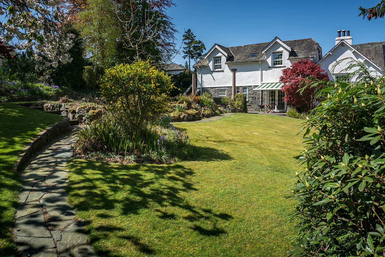
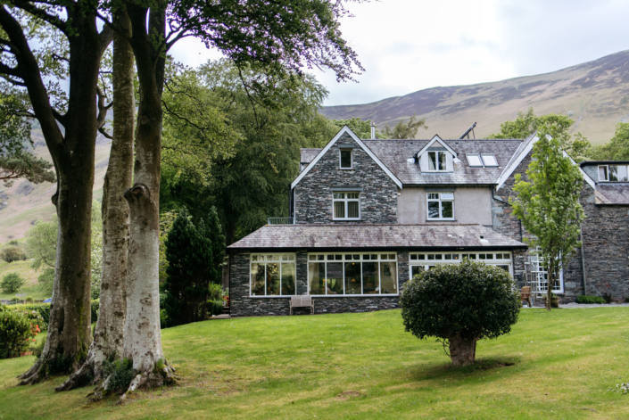
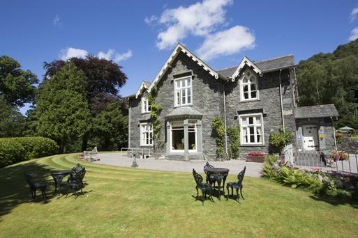


YHA Hawse End
Located on the doorstep of picturesque Derwentwater, and at the head of the magnificent…

A delightful romp high above two lovely valleys steeped in industrial history culminates in views over Derwent Water.
Cat Bells
9 miles (14.5kms)
Both Borrowdale and the Newlands Valley, like many parts of Lakeland, have seen extensive periods of industry from an early age. This walk takes you over Maiden Moor, from where you can see scree issuing from the workings of an old mine in Newlands. This Goldscope, a name that first appears in records during the reign of Elizabeth I, who imported German miners to work here in a serious attempt to exploit England’s own resources to reduce dependency on imports. The name is a corruption of ‘Gottesgab’ or ‘God’s gift’, so called because it was one of the most prosperous mines in Lakeland. Copper was mined here as early as the 13th century from a vein 9ft (2.7m) thick. The mine also produced large quantities of lead, a small amount of silver and a modicum of gold. Copper ore was taken by packhorse to the shores of Derwent Water by way of Little Town. It was then transported to a smelter on the banks of the River Greta, at Brigham. From here the copper went to the Receiving House (now the Moot Hall) in Keswick, to receive the Queen’s Mark.
The Rigghead Quarries in Tongue Gill produced slate from levels cut deep into the fellside and a number of adits are still open, though they are dangerous and should not be explored. But the real secret of these fells is wad, more commonly known as graphite, or the lead in your pencil. Its discovery dates from the early 16th century, when trees uprooted in a storm revealed a black mineral on their roots. Shepherds soon realised that the substance was useful for marking sheep, and later for making metal castings and as a lubricant. Its other uses included a fixing agent for blue dyes, glazing pottery, a rust preventative and polishing iron. Pencils, for which graphite was ultimately used, appeared around 1660 as wooden sticks with a piece of graphite in the tip. Keswick became the world centre of the graphite and pencil industries, the first record of a pencil factory here appearing in 1832. The Cumberland Pencil Company was set up in nearby Braithwaite in 1868, and moved to Keswick 30 years later. The old factory is now the site of a pencil museum.
Take the path climbing from the eastern end of the car park. On a bend to the right, bear right at a fork in the path. This becomes stepped and rocky as it rises steeply. Continue uphill, clambering up small rocky outcrops before reaching Skelgill Bank. The onward route keeps to the centre of a grassy ridge, before rising through more rock outcrops to Cat Bells.
From Cat Bells descend easily to the broad col of Hause Gate. Go forward across Hause Gate on a clear path and onto the broad expanse of Maiden Moor, across which a good path leads to the summit of High Spy, marked by a tall cairn.
Head down a path towards the col housing Dalehead Tarn. Gradually, the top end of the ravine of Tongue Gill appears over to the left. Strike off southeast towards it about 500yds (457m) after leaving High Spy’s summit cairn. Such paths as there are across to Tongue Gill are indistinct and invariably wet underfoot, but just keep heading for a fence.
Either of the stiles across the fence gives on to a path leading to a cairn at the start of a path down to Rigghead Quarries. Take care descending the steep slate paths until the gradient eases alongside Tongue Gill itself. Keeping to the south bank, follow the gill to a path T-junction, and there turn left to a gate and footbridge.
The path climbs gently and soon crosses a shallow col near Castle Crag. Go past the crag, descending, soon to enter woodland at a gate. When the path splits, bear right to cross a narrow footbridge spanning Broadslack Gill. Follow a path down to the banks of the River Derwent. Just before the river, cross a footbridge on the left and, a little further on, a second bridge. Keep to a path roughly parallel with the river until you reach a wall. Take a broad track following the wall and eventually walk out to a surfaced lane. Go right and walk up to Grange village, then left, following the road.
Just after Manesty Cottages, branch left onto a path climbing gently above the road to a gate. Through this, go forward onto a gently rising broad track and, when it forks, bear right, heading for a path above a wall. Pressing on beyond Brackenburn, the footpath, which affords lovely views of Derwent Water, soon dips to make a brief acquaintance with the road at a small quarry car park. Beyond this gap immediately return to a gently rising path – this is an old road, traversing the lower slopes of Cat Bells. Nearing Hawes End, keep right when the path splits. Turn left at the road and left again to return to the car park.
Generally good paths, but slippery on bare rock on ascent of Cat Bells and indistinct above Tongue Gill, 2 stiles
Fell ridge tops, quarry workings, woodland, riverside path
No particular problems, though sheep roam the tops
OS Explorer OL4 The English Lakes (NW)
Parking area between Hawes End and Skelgill
Public toilets in Grange
Read our tips to look after yourself and the environment when following this walk.
Cumbria's rugged yet beautiful landscape is best known for the Lake District National Park that sits within its boundaries. It’s famous for Lake Windermere, England’s largest lake, and Derwent Water, ‘Queen of the English Lakes'. This beautiful countryside once inspired William Wordsworth and his home, Dove Cottage, in Grasmere is a popular museum. Another place of literary pilgrimage is Hill Top, home of Beatrix Potter, located near Windermere. Tom Kitten, Samuel Whiskers and Jemima Puddleduck were all created here.
Much of Cumbria is often overlooked in favour of the Lake Distirct. In the south, the Lune Valley remains as lovely as it was when Turner painted it. The coast is also a secret gem. With its wide cobbled streets, spacious green and views of the Solway Firth, Silloth is a fine Victorian seaside resort. Other towns along this coastline include Whitehaven, Workington and Maryport. Carlisle is well worth a look – once a Roman camp, its red-brick cathedral dates back to the early 12th century and its 11th-century castle was built by William Rufus.
Discover more than 15,000 professionally rated places to stay, eat and visit from across the UK and Ireland.
Choose a place to stay safe in the knowledge that it has been expertly assessed by trained assessors.
Search by location or the type of place you're visiting to find your next ideal holiday experience.
Read our articles, city guides and recommended things to do for inspiration. We're here to help you explore the UK.