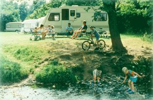


YHA Bridges Long Mynd
The tranquil retreat of YHA Bridges has been described as one of the last remaining rural idylls…

Hope Valley
9.5 miles (15.3kms)
Hope Valley is an ancient woodland of sessile oak, but in the 1960s much of it was felled and replanted with conifers. However, the oaks regenerated from their mossy stumps and Shropshire Wildlife Trust, recognising the potential for restoration, bought the long, narrow wood in 1981. Most of the conifers have now been removed and Hope Valley is recovering.
The Trust installed nest boxes for birds and in the 1980s a naturalist checking one of them was startled to discover a dormouse. This was an exciting find because dormice were known to be in serious decline. Since then, much research has been done to find out exactly where dormice do occur in the county. One way to detect their presence is to look for discarded hazelnut shells. Dormice nibble them in a unique style, leaving a perfectly smooth oval hole with an inner rim.
The good news is that over 30 dormouse colonies have been discovered, several of them in the valleys round Stiperstones. The bad news is that coniferisation, hedge removal, flail cutting and other modern practices have left these colonies isolated and vulnerable. The Trust is working with local landowners to restore hedgerows linking woods, to maintain mature hedgerows and to carry out appropriate woodland management. You're not likely to see any of Hope Valley's dormice, shy and famously sleepy as these endearing mammals are, but it's good to know they're there.
Follow a bridleway through the reserve. Ignore all branching paths and eventually meet a lane. Turn left. After passing the Stables Inn you'll see two footpaths together on the right. Take the right-hand path to a hedge corner and then follow the hedge to the field corner.
Follow the left edge of the next field until a stile leads to a terraced path going down a pasture. Skirt woodland, cross a brook and follow a track towards a farm. Cross a stile, turn left and follow waymarkers to a lane.
Turn left, then first right on a track as far as a stile. Turn right along a field-edge, pass a cottage, then bear left and up to a stile/gate. The path continues across a track and two more fields, then goes through a plantation to a driveway. Turn left to a lane, then right, keeping straight on along a track.
Cross a lane and climb up Bromlow Callow. Enter the fenced Scots pines on the summit. Leaving the trees again, turn sharp left and descend, soon bearing right through gorse to a marshy saddle. Go left to a gate and signboard. Descend rightwards to a lane and go a few paces right to a footpath. Follow this along field-edges and out to a lane.
Descend through a crossroads, towards Hopesgate. Turn first right on a track and follow it to a T-junction, then go left. When it runs out into a field, bear left, roughly following power lines. The track soon becomes clear again.
When you come to an old quarry turn left down a bank (the ground is uneven) and across a field. Twenty yards (18m) left of a power line pole, a path descends to ford a brook. Go right to a stile then walk down the lovely little valley to a footbridge.
Walk to the A488 and cross to a path opposite. Go past a riding centre and follow a fenced path past Croft Cottage to a stile. Go left and climb a steep jungly slope on a clear narrow path. At the crest, bear left and follow frequent waymarks to Bank Farm.
Cross a lawn (waymarks) and follow the access track out to a lane. Turn right, then first left on a bridleway. Bear half-right across a field to find a metal gate and then cross a footbridge. Climb up to another field. Bear right and cross the field to another metal gate and footbridge. Skirt Lower Santley Farm then join a green track. Climb between fields then enter a wood. Turn second right on a path, descending steeply at first. Join a track then keep straight ahead as it bends left, and meet a road in Stiperstones.
Turn left, past the pub and shop, then right at Mytton Dingle. After passing through a gate, turn left and climb very steeply into Stiperstones National Nature Reserve. Follow the path round Oak Hill, then down to a road. Cross and turn sharp left on a track to Central Farm. Turn right at a T-junction, through the farmyard, then along a track.
At Hogstow Hall, turn left for a few paces, then right on a footpath. Cross two fields, a belt of trees, and another field, then go left on a track. Pass through a gateway, then turn right, following the right-hand hedge to a gate. Switch sides and continue down to the A488 and cross to the Hope Valley Nature Reserve.
Some boggy areas, streams to ford, route-finding skills required, very many stiles
Pastoral scene of hills and valleys on the Welsh border
Mostly on lead, particularly in nature reserves
OS Explorer 216 Welshpool & Montgomery
Hope Valley Nature Reserve, signposted from A488
None on route
Read our tips to look after yourself and the environment when following this walk.
Perhaps nowhere else in England will you find a county so deeply rural and with so much variety as Shropshire. Choose a clear day, climb to the top of The Wrekin, and look down on that ‘land of lost content’ so wistfully evoked by A E Housman. Peer through your binoculars and trace the course of Britain’s longest river as the Severn sweeps through the county, from the Breidden Hills to Wyre Forest, slicing Shropshire in two. To the north is a patchwork of dairy fields, hedgerows, copses and crops, broken at intervals by rugged sandstone ridges such as Grinshill or Nesscliffe, and dissected by a complex network of canals.
Spilling over the border into neighbouring Cheshire and North Wales is the unique meres and mosses country, with serenely smooth lakes glinting silver, interspersed with russet-tinged expanses of alder-fringed peat bog, where only the cry of the curlew disturbs the silence. South of the Severn lies the Shropshire Hills AONB. It’s only when you walk Wenlock Edge that you fully discover what a magical place it is – glorious woods and unexpectedly steep slopes plunge to innumerable secret valleys, meadows, streams and farmhouses, all tucked away, invisible from the outside world.
Discover more than 15,000 professionally rated places to stay, eat and visit from across the UK and Ireland.
Choose a place to stay safe in the knowledge that it has been expertly assessed by trained assessors.
Search by location or the type of place you're visiting to find your next ideal holiday experience.
Read our articles, city guides and recommended things to do for inspiration. We're here to help you explore the UK.