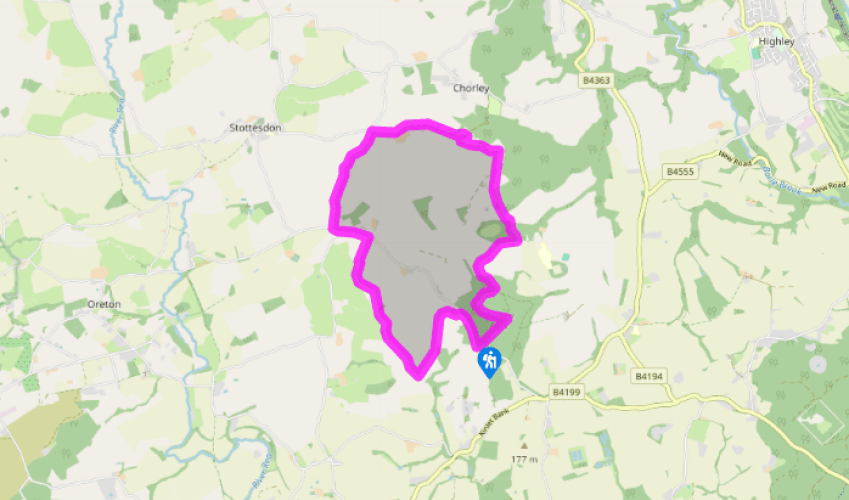
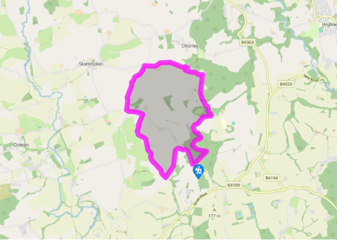
Turn right along the road for 500yds (457m) then turn left on the track to Upper Bradley Farm. Go through the farmyard and, after the last building, go right a few paces to find a clear track between hedges. Follow this then continue down the left edge of a large field. At the bottom go right skirting trees, ignore a track leading to a ford and continue along the bottom edge of the field. In the corner find a footbridge hidden in the foliage.
Continue in similar vein along the lower edges of several fields, with the stream hidden in the trees just to the left. One plank bridge has a very wobbly handrail, but the bridge itself is solid. In the sixth field, the right of way is shown ascending the slope before slanting back to the far end, but if there are growing crops the farmer would surely prefer you to stick to the unplanted margin.
At the end the path is signed through a junk-filled yard, but you can avoid this by using a second stile a few paces to the right. Emerge to the road and turn left for 150yds (137m) to a footpath sign and stile on the right. Cross a yard (Country Treks) to a second stile and descend ahead through horse paddocks to a small gate at the bottom.
Follow field-edges, with a stream in the trees on the right. After four fields, waymarks lead down to the right. Ford the stream (it's usually about 2 inches deep) and go up to a stile, then go left, downstream. Pass a gate and two stiles then bear right up a field to a gate under a tree. (This field has a stream, sometimes dry, down the middle). Through the gate, turn left along the hedge to a track and go right.
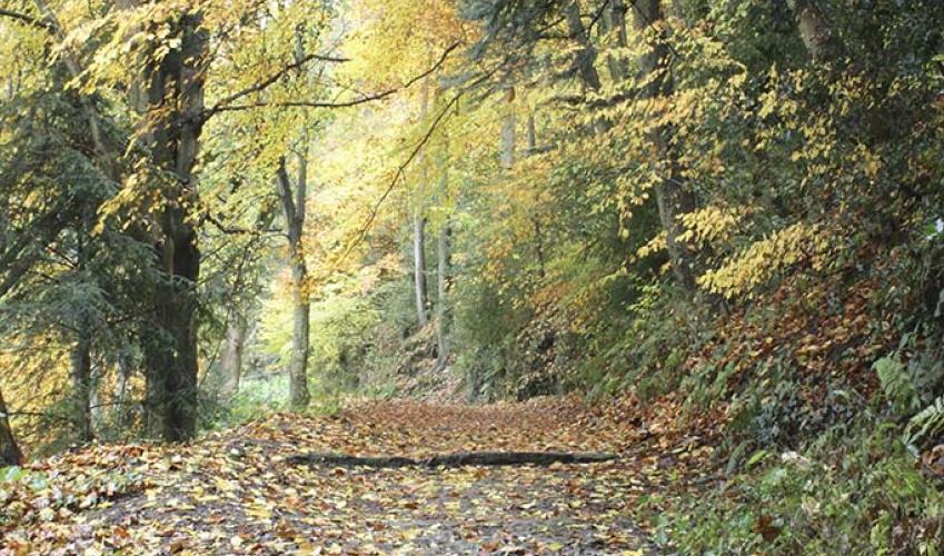
Follow the track past a cottage; ignore a track down to another (Bush Cottage). Shortly there’s a stile, with bridleway waymarks, on the right. Go straight up the field to a gate. Ignore the track in the next field and go straight over the crest and down to a double stile at the corner of a wood. Follow the edge of the wood through a dip then continue ahead to another gate. Turn left then ignore the track and find a little path along the wood-edge and then into it.
Descend to a stream, then go half-left to a waymark post in a cleared area. Go straight up the slope then bear left as the gradient eases, to a waymarked gateway. Turn right on the track to a stile. Cross this or use the gap on the right and follow the right edge of the field. Go through a gate then descend left in a dip, with scattered trees on your right.
A waymarked gate leads into woodland. Descend the track to a four-way junction and go half-right (bridleway). Climb past a cleared area then take a waymarked path on the left. Follow this to a clear track and turn right, straight up to the parking place.
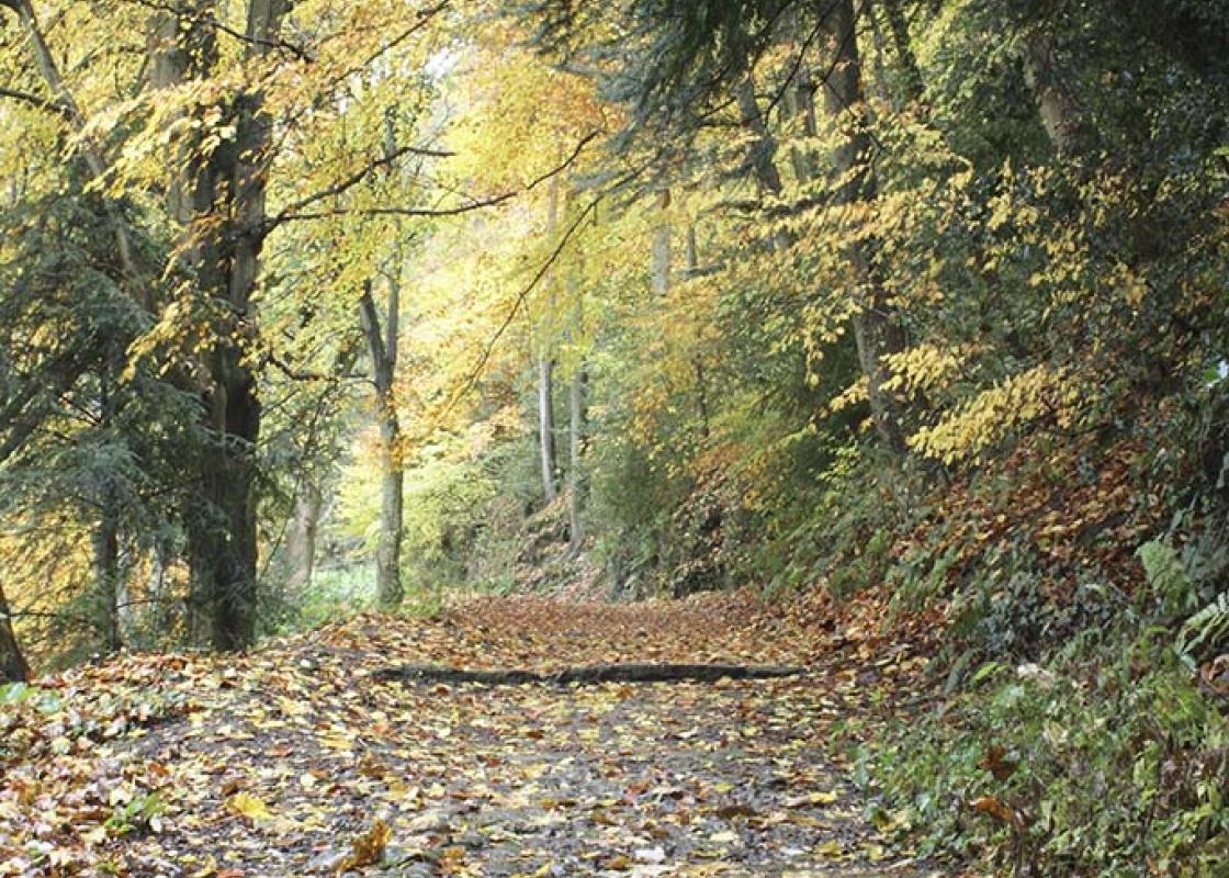
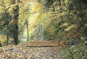
Pack a sense of adventure for this walk, as much of it is little-trodden, with paths that are virtually non-existent. Navigation is actually pretty straightforward as the route largely follows field-edges and stiles and waymarks are all in place, but they can virtually disappear behind the lush... vegetation of the field-corners in high summer. It’s actually good environmental practice by the farmers to leave broad margins clear of commercial crops, so let’s not grumble. And let’s not exaggerate either; this is not the Darien Gap and you won’t need a machete – though shorts-wearers will need to watch out for nettles! It’s precisely that feeling of being (quite literally) off the beaten track that gives this walk its charm. 'Going on was not altogether easy. They had packs to carry, and the bushes and brambles were reluctant to let them through.' J R R Tolkien, The Fellowship of the Ring. Many places have cashed in on the worldwide success of J R R Tolkien’s books, notably The Hobbit and The Lord of the Rings. More recently, Peter Jackson’s epic films have brought Tolkien’s imagined world of Middle Earth to a vast new audience – and because they were filmed in New Zealand, many people imagine that Tolkien, too, was a New Zealander. In fact, though born in South Africa, he grew up in the West Midlands, and never visited New Zealand. Most of the inspiration for Middle Earth lies in the stark contrast between the industrial blight of the Black Country and the idyllic countryside just a stone’s throw away. It’s Worcestershire, not Shropshire, which is the main inspiration for the hobbits’ homeland, The Shire, but Tolkien was fascinated by placenames, and it’s hard to imagine that the name Bagginswood did not attract his attention and inspire the names of his heroes, Bilbo and Frodo Baggins. To be honest, there’s not much to see at Bagginswood, and it’s highly unlikely that its Tolkien connections go any further than suggesting a name. On the other hand, it’s exactly the sort of landscape that Tolkien cherished.
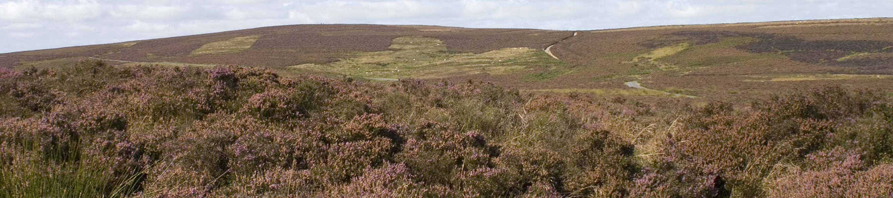
Perhaps nowhere else in England will you find a county so deeply rural and with so much variety as Shropshire. Choose a clear day, climb to the top of The Wrekin, and look down on that ‘land of lost content’ so wistfully evoked by A E Housman.
Turn right along the road for 500yds (457m) then turn left on the track to Upper Bradley Farm. Go through the farmyard and, after the last building, go right a few paces to find a clear track between hedges. Follow this then continue down the left edge of a large field. At the bottom go right skirting trees, ignore a track leading to a ford and continue along the bottom edge of the field. In the corner find a footbridge hidden in the foliage.
1 of 7
Continue in similar vein along the lower edges of several fields, with the stream hidden in the trees just to the left. One plank bridge has a very wobbly handrail, but the bridge itself is solid. In the sixth field, the right of way is shown ascending the slope before slanting back to the far end, but if there are growing crops the farmer would surely prefer you to stick to the unplanted margin.
2 of 7
At the end the path is signed through a junk-filled yard, but you can avoid this by using a second stile a few paces to the right. Emerge to the road and turn left for 150yds (137m) to a footpath sign and stile on the right. Cross a yard (Country Treks) to a second stile and descend ahead through horse paddocks to a small gate at the bottom.
3 of 7
Follow field-edges, with a stream in the trees on the right. After four fields, waymarks lead down to the right. Ford the stream (it's usually about 2 inches deep) and go up to a stile, then go left, downstream. Pass a gate and two stiles then bear right up a field to a gate under a tree. (This field has a stream, sometimes dry, down the middle). Through the gate, turn left along the hedge to a track and go right.
4 of 7
Follow the track past a cottage; ignore a track down to another (Bush Cottage). Shortly there’s a stile, with bridleway waymarks, on the right. Go straight up the field to a gate. Ignore the track in the next field and go straight over the crest and down to a double stile at the corner of a wood. Follow the edge of the wood through a dip then continue ahead to another gate. Turn left then ignore the track and find a little path along the wood-edge and then into it.
5 of 7
Descend to a stream, then go half-left to a waymark post in a cleared area. Go straight up the slope then bear left as the gradient eases, to a waymarked gateway. Turn right on the track to a stile. Cross this or use the gap on the right and follow the right edge of the field. Go through a gate then descend left in a dip, with scattered trees on your right.
6 of 7
A waymarked gate leads into woodland. Descend the track to a four-way junction and go half-right (bridleway). Climb past a cleared area then take a waymarked path on the left. Follow this to a clear track and turn right, straight up to the parking place.
Pack a sense of adventure for this walk, as much of it is little-trodden, with paths that are virtually non-existent. Navigation is actually pretty straightforward as the route largely follows field-edges and stiles and waymarks are all in place, but they can virtually disappear behind the lush... vegetation of the field-corners in high summer. It’s actually good environmental practice by the farmers to leave broad margins clear of commercial crops, so let’s not grumble. And let’s not exaggerate either; this is not the Darien Gap and you won’t need a machete – though shorts-wearers will need to watch out for nettles! It’s precisely that feeling of being (quite literally) off the beaten track that gives this walk its charm. 'Going on was not altogether easy. They had packs to carry, and the bushes and brambles were reluctant to let them through.' J R R Tolkien, The Fellowship of the Ring. Many places have cashed in on the worldwide success of J R R Tolkien’s books, notably The Hobbit and The Lord of the Rings. More recently, Peter Jackson’s epic films have brought Tolkien’s imagined world of Middle Earth to a vast new audience – and because they were filmed in New Zealand, many people imagine that Tolkien, too, was a New Zealander. In fact, though born in South Africa, he grew up in the West Midlands, and never visited New Zealand. Most of the inspiration for Middle Earth lies in the stark contrast between the industrial blight of the Black Country and the idyllic countryside just a stone’s throw away. It’s Worcestershire, not Shropshire, which is the main inspiration for the hobbits’ homeland, The Shire, but Tolkien was fascinated by placenames, and it’s hard to imagine that the name Bagginswood did not attract his attention and inspire the names of his heroes, Bilbo and Frodo Baggins. To be honest, there’s not much to see at Bagginswood, and it’s highly unlikely that its Tolkien connections go any further than suggesting a name. On the other hand, it’s exactly the sort of landscape that Tolkien cherished.
Perhaps nowhere else in England will you find a county so deeply rural and with so much variety as Shropshire. Choose a clear day, climb to the top of The Wrekin, and look down on that ‘land of lost content’ so wistfully evoked by A E Housman.