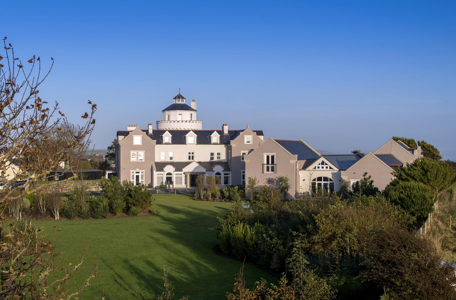

Ty Hotel, Milford Haven Waterfront
Launched in partnership with the Port of Milford Haven and Milford Waterfront, Ty Hotel is…

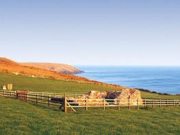
A windswept headland overlooking two offshore islands and a marine nature reserve
Marloes
6 miles (9.7kms)
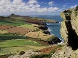
The Marloes Peninsula forms the westernmost tip of the southern shores of St Brides Bay. The paddle-shaped headland is a popular place to walk due to the narrow neck that affords minimum inland walking for maximum time spent on the coast. It is famous for its stunning scenery, which includes two of the National Park’s finest and least-crowded beaches, some secluded coves that are often inhabited by seals, and wonderfully rugged coastline. There are also fine views over a narrow but turbulent sound to the small islands of Skomer and Skokholm – two significant seabird breeding grounds. The walking is captivating, even by Pembrokeshire standards.
Skomer is the largest of the Pembrokeshire islands and is one of the most significant wildlife habitats in the whole country. The island, separated from the mainland by the rushing waters of Jack Sound, measures approximately 1.5 miles (2.4km) from north to south and 2 miles (3.2km) from east to west. It was declared a National Nature Reserve in 1959 and, as well as the protection it receives as part of the National Park, it’s also designated as a Site of Special Scientific Interest (SSSI), a Special Protection Area (SPA) and a Geological Conservation Review Site (GCR). Much of the land is a Scheduled Ancient Monument, courtesy of a number of clearly visible Iron Age settlements and enclosures. And to put the icing on the cake, the sea that surrounds the island is a Marine Nature Reserve, one of only three in the United Kingdom; the others are Lundy, off the North Devon coast and Strangford Lough in Northern Ireland.
The two stars of the Skomer show are the diminutive but colourful puffin and the dowdy and secretive Manx shearwater. Puffins need little introduction; their colourful beaks and clown-like facial markings put them high on everybody’s list of favourite birds. They arrive in April and lay a single egg in a burrow. The chick hatches at the end of May and the adult birds spend the next two months ferrying back catches of sand eels for their flightless offspring. After around seven weeks of this lavish attention, the chick leaves the nest, usually at night, and makes its way to the sea. It will spend the next few years at sea, only returning when it reaches breeding maturity. Between April and July, there are more than 42,500 puffins on the island.
The mouse-like shearwater is slightly larger than the puffin but it also lays its single egg in a burrow, overlooking the sea. It may not be as obviously endearing as its painted neighbour, especially as most visitors to the island never actually see one, but it’s a beautiful and fascinating bird in its own right and there are in fact around 150,000 pairs on Skomer, Skokholm and Middleholm; which amounts to about 60 per cent of the world’s total population. The reason they are seldom seen is because they are fairly vulnerable to predators on land so they leave the nest at dawn and spend the whole day at sea, not returning to their burrow until it’s almost dark. A careful seawatch at last light may reveal them gathering in huge rafts just offshore or even endless lines of flying birds returning to the island – against the sunset, it’s quite a magical sight.
From the bottom of the car park, walk down to the bottom of the hill. Bear around to the left, then go through the gate straight ahead into the Deer Park. Turn left and follow the path along to a gate and out on to the coast.
With the sea to your right, continue easily along over Deadman’s Bay. The next section cruises along easily, passing the earthworks of an Iron Age fort on the left as you approach Gateholm Island.
It is possible to get across to the island at low tide, but care is needed to scramble over the slippery rocks. To continue the walk, follow the coast path, above the western end of the beautiful Marloes Sands until you drop almost onto the beach. Turn left along the wide well-made gravel path.
Climb up to the road; turn right here. Follow the road along for around 0.75 miles (1.2km) to a hedged bridleway on the left. Follow this down and emerge by the clock tower.
Turn left and pass the Lobster Pot Inn, continuing ahead to leave the village. Ignore a few tracks on the right, as the road bends around to the left, and continue out into open countryside where you’ll meet a footpath on the right.
Walk down the edge of the field and bear around to the left to drop back down on to the coast path above Musselwick Sands. Turn left and follow the path west for over 1.5 miles (2.4km) to Martin’s Haven. Meet the road and climb past the information centre back to the car park.
Coast path and clear footpaths, short section on tarmac
Rugged cliff tops and beautiful sandy beaches
Care near cliff tops and poop scoop on beaches
OS Explorer OL36 South Pembrokeshire
National Trust car park above Martin's Haven, near Marloes village
Marloes village and near information centre at start of walk
Read our tips to look after yourself and the environment when following this walk.
Wales meets the Atlantic Ocean in spectacular fashion at Pembrokeshire. Unlike the West Country, Pembrokeshire can offer the coast without the crowds, and quaint fishing villages without those huge coach parks. Volcanic eruptions and earth movements have left a tortured rocky coastline of some 160 miles, whose beauty and drama have been recognised by National Park status.
Sometimes known as ‘Little England Beyond Wales’, the county has held a fascination for English visitors ever since the first Norman warlords forced their way in 800 years ago, leaving a string of 50 fine castles in their wake. The anonymous author of The Mabinogion, an 11th-century collection of Welsh folk legends, started it all. His description of the old Celtic kingdom of Dyfed (which encompasses Cardiganshire, Carmarthenshire and Pembrokeshire) as ‘the land of magic and enchantment’ was perhaps the earliest written attempt to sum up the outstanding natural beauty of this wonderful westernmost outpost of Wales. This is a county where you can take it easy on the sandy beaches, make sport out of those Atlantic waves, or discover the mysteries of St David’s or the ancient Preseli Hills.
Discover more than 15,000 professionally rated places to stay, eat and visit from across the UK and Ireland.
Choose a place to stay safe in the knowledge that it has been expertly assessed by trained assessors.
Search by location or the type of place you're visiting to find your next ideal holiday experience.
Read our articles, city guides and recommended things to do for inspiration. We're here to help you explore the UK.