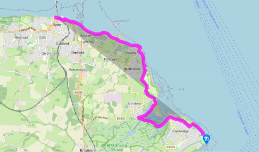
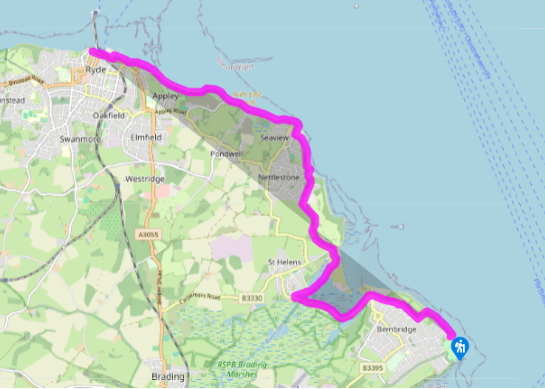
Facing Bembridge lifeboat station, turn left and follow the path along the sea wall, by the Lifeboat View Café and beach huts. Step down at the end and continue along the beach. This is easiest when the tide is part-way out and you can walk on sand rather than shingle. Look for a handrail up on the left by a wooden fence; scramble over the shingle bank and turn up the steps here. Follow the path straight inland – it becomes a wide gravel drive. Turn right at the end of the wall onto a broad path. This runs between houses, to emerge onto a lane. Where the lane bends sharp left, take the footpath right, signed to Ducie Avenue and Bembridge Point. Cross a lane and keep ahead. Descend slightly and meet the road (B3394) on the corner, opposite the distinctive Pilot Boat Inn.
From the Victorian drinking fountain, follow the pavement along the road around Bembridge Harbour. The road skirting the harbour is Embankment Road, built in 1878 for a quarter of a million pounds, a princely sum in those days. Boat sheds and chandlers give way to houseboats. Continue past the café on Fisherman’s Pontoon. Cross the sluice bridge over the River Yar to enter St Helens, and turn right onto Latimer Road. Keep ahead at the end, towards the harbour. Turn right at the wall, and follow the path left and right, then across the dam. This was constructed for the former tide mill. The walk across the dam gives good views back across the harbour and of the old mill workings.
The dam leads to The Duver, once a golf course and now a National Trust property designated a Site of Special Scientific Interest because of its population of 250 or so different, and sometimes rare, wild plants. Follow the arrows ahead across the grass and turn left along the access road. (For toilets, Baywatch on the Beach café and St Helen’s Old Church, continue straight ahead here, through the dunes and turn left along the shore walk.)
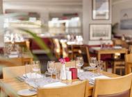
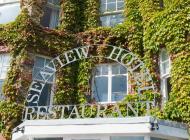
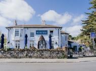
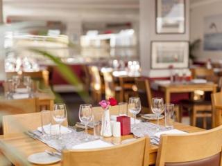
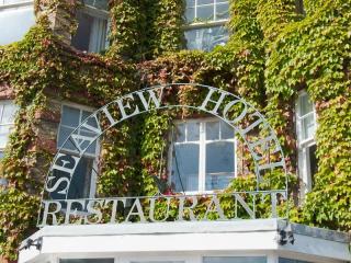
Take the footpath through the hedge, opposite Old Church Lodge, where the access road bends. Go through a kissing gate and walk up the right-hand field edge. Cross a gated wooden bridge and keep right, by a fence. Walk straight up the field to a metal kissing gate, and turn right along the road. Soon turn left through the gateway of the Priory Bay Hotel and walk up the drive. At a second gateway, fork left onto a bridleway along the edge of a wood. Follow this sharp right to cross the drive ahead, and follow this track past houses all the way down to Seagrove Bay. Turn left immediately beyond the public toilets on an enclosed path, signed to Seaview. This track soon becomes a gravel road. Veer right at the end and turn left along the sea wall for a short distance, then follow the road up the hill. This brings you into attractive Seaview village. Turn right down the High Street, passing the Seaview Hotel (public toilets throught the lobby) to Nettlestone Point at the bottom, with superb views over the Solent and No Man’s Land Fort to Portsmouth.
Turn left here, passing The Old Fort Bar/Café and the yacht club. Bear right onto the sea wall. Where this meets a road, continue ahead along the wall. Pass the Hersey Nature Reserve, where wildlife has overtaken the former salt pans. At low tide, it is pleasant to take to the sands here.
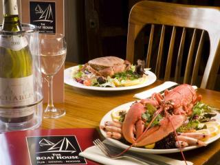
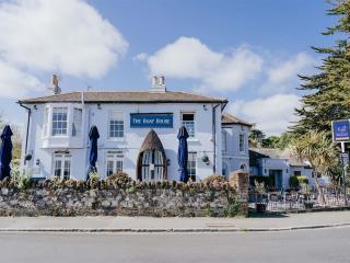
By The Boat House pub at the far end, continue ahead along the sea wall, past a row of beach huts. Ryde’s 0.5 mile long (800m) pier can be clearly seen in the distance, with the roar of the Red Jet passenger ferry and the hovercrafts. Pass more beach huts and the The Dell Café at Puckpool Point, and follow the curving bay round. Keep ahead through Appley Park, past the castellated viewing tower, a picturesque folly built in 1875. Pass more beach huts and toilets, to reach the amusements which mark the entry into Ryde. Pass the large boating lake and follow the roadside past the harbour buildings all the way to the pier.
Terrain
- Easy walking, mostly on firm tracks, roads, paths and sea wall; short stretch of shingle beach at the start</p>
Landscape
- Villages and towns, streets and harbours, meadows and pubic parkland
Dog friendliness
- Lead required along roads, and keep under strict control along seafront
Parking
- Pay and display by Bembridge Lifeboat Station
Toilets en route
- Bembridge by lifeboat station; on seafront at St Helen’s; in the Seaview Hotel, Seaview; along the sea front at Puckpool, Appley and Ryde</p>
The route follows the Coastal Path (69 miles/111km), which is well signed on the ground with blue signs and a seagull symbol. Constant erosion of the island’s coastline means the path may be rerouted at any point, but this is usually clearly marked. Note that access for dogs to most of the island’s... beaches is restricted in summer. For information about bus links and timetables, see www.islandbuses.info Bembridge is a sprawling village which grew to popularity in the 1820s. Its rapid expansion in the 19th century led to the extensive draining and reclaiming of the land behind Bembridge harbour, leaving Brading stranded well inland, but enabling the later construction of the island’s airfield. The lifeboat station sticks out prominently over the notoriously rocky Bembridge Ledge, and covers the eastern end of the very busy seaway. The new station replaced an older one in 2010, at a cost of around £7.8 million, and is well worth exploring when open, with displays about the history of rescues in the area. The walk around curving Bembridge Harbour gives you the chance to examine the intriguing variety of houseboats moored there. They include several which offer very unusual bed and breakfast accommodation. Of St Helen’s Old Church, only the tower remains, built in 13th century. The church began its seawards disintegration in about 1550 and was eventually bricked up in 1703, and painted white for use as a seamark. The route passes down the High Street of Seaview, an attractive small Victorian resort which once had its own pier for landing visitors – a memorial by the shore recalls its use in World War II for embarking troops. Today there’s only a clutch of moored wooden yachts to interrupt the view across to No Man’s Land Fort, one of four such circular structures built in the 1880s to protect the Solent from possible attack. It was later sold off and converted to a lavish private home, and is currently under development as a boutique hotel. The esplanade path to Ryde follows the edge of Puckpool Park, which looks out over the glorious golden East Ryde Sands. It is the site of another of Palmerston’s Victorian forts, and like so much of the island, it was taken over by troops during World War II in the run-up to D-Day. The park was first occupied by the Fleet Air Arm, and renamed HMS Medina, before being filled with accommodation for naval engineers who were working on the landing craft that would take the Allied troops onto the beaches of France.
Small and intimate – at just 23 miles by 13 miles, the Isle of Wight is a popular holiday destination; with its mild climate, long hours of sunshine and colourful architecture, it has something of a continental flavour. Visitors can walk along the island’s varied coastline using the well-established Coast Path or step back in time to explore the island’s history at some of the forts and castles.
Facing Bembridge lifeboat station, turn left and follow the path along the sea wall, by the Lifeboat View Café and beach huts. Step down at the end and continue along the beach. This is easiest when the tide is part-way out and you can walk on sand rather than shingle. Look for a handrail up on the left by a wooden fence; scramble over the shingle bank and turn up the steps here. Follow the path straight inland – it becomes a wide gravel drive. Turn right at the end of the wall onto a broad path. This runs between houses, to emerge onto a lane. Where the lane bends sharp left, take the footpath right, signed to Ducie Avenue and Bembridge Point. Cross a lane and keep ahead. Descend slightly and meet the road (B3394) on the corner, opposite the distinctive Pilot Boat Inn.
1 of 6
From the Victorian drinking fountain, follow the pavement along the road around Bembridge Harbour. The road skirting the harbour is Embankment Road, built in 1878 for a quarter of a million pounds, a princely sum in those days. Boat sheds and chandlers give way to houseboats. Continue past the café on Fisherman’s Pontoon. Cross the sluice bridge over the River Yar to enter St Helens, and turn right onto Latimer Road. Keep ahead at the end, towards the harbour. Turn right at the wall, and follow the path left and right, then across the dam. This was constructed for the former tide mill. The walk across the dam gives good views back across the harbour and of the old mill workings.
2 of 6
The dam leads to The Duver, once a golf course and now a National Trust property designated a Site of Special Scientific Interest because of its population of 250 or so different, and sometimes rare, wild plants. Follow the arrows ahead across the grass and turn left along the access road. (For toilets, Baywatch on the Beach café and St Helen’s Old Church, continue straight ahead here, through the dunes and turn left along the shore walk.)
3 of 6
Take the footpath through the hedge, opposite Old Church Lodge, where the access road bends. Go through a kissing gate and walk up the right-hand field edge. Cross a gated wooden bridge and keep right, by a fence. Walk straight up the field to a metal kissing gate, and turn right along the road. Soon turn left through the gateway of the Priory Bay Hotel and walk up the drive. At a second gateway, fork left onto a bridleway along the edge of a wood. Follow this sharp right to cross the drive ahead, and follow this track past houses all the way down to Seagrove Bay. Turn left immediately beyond the public toilets on an enclosed path, signed to Seaview. This track soon becomes a gravel road. Veer right at the end and turn left along the sea wall for a short distance, then follow the road up the hill. This brings you into attractive Seaview village. Turn right down the High Street, passing the Seaview Hotel (public toilets throught the lobby) to Nettlestone Point at the bottom, with superb views over the Solent and No Man’s Land Fort to Portsmouth.
4 of 6
Turn left here, passing The Old Fort Bar/Café and the yacht club. Bear right onto the sea wall. Where this meets a road, continue ahead along the wall. Pass the Hersey Nature Reserve, where wildlife has overtaken the former salt pans. At low tide, it is pleasant to take to the sands here.
5 of 6
By The Boat House pub at the far end, continue ahead along the sea wall, past a row of beach huts. Ryde’s 0.5 mile long (800m) pier can be clearly seen in the distance, with the roar of the Red Jet passenger ferry and the hovercrafts. Pass more beach huts and the The Dell Café at Puckpool Point, and follow the curving bay round. Keep ahead through Appley Park, past the castellated viewing tower, a picturesque folly built in 1875. Pass more beach huts and toilets, to reach the amusements which mark the entry into Ryde. Pass the large boating lake and follow the roadside past the harbour buildings all the way to the pier.
Terrain
- Easy walking, mostly on firm tracks, roads, paths and sea wall; short stretch of shingle beach at the start</p>
Landscape
- Villages and towns, streets and harbours, meadows and pubic parkland
Dog friendliness
- Lead required along roads, and keep under strict control along seafront
Parking
- Pay and display by Bembridge Lifeboat Station
Toilets en route
- Bembridge by lifeboat station; on seafront at St Helen’s; in the Seaview Hotel, Seaview; along the sea front at Puckpool, Appley and Ryde</p>
The route follows the Coastal Path (69 miles/111km), which is well signed on the ground with blue signs and a seagull symbol. Constant erosion of the island’s coastline means the path may be rerouted at any point, but this is usually clearly marked. Note that access for dogs to most of the island’s... beaches is restricted in summer. For information about bus links and timetables, see www.islandbuses.info Bembridge is a sprawling village which grew to popularity in the 1820s. Its rapid expansion in the 19th century led to the extensive draining and reclaiming of the land behind Bembridge harbour, leaving Brading stranded well inland, but enabling the later construction of the island’s airfield. The lifeboat station sticks out prominently over the notoriously rocky Bembridge Ledge, and covers the eastern end of the very busy seaway. The new station replaced an older one in 2010, at a cost of around £7.8 million, and is well worth exploring when open, with displays about the history of rescues in the area. The walk around curving Bembridge Harbour gives you the chance to examine the intriguing variety of houseboats moored there. They include several which offer very unusual bed and breakfast accommodation. Of St Helen’s Old Church, only the tower remains, built in 13th century. The church began its seawards disintegration in about 1550 and was eventually bricked up in 1703, and painted white for use as a seamark. The route passes down the High Street of Seaview, an attractive small Victorian resort which once had its own pier for landing visitors – a memorial by the shore recalls its use in World War II for embarking troops. Today there’s only a clutch of moored wooden yachts to interrupt the view across to No Man’s Land Fort, one of four such circular structures built in the 1880s to protect the Solent from possible attack. It was later sold off and converted to a lavish private home, and is currently under development as a boutique hotel. The esplanade path to Ryde follows the edge of Puckpool Park, which looks out over the glorious golden East Ryde Sands. It is the site of another of Palmerston’s Victorian forts, and like so much of the island, it was taken over by troops during World War II in the run-up to D-Day. The park was first occupied by the Fleet Air Arm, and renamed HMS Medina, before being filled with accommodation for naval engineers who were working on the landing craft that would take the Allied troops onto the beaches of France.
Small and intimate – at just 23 miles by 13 miles, the Isle of Wight is a popular holiday destination; with its mild climate, long hours of sunshine and colourful architecture, it has something of a continental flavour. Visitors can walk along the island’s varied coastline using the well-established Coast Path or step back in time to explore the island’s history at some of the forts and castles.