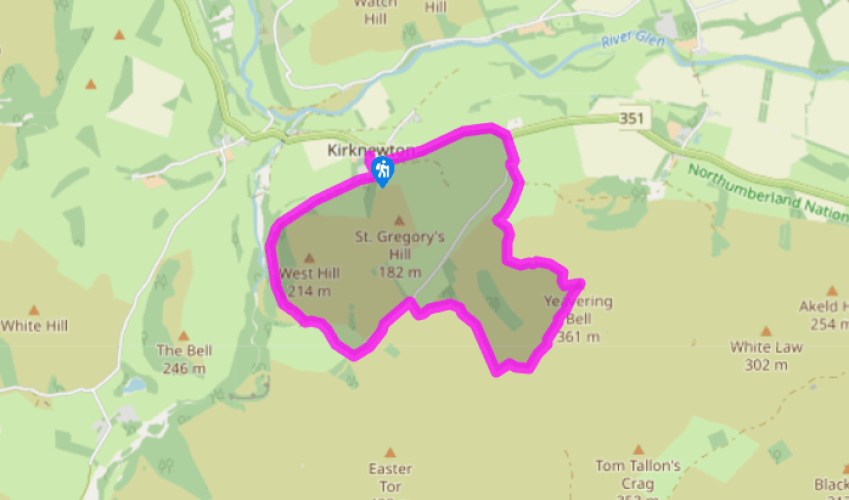
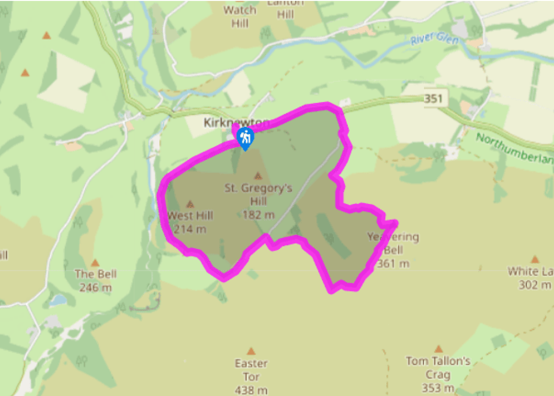
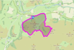
Walk left from the car park and then left again into the village. Just before a gate, turn right along a lane, which shortly degrades to a grass track. Passing through occasional gates, it gently climbs across the northern flank of West Hill, eventually passing old barns. The track continues for another 0.75 miles (1.2km), curving around the hill before reaching a waypost. Bear off right, descending across a steam to a gate and ladder stile.
Turn left to another stile, then climb half right across the field beyond to a hand gate in the top wall. Through that, bear right to a waymarked post beside a track, part of St Cuthbert’s Way.
Walk left. Approaching Torleehouse, bear off right along a path bypassing the farm. Rejoin the track beyond and continue for another 0.25 miles (400m). Reaching a cattle grid, turn off right with St Cuthbert's Way along a grass track. Keep with it through a gate and up the rough hillside beyond to a gate and ladder stile in the top corner.
Go over the stile and turn right to follow the footpath uphill. After 0.25 miles (400m), at a low-level signpost, swing left, signed ‘Yeavering Bell’. Waymarkers guide you down into the valley, across a stream, then steeply uphill. The path eventually passes through the collapsed rubble of the fort wall. Bend right to reach the summit of Yeavering Bell.
The fort area is worthy of exploration and the outlines of hut circles are readily discernible. The way off lies through a waymarked break halfway along the northern wall (the opposite side to which you arrived), from which a path drops to the left. Occasionally waymarked, it runs steeply downhill, ultimately reaching a fence stile beside a wall.
Walk down to a ladder stile from which a rough path continues across the lower slopes. Joining a track at the bottom, leave the hill beside a barn and follow the ongoing track ahead past cottages out to a lane. The site of the Ad Gefrin palace can be visited from an access path opposite.
Turn left along the road and follow it back to Kirknewton. Where it bends right at the edge of the village, keep ahead past cottages. Go through a gate and swing right, back to the car park.
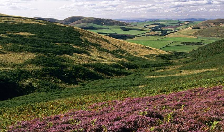
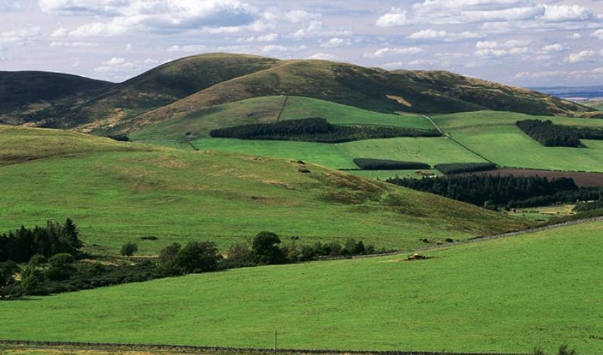
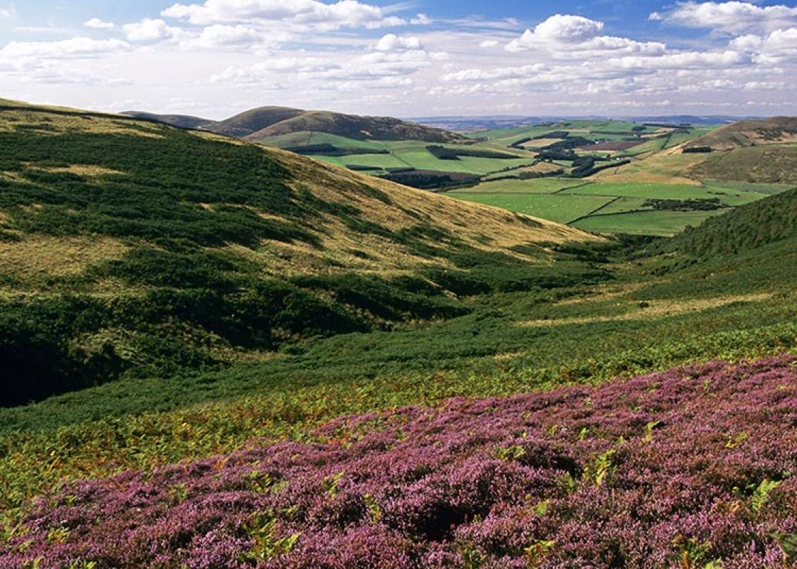
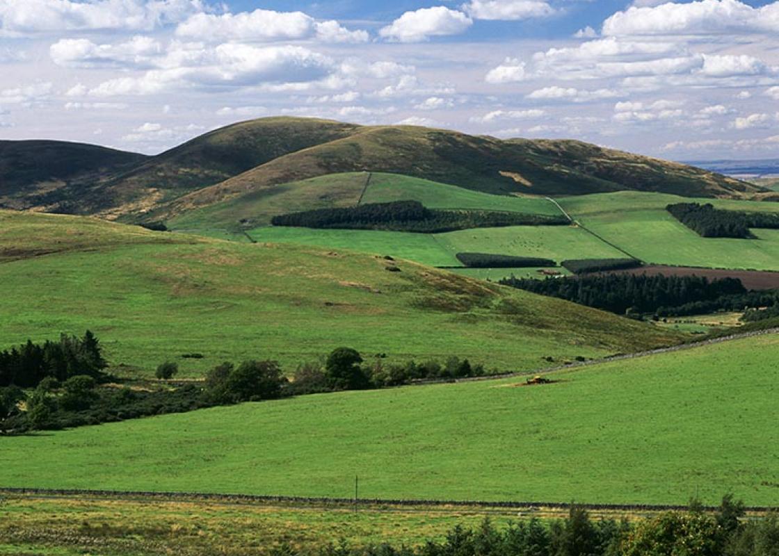
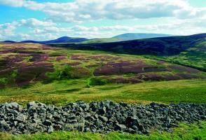
The village of Kirknewton huddles at the foot of the Cheviot Hills, close to the beautiful valley of the College Burn. Often used as a stopping-off point for walkers, the village itself deserves exploration. It has some old farmhouses and a deceptive church, which appears to be Victorian, but... contains a chancel with a stone roof that curves to the floor like the hull of an upturned ship. By the arch leading to the chancel is Kirknewton's other treasure – a 12th-century carving of the Wise Men visiting the infant Jesus and his mother. It is roughly carved and has an almost cartoon-like quality, but is a fascinating and moving glimpse into a world that existed nearly 1,000 years ago. A Victorian reformer A memorial in Kirknewton Church remembers Josephine Butler, the 19th-century social reformer, who is buried in the churchyard. She was born near by in 1828 and married George Butler, a lecturer at Durham University. They moved to Oxford after they married but, following the death of their five-year-old daughter, they set up home in Liverpool, where Josephine began her life's work of helping to rescue women from prostitution and the 'white slave' trade. Her campaign included direct physical action against what she considered unfair laws, which were eventually repealed. She based her life on prayer and modelled herself on St Catherine of Siena. She retired to Northumberland in 1890 after George's death, and died in 1906. College Valley The first part of the walk skirts West Hill, which is topped by a small hill fort with a stone wall and the remains of a Romano-British settlement. You will then pass the head of the beautiful College Valley – it is possible to drive down beyond Hethpool only with a special free permit from Sale and Partners at 18–20 Glendale Road in Wooler. Only 12 a day are issued, and none in the lambing season from mid-April to the end of May. It is open to walkers at any time. The climax of the walk is the hill-fort at Yeavering Bell. Northumberland's most spectacular Iron Age structure, the fort has a massive rubble wall, once 10ft (3m) thick at the base, surrounding the two peaks of the hill. The 13.5 acres (5.5ha) within held more than 130 timber buildings, the largest of them 42ft (12.8m) across. Below the hill, just east of Kirknewton, once stood Ad Gefrin, the 7th-century palace of King Edwin. Mentioned in Bede's Ecclesiastical History of the English People, the site was lost for centuries until identified by crop marks in 1949, then excavated. St Paulinus baptised converts in the River Glen near by in AD 627, and probably preached in Ad Gefrin's most unusual feature, an open-air wooden theatre that held more than 300 people.
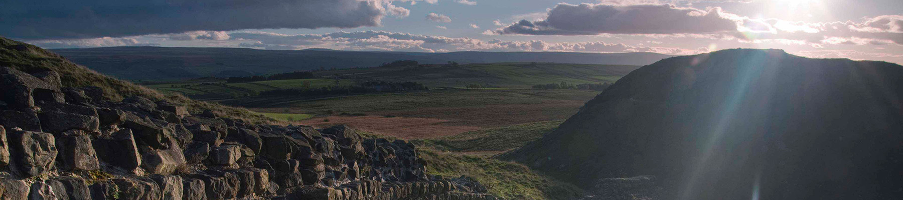
If it’s history you’re after, there’s heaps of it in Northumberland. On Hadrian’s Wall you can imagine scarlet-cloaked Roman legionaries keeping watch for painted Pictish warriors while cursing the English weather and dreaming of home.
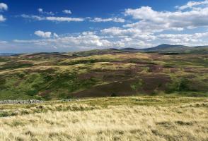
Walk left from the car park and then left again into the village. Just before a gate, turn right along a lane, which shortly degrades to a grass track. Passing through occasional gates, it gently climbs across the northern flank of West Hill, eventually passing old barns. The track continues for another 0.75 miles (1.2km), curving around the hill before reaching a waypost. Bear off right, descending across a steam to a gate and ladder stile.
1 of 7
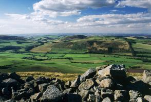
Turn left to another stile, then climb half right across the field beyond to a hand gate in the top wall. Through that, bear right to a waymarked post beside a track, part of St Cuthbert’s Way.
2 of 7
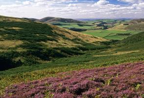
Walk left. Approaching Torleehouse, bear off right along a path bypassing the farm. Rejoin the track beyond and continue for another 0.25 miles (400m). Reaching a cattle grid, turn off right with St Cuthbert's Way along a grass track. Keep with it through a gate and up the rough hillside beyond to a gate and ladder stile in the top corner.
3 of 7
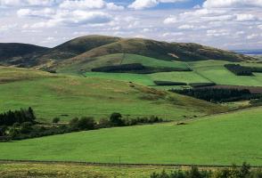
Go over the stile and turn right to follow the footpath uphill. After 0.25 miles (400m), at a low-level signpost, swing left, signed ‘Yeavering Bell’. Waymarkers guide you down into the valley, across a stream, then steeply uphill. The path eventually passes through the collapsed rubble of the fort wall. Bend right to reach the summit of Yeavering Bell.
4 of 7
The fort area is worthy of exploration and the outlines of hut circles are readily discernible. The way off lies through a waymarked break halfway along the northern wall (the opposite side to which you arrived), from which a path drops to the left. Occasionally waymarked, it runs steeply downhill, ultimately reaching a fence stile beside a wall.
5 of 7
Walk down to a ladder stile from which a rough path continues across the lower slopes. Joining a track at the bottom, leave the hill beside a barn and follow the ongoing track ahead past cottages out to a lane. The site of the Ad Gefrin palace can be visited from an access path opposite.
6 of 7
Turn left along the road and follow it back to Kirknewton. Where it bends right at the edge of the village, keep ahead past cottages. Go through a gate and swing right, back to the car park.
The village of Kirknewton huddles at the foot of the Cheviot Hills, close to the beautiful valley of the College Burn. Often used as a stopping-off point for walkers, the village itself deserves exploration. It has some old farmhouses and a deceptive church, which appears to be Victorian, but... contains a chancel with a stone roof that curves to the floor like the hull of an upturned ship. By the arch leading to the chancel is Kirknewton's other treasure – a 12th-century carving of the Wise Men visiting the infant Jesus and his mother. It is roughly carved and has an almost cartoon-like quality, but is a fascinating and moving glimpse into a world that existed nearly 1,000 years ago. A Victorian reformer A memorial in Kirknewton Church remembers Josephine Butler, the 19th-century social reformer, who is buried in the churchyard. She was born near by in 1828 and married George Butler, a lecturer at Durham University. They moved to Oxford after they married but, following the death of their five-year-old daughter, they set up home in Liverpool, where Josephine began her life's work of helping to rescue women from prostitution and the 'white slave' trade. Her campaign included direct physical action against what she considered unfair laws, which were eventually repealed. She based her life on prayer and modelled herself on St Catherine of Siena. She retired to Northumberland in 1890 after George's death, and died in 1906. College Valley The first part of the walk skirts West Hill, which is topped by a small hill fort with a stone wall and the remains of a Romano-British settlement. You will then pass the head of the beautiful College Valley – it is possible to drive down beyond Hethpool only with a special free permit from Sale and Partners at 18–20 Glendale Road in Wooler. Only 12 a day are issued, and none in the lambing season from mid-April to the end of May. It is open to walkers at any time. The climax of the walk is the hill-fort at Yeavering Bell. Northumberland's most spectacular Iron Age structure, the fort has a massive rubble wall, once 10ft (3m) thick at the base, surrounding the two peaks of the hill. The 13.5 acres (5.5ha) within held more than 130 timber buildings, the largest of them 42ft (12.8m) across. Below the hill, just east of Kirknewton, once stood Ad Gefrin, the 7th-century palace of King Edwin. Mentioned in Bede's Ecclesiastical History of the English People, the site was lost for centuries until identified by crop marks in 1949, then excavated. St Paulinus baptised converts in the River Glen near by in AD 627, and probably preached in Ad Gefrin's most unusual feature, an open-air wooden theatre that held more than 300 people.
If it’s history you’re after, there’s heaps of it in Northumberland. On Hadrian’s Wall you can imagine scarlet-cloaked Roman legionaries keeping watch for painted Pictish warriors while cursing the English weather and dreaming of home.