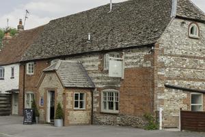
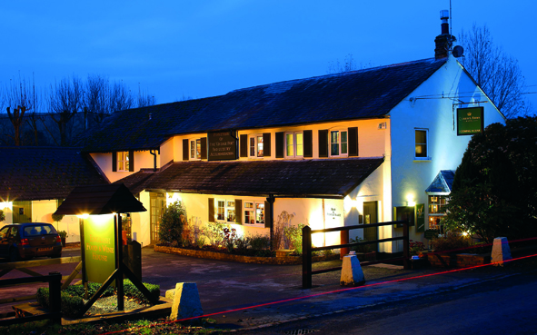

The Greyhound Inn
The Greyhound is an 18th-century inn in the pretty village of Letcombe Regis in the Vale of the…

Letcombe Bassett
6.75 miles (10.9kms)
As a writer, landscape was crucial to Thomas Hardy. In many of his books, he captures, often quite beautifully, the mood and atmosphere of his beloved Wessex, giving the settings in the stories a strong sense of place. He drew heavily on innumerable locations for inspiration. For example Dorchester was the model for Casterbridge and Bere Regis became Kingsbere. The landscape that influenced Hardy stretches far and wide, even to the border country of Berkshire and Oxfordshire, many miles from his home and birthplace in Dorset. He cast his net as far as the picturesque downland village of Letcombe Bassett, two miles (3.2km) from Wantage on the southern edge of the Vale of White Horse.
Known these days for its racing connections, Letcombe Bassett was once a hive of activity of a very different kind when it was used for the growing and cultivating of watercress. ‘Bassett Cress’ was often heard being shouted in the street, in the days when Covent Garden thrived as a vital market. Therefore, it should come as no surprise to discover that Thomas Hardy refers to the village as Cresscombe in Jude the Obscure, published in 1895.
When Hardy wrote his classic novel, this corner of Oxfordshire was actually part of Berkshire, then a much larger county. Almost 80 years later, in 1974, the map of Britain was radically and extensively redrawn as part of local government administrative changes, and Letcombe Bassett and its surroundings became part of neighbouring Oxfordshire. In terms of this landscape, not much else has changed since Hardy’s book was published The delightful Letcombe Brook and the spectacular, remote country bisected by the Ridgeway have retained their timeless quality. As well as the Hardy link, Letcombe Bassett boasts another literary connection. Jonathan Swift spent the summer of 1714 here, staying with his friend, the Reverend Geree at the village’s Queen Anne rectory just before he departed for Ireland. It is claimed he sat and wrote under the mulberry tree in the garden. Alexander Pope and others visited Swift at Letcombe Bassett and it was while here that the satirist and clergyman heard from Bolingbroke that Queen Anne had died.
From the church, follow the road marked ‘Village Downs Only’ The road is also signposted for the Ridgeway and Segsbury Camp. Pass an assortment of houses and thatched cottages. When the road swings left, with good views of downland ahead, turn sharp right.
Approach a gate leading into a nature reserve; swing left in front of it and follow the path for about 50yds (46m). At a junction of rights of way, keep right (signposted Nature Trail). Pass a gate on the right and here there are pleasant views of a lake down among the trees. Continue along the tree-shaded path, which runs high above the Letcombe Brook. The brook is seen at times dashing between banks of greenery. Glimpses of distant downland and the occasional chocolate-box cottage complete the picture as you approach Letcombe Bassett.
On reaching the road, by the junction with Rectory Lane, keep ahead and uphill on the road through the village. Turn left at the church sign and soon Letcombe Bassett’s St Michael and All Angels is visible over to the right, amid delightful thatched cottages. Continue on up the hill following the single-track lane and pass a footpath with a ‘Ridgeway-circular walks’ sign on the left. As the lane curves right, bear left to join a path marked ‘Ridgeway and Segsbury Camp.’
Cross a stile and walk ahead with fence on the right. Make for a stile in the corner and keep ahead on an undulating downland path. Head for the next two stiles and continue across grassland to reach a stile leading onto the Ridgeway. Turn right, passing a private road on the left and a turning for Letcombe Bassett on the right. Keep to the restricted byway (Ridgeway) for a short distance, then take the next left, also a restricted byway. Pass some remote barns and keep heading south until you reach some trees and bushes, branching right at the fork.
This stretch of the byway reveals glorious views to the south into Berkshire. On reaching a major intersection, turn right and follow the wide grassy track in a northerly direction. Keep to the byway, join a metalled section to pass over the Ridgeway and continue to Letcombe Bassett. Pass the footpath taken earlier, on the right and take the next right path. Walk to the right of a large thatched barn, cross a stile to pass under a footbridge and make for a stile and gate. Bear right at the road and pass several watercress beds. Leave Letcombe Bassett and head uphill to a house and thatched cottage on the right.
Turn left at this point to follow a bridleway. Follow it between fields and after a little over 0.75 miles (1.2km) you reach a junction with a track known as Green Road. Turn right and follow this for a little under 0.5 miles (800m). At the next junction turn right. Follow the track beside Antwicks Stud on the left, pass beneath power lines to bend right, then left alongside Letcombes Riding Club and Letcombe Regis village hall. At the road, go straight on, back to the centre of the village.
Pavements, tow path, field paths and tracks, 1 stile
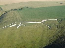
Dramatic downland country on the southern edge of the Vale of White Horse
Under control in and around villages
OS Explorer 170 Abingdon, Wantage & Vale of White Horse
Limited spaces near the church at Letcombe Regis
None on route
Read our tips to look after yourself and the environment when following this walk.
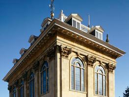
Located at the heart of England, Oxfordshire enjoys a rich heritage and surprisingly varied scenery. Its landscape encompasses open chalk downland and glorious beechwoods, picturesque rivers and attractive villages set in peaceful farmland. The countryside in the northwest of Oxfordshire seems isolated by comparison, more redolent of the north of England, with its broad views, undulating landscape and dry-stone walls. The sleepy backwaters of Abingdon, Wallingford, Wantage, Watlington and Witney reveal how Oxfordshire’s old towns evolved over the centuries, while Oxford’s imposing streets reflect the beauty and elegance of ‘that sweet city with her dreaming spires.’ Fans of the fictional sleuth Inspector Morse will recognise many Oxford landmarks described in the books and used in the television series.
The county demonstrates how the strong influence of humans has shaped this part of England over the centuries. The Romans built villas in the pretty river valleys that thread their way through Oxfordshire, the Saxons constructed royal palaces here, and the Normans left an impressive legacy of castles and churches. The philanthropic wool merchants made their mark too, and many of their fine buildings serve as a long-lasting testimony to what they did for the good of the local community.
Discover more than 15,000 professionally rated places to stay, eat and visit from across the UK and Ireland.
Choose a place to stay safe in the knowledge that it has been expertly assessed by trained assessors.
Search by location or the type of place you're visiting to find your next ideal holiday experience.
Read our articles, city guides and recommended things to do for inspiration. We're here to help you explore the UK.