
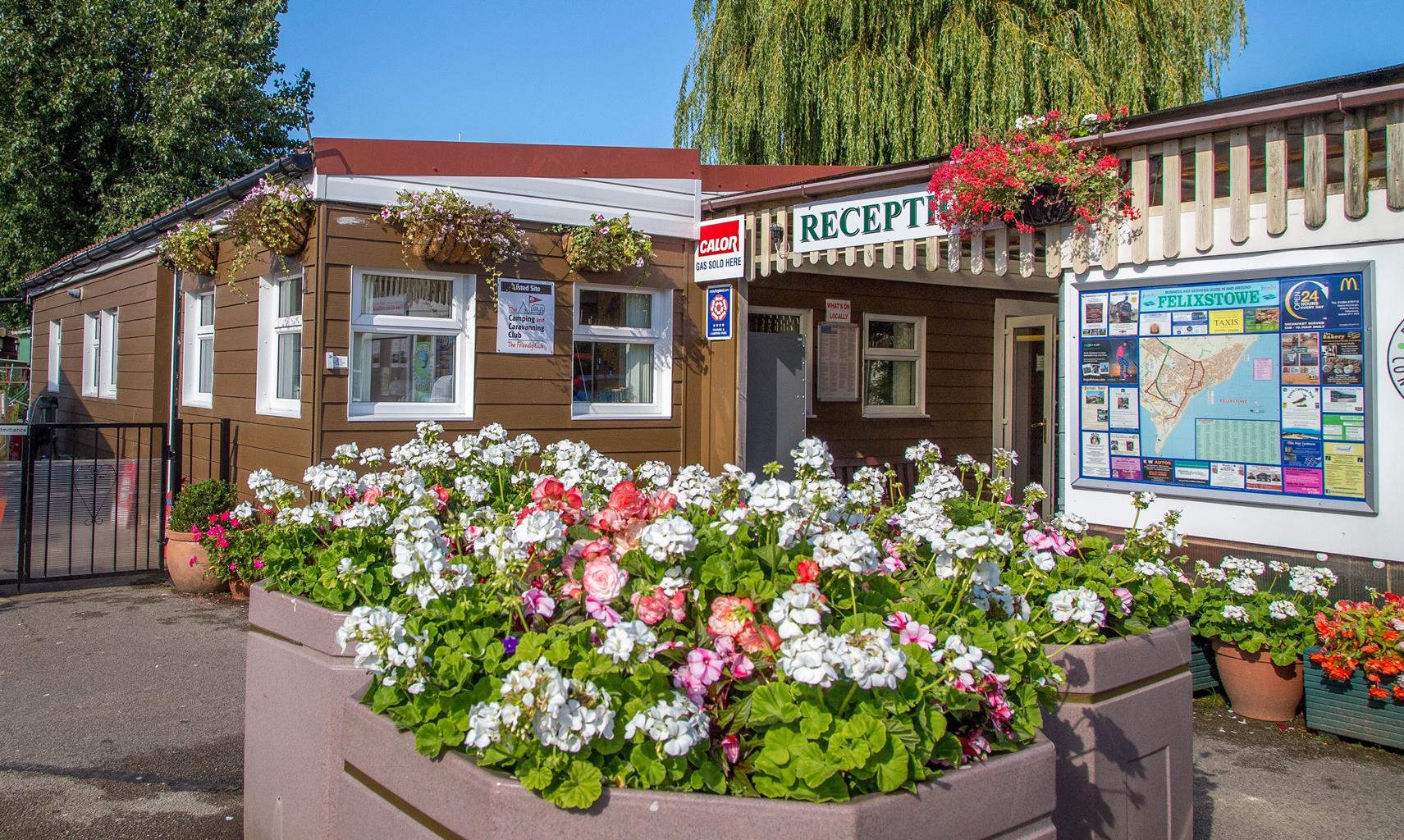
Peewit Caravan Park
A grass touring area fringed by trees, with well-maintained grounds and a colourful floral…

A wild walk to the very edge of Suffolk, with views over the Felixstowe Point.
Landguard Point
2 miles (3.2kms)
This is a walk for people who find beauty in bleak landscapes and charm in the most unexpected places. You won't find any meadows or fields of wheat, just a shingle beach and a lonely spit where Suffolk dips its toe into the sea. You won't see country cottages or half-timbered farmhouses, but you will see gantries and cranes. If you're looking for a rural ramble, don't say you weren't warned!
Landguard Reserve is a small nature reserve containing at least one per cent of all Britain's vegetated shingle, a delicate ecosystem that is constantly under threat. The shingle spit here has been formed by the action of the tides over millions of years and has been colonised by rare plants such as the seakale and yellow-horned poppy. At the same time there are also reminders of human presence in the form of earthworks and anti-invasion defences at this strategic spot at the mouth of the Orwell and Stour rivers. In spring and summer, you will notice that parts of the beach have been roped off to prevent any disturbance to nesting birds. Little tern return here each spring after wintering in Africa and ringed plover arrive from the nearby estuaries to lay their eggs in the shingle, cleverly camouflaged to appear like pebbles.
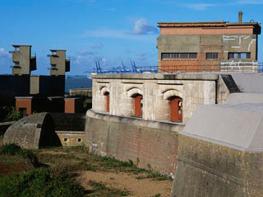
Work on the bastion that stands today at the mouth of the River Orwell was begun in the 18th century. However, a strongpoint has been sited here since 1540 when a blockhouse was built with earthworks around it. James I of England later had a square fortress constructed on this spot, but it was in 1667 that the fort really came into its own. A force of 2,000 Dutchmen landed on the beach at Felixstowe and attempted to take the fort by force. The action was repelled by one Nathaniel Darrell commanding a garrison of 400 musketeers from the Duke of York & Albany's Maritime Regiment, along with 100 artillerymen and 54 cannon. A new fortress was constructed here in 1745, with various improvements being carried out until the 1870s when the barracks were remodelled to resemble a keep.
On most days you will find a surprising number of people here peering out over Felixstowe Docks and admiring the ferries and cruise ships and watching the dockers at work bringing shiploads of containers ashore. This is the largest container port in England, the sixth busiest in Europe and the 35th busiest in the world - the statistics are staggering. At its two terminals, the Port of Felixstowe operates 42 ship-to-shore cranes and manages to deal with more than two million containers each year. In contrast to all these big ships, a foot ferry crosses the river from here to Shotley and Harwich in summer. The main navigation channel is kept dredged to allow Felixstowe to accommodate the world's latest generations of container ships.
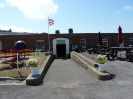
From the car park in Manor Terrace you can walk straight into Landguard Reserve, pausing to look at the interpretation board on the way. Take the gravel path ahead of you to climb an embankment. Walk along the top of the bank for about 200yds (183m) then drop down some steps and climb up on the other side to a second embankment with good views of Felixstowe and its beach. The path drops down to a concrete track. After passing an information board, bear left across the grass and shingle towards the beach. Walk right along the beach towards the jetty at Landguard Point. This is Suffolk's southernmost point, a wild and windswept place where fishermen can sometimes be seen casting their rods into the sea. Beneath the groyne there are views of Harwich across the river.
Turn right and walk away from the jetty along a boardwalk beside a fenced-off area, following the fence round to the left past a series of small concrete structures built to defend the coast in World War II. Leave the concrete track to follow a faint grass track on the left to pass by a red house, bear slightly right then left to continue beside another fenced-off area on your left. Behind the fence is the Bird Observatory, where 8,000 birds are trapped, ringed and released each year in an effort to understand migratory patterns and population trends. A board outside the observatory lists recent sightings and describes the annual migrations of birds like wood pigeon who travel south to Africa in winter and brent geese who arrive from Siberia to benefit from the warmer climes that the pigeons are leaving behind. Turn left at the end of the fence to leave the nature reserve through a gate. On your left is Landguard Fort. Walk around the fort to the right and you will come to the John Bradfield viewing area overlooking Felixstowe Docks.
Return to the fort and continue straight ahead beside the road, passing some concrete defence structures to your right. At the end of the fence, bear right to return to the nature reserve. Climb the steps on the left to reach another embankment. Walk along this, then descend some steps and return across the left-hand side of the reserve with a caravan site in the distance and the shiny glass structure of Felixstowe customs house to your left.
Sand and shingle beach, grass, concrete lanes, some steps, boardwalk
Shingle, grassland, sea and docks
Dogs must be kept on lead in Landguard Reserve
OS Explorer 197 Ipswich, Felixstowe & Harwich
Manor Terrace car park (free), Felixstowe
At car park
Read our tips to look after yourself and the environment when following this walk.
Suffolk is Constable country, where the county’s crumbling, time-ravaged coastline spreads itself under wide skies to convey a wonderful sense of remoteness and solitude. Highly evocative and atmospheric, this is where rivers wind lazily to the sea and notorious 18th-century smugglers hid from the excise men. John Constable immortalised these expansive flatlands in his paintings in the 18th century, and his artwork raises the region’s profile to this day.
Walking is one of Suffolk’s most popular recreational activities. It may be flat but the county has much to discover on foot – not least the isolated Heritage Coast, which can be accessed via the Suffolk Coast Path. Southwold, with its distinctive, white-walled lighthouse standing sentinel above the town and its colourful beach huts and attractive pier features on many a promotional brochure. Much of Suffolk’s coastal heathland is protected as a designated Area of Outstanding Natural Beauty and shelters several rare creatures including the adder, the heath butterfly and the nightjar. In addition to walking, there is a good choice of cycling routes but for something less demanding, visit some of Suffolk’s charming old towns, with streets of handsome, period buildings and picturesque, timber-framed houses.
Discover more than 15,000 professionally rated places to stay, eat and visit from across the UK and Ireland.
Choose a place to stay safe in the knowledge that it has been expertly assessed by trained assessors.
Search by location or the type of place you're visiting to find your next ideal holiday experience.
Read our articles, city guides and recommended things to do for inspiration. We're here to help you explore the UK.