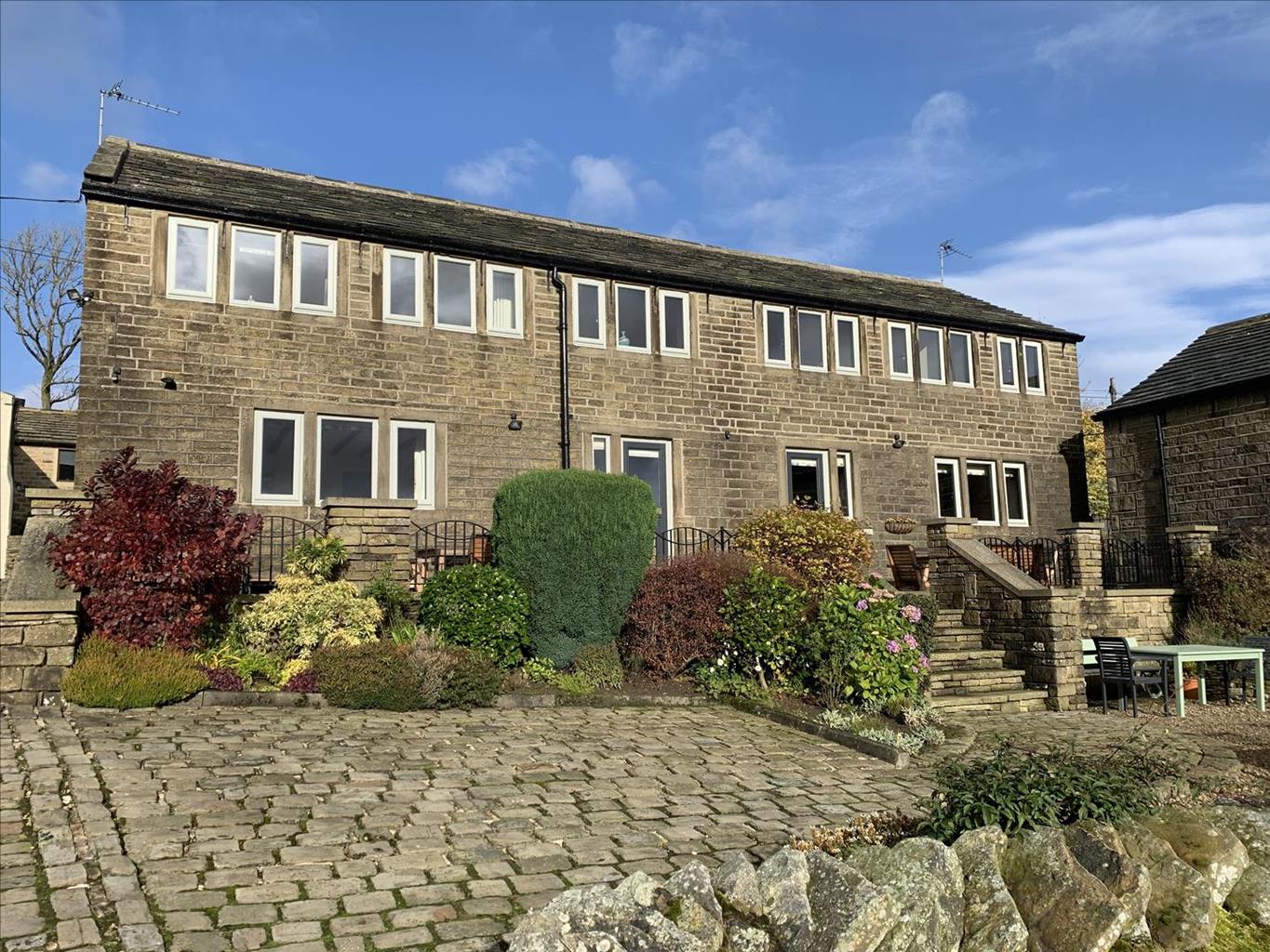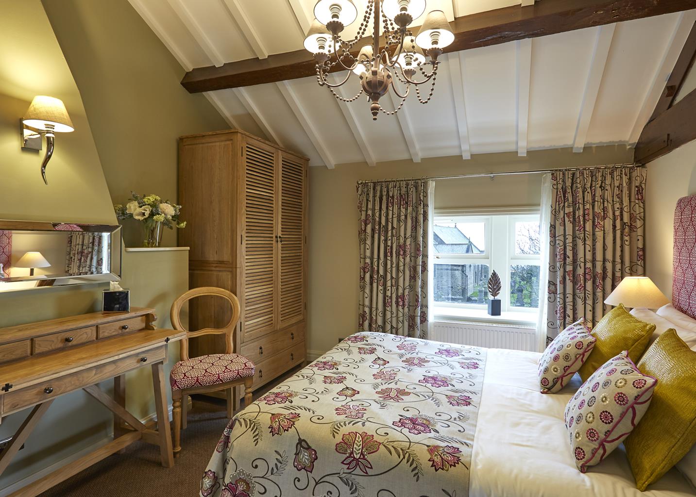


Windy Harbour Farm Restaurant and Accommodation
Windy Harbour Farm is situated just outside Glossop, in a rural location on the edge of the Peak…

Longdendale
7.5 miles (12kms)
Longdendale, the valley of the River Etherow, threads deep into the Pennines between the craggy cliffs of Bleaklow and the sullen slopes of Black Hill. In bygone centuries this must have been an inhospitable but dramatic wilderness of heath and bog. Meanwhile, in nearby Manchester, the Industrial Revolution had caused a dramatic increase in the population from around 10,000 to over 230,000. This meant that Manchester needed more water, and its engineers turned to Longdendale. Between 1848 and 1877 a string of five reservoirs were built to the designs of John Frederick La Trobe Bateman. Later came the railway, linking Manchester with Sheffield, then came electricity. So this remote narrow valley was filled with the contraptions of the modern world. Manchester’s people came here in their thousands, using the railway and taking to the hills.
Crowden, where the walk starts, is one of the few settlements in the valley. Around the campsite you’ll often see weary walkers with heavy backpacks. More often than not they will have just completed the first day of the Pennine Way over Kinder Scout and Bleaklow. In the book they’re clutching, Alfred Wainwright has told them how unsightly Longdendale is, and how they will continue towards the horrors of Black Hill’s bogs. But this walk shows you the very best of Longdendale. The railway has gone now, dismantled in 1981 with the decline of the coal industry. After strolling down to the Torside Reservoir you follow its trackbed, now part of the Longdendale Trail. Soon you’ve left the valley behind and you’re climbing through the shade of woods. Longdendale looks pretty good now. Bleaklow’s ruffled peat-hagged top is fronted by a bold line of cliffs, which overlook the valley’s lakes and fields. Several streams plummet down shady ravines, while Torside Clough, a huge gash in the side of the fell, dwarfs the little farm at its foot. Now you’re on the moors with the squat cliffs of Millstone Rocks lying across cottongrass moors. At Lad’s Leap, the Hollins Clough stream tumbles over a slabbed rocky bed into Coombes Clough. Despite the name, you should descend to ford the stream before continuing above Highstone Rocks to the rim of the Crowden Valley, where you can look deep into the inner recesses of Black Hill. Below, your car awaits.
Leave the car park via the path from the toilet block, cross the main road, turn left and then go right at a kissing gate. Turn though a second gate (signed ‘Woodhead Dam’) a short way along on the left. Walk past Torside Reservoir to cross the River Etherow below the Woodhead Dam. Climb away to the road.
Cross to a path opposite, which leads up to the Longdendale and Trans Pennine trails. Follow the trackbed right for 1.75 miles (2.8km) to meet the road again. Cross and go right, then left on a wide descending track (Pennine Way) that swings across the valley over the Torside Dam. Stay on the tarmac road as it climbs away left. Leave the road when it bends right, walking ahead to the left of two gates.
Go through the gate and follow the path through some scrub woodland to reach the Rhodeswood Dam, where a tarmac lane takes you back to the main road.
Diagonally opposite, a gated track rises on to the moor. Swing right at a bend, then bear left at a fork, soon climbing around another bend. Ignore a sharp right and turn though a final bend, now heading for the top of a plantation. Go over a stile there, and climb on, shortly passing below the cliffs of a quarry.
The path then narrows and soon turns up to a stile beside Rawkins Brook. Go over the stile and bear right, away from the fence line, across the stream to follow a peaty path northeast towards the high ground of Millstone Rocks.
On reaching the edge, follow it right to Lad’s Leap, turning in to ford the stream. Now diverging from the edge, a clear path runs on, soon crossing a broken wall to descend along a shallow trough. Joining another wall for a while, the descent gradually steepens and eventually drops off the nose of the hill to a small copse.
Now on the Pennine Way, go through a gate on the right and follow the ongoing path across successive fields to reach a track.
To the left, the track falls across the foot of Crowden Brook and continues to a farm. Walk on past large sheds, then, through a gate, turn right beside a campsite. At a toilet block, fork left back to the car park.
Good paths and tracks, moorland path may be boggy in wet weather, some stiles
Heather moorland and rolling farm pastures
Walk is on farmland and access agreement land; dogs should be kept on lead
OS Explorer OL1 Peak District – Dark Peak Area
Crowden car park
At Crowden and Torside car park
Read our tips to look after yourself and the environment when following this walk.
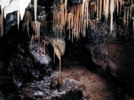
The natural features of this central English county range from the modest heights of the Peak District National Park, where Kinder Scout stands at 2,088 ft (636 m), to the depths of its remarkable underground caverns, floodlit to reveal exquisite Blue John stone. Walkers and cyclists will enjoy the High Peak Trail which extends from the Derwent Valley to the limestone plateau near Buxton, and for many, the spectacular scenery is what draws them to the area.
The county is well endowed with stately homes – most notably Chatsworth, the palatial home of the Duke and Duchess of Devonshire, with its outstanding collections of paintings, statuary and art. Other gems include the well preserved medieval Haddon Hall, the Elizabethan Hardwick Hall, and Kedleston Hall, whose entrance front has been described as the grandest Palladian façade in Britain.
The spa town of Matlock is the county’s administrative centre and other major towns of interest include Derby and the old coal mining town of Chesterfield, with its crooked spire. Around the villages of Derbyshire, look out for the ancient tradition of well dressing, the decorating of springs and wells – the precious sources of life-sustaining water – with pictures formed from flowers.
Discover more than 15,000 professionally rated places to stay, eat and visit from across the UK and Ireland.
Choose a place to stay safe in the knowledge that it has been expertly assessed by trained assessors.
Search by location or the type of place you're visiting to find your next ideal holiday experience.
Read our articles, city guides and recommended things to do for inspiration. We're here to help you explore the UK.