


Burmington View
Set in gardens with large lawn and family tennis court (racquets and balls provided) Burmington…

Brailes
5 miles (8kms)
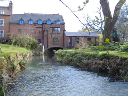
In medieval times Brailes was the third-largest town in Warwickshire. Today it comprises a pair of small country villages, happily situated off main routes, away from the hustle and bustle of the modern towns and cities. This fine walk takes you over part of Brailes Hill which, at 761ft (232m), is the second-highest point in Warwickshire. From the pretty village of Upper Brailes you walk into Lower Brailes and can enjoy lovely views as you descend into open countryside. You climb above Sutton Brook and will have a wonderful valley view as you go down to Sutton-under-Brailes.
It is a delight to walk through the old part of Upper Brailes, where there are a number of thatched cottages, and an ancient earthwork and burial ground called Castle Hill. Following the arrival of the Normans in the 11th century, it was used as the basis for a conventional castle of the motte-and-bailey style. Now it is an excellent vantage point for those who wish to play 'King of the Castle'. From the top of its hill you can see the distinctive marks of medieval ridge-and-furrow cultivation methods in the surrounding fields.
Lower Brailes is also a dreamy place and, although it has no castle, it does contain the 14th-century Church of St George. With its splendid 120ft (37m) tower, it is sometimes referred to as the 'Cathedral of the Feldon', a potentially baffling claim to fame until you learn that 'Feldon' is an old English word for an area of rich, fertile farmland. It is without a doubt one of the finest churches in Warwickshire. Inside you'll find some exquisite illuminated manuscripts. These date from the middle of the 13th century and are the work of William de Brailes and Matthew Paris.
Brailes has attracted its fair share of unusual and interesting characters. Nance Austin gained a reputation as the Brailes witch. Apparently she specialised in levitation and had a familiar in the form of a cat. Richard Davies was a worthy Elizabethan scholar who is remembered in a monument above a tomb of black marble in St George's Church.
Field paths lead you around the slopes of Brailes Hill between these three lovely villages, which reward you for taking time to explore on foot.
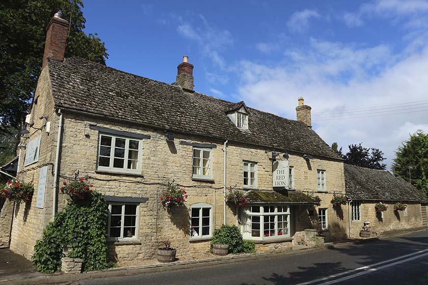
Leave the car park by the village hall in Lower Brailes to join the B4035. Turn left to stroll up through the beautiful village for about 0.5 miles (800m), passing The George Hotel, which has always been popular with local ramblers (see Where to Eat and Drink) and now houses the village post office.
Turn right and walk down a waymarked public footpath just beyond The George Hotel. This runs beside a small Cotswold dry-stone wall, passing over a low stile, and then through a gate to cross Cow Lane into pastureland via a stile. Continue ahead, and at a footpath junction waymark post continue ahead to a double stile and footbridge in the hedge. Cross them and bear half right to the next stile, then quarter left for two further fields via a stile by a footbridge between them, heading for New Barn Farm. The footpath goes to the left of the farm complex to a handgate. Through this, continue alongside the hedge to another gate. Beyond continue half left up the hill, crossing the field to a footbridge and stile. Cross the corner of the next field and continue ahead on the right-hand side of the hedge – there is a good view back over Lower Brailes. Walk up the path, then go through a hedge gap and bear right, walking above the trees surrounding the ruinous Rectory Farm.
Bear right at the end of the trees then half left, and now begin a gentle descent on a farm track, enjoying a wonderful view ahead over the valley as you proceed towards Sutton-under-Brailes. Pass through a field gate, the golf course now to your right, and when you reach the road at the bottom of the hill, turn left and wander through this beautiful Cotswold village, going to the right, past the village green, and heading for a stile to the left-hand side of the parish church and Church Cottage.
Clamber over the stile, then another, to cross an orchard and walk past the church. Go through a kissing gate and head half left across the cultivated field by Church Farm. Go through a kissing gate in the far corner onto a farm lane. Turn right up this track, passing to the right-hand side of Oaken Covert. Continue ahead through a field gate and uphill alongside a post-and-wire fence. Pass through another field gate, and with a hedge on your right you ascend Cherington Hill.
Just past three pine trees you reach a junction of public footpaths. Go right through a metal bridle gate and follow a tractor track heading generally eastwards. The route goes to the left-hand side of New House Barn. Continue ahead through a field gate along a track, through another gate, and continue along the top of a farm field, with more good views over the Brailes Valley to the right. At end of the field go through a handgate to descend the hedged track called High Lane, the lower part a deep sunken lane, to reach Tommy's Turn.
Turn left and walk down the lane, continuing your descent into Henbrook Lane. Soon you will come back out onto the High Street in Lower Brailes (the B4035). Turn right along the road for about 100yds (91m) to return to the village hall car park on the corner of Castle Hill Lane.
Field paths and country lanes, many stiles
Rolling hills
Under control at all times
OS Explorer 191 Banbury, Bicester & Chipping Norton
Village Hall car park in Lower Brailes – donation to hall funds expected
None on route
Read our tips to look after yourself and the environment when following this walk.
The sparkle of sunlight on a gentle river as it meanders through beautiful countryside; the reflections of sailing boats on a lake; relaxing with a pint in the garden of an old English pub in a picturesque village; brightly coloured narrow boats making their way through a flight of lock gates; the imposing silhouette of an historic castle. These are the scenes that make Warwickshire a delight.
There may be few seriously high hills in this fertile plain, but it is an area full of attractive walking in rolling countryside, blessed with a fascinating history and wonderful places and buildings to visit. This is Shakespeare’s county, and the footprint of the famous Bard appears almost everywhere. He was born and brought up around the beautiful Warwickshire town of Stratford-upon-Avon, and many of his plays draw upon his own experiences in the area.
Warwickshire has a history that embraces the Civil War, castles and large country houses are scattered over the county. Warwick Castle is the home of the Earl of Warwick, Kenilworth Castle was a stronghold for lords and kings of England in the 11th and 12th centuries, and so the list goes on.
Discover more than 15,000 professionally rated places to stay, eat and visit from across the UK and Ireland.
Choose a place to stay safe in the knowledge that it has been expertly assessed by trained assessors.
Search by location or the type of place you're visiting to find your next ideal holiday experience.
Read our articles, city guides and recommended things to do for inspiration. We're here to help you explore the UK.