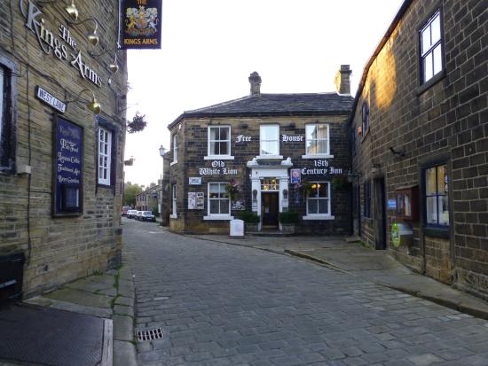


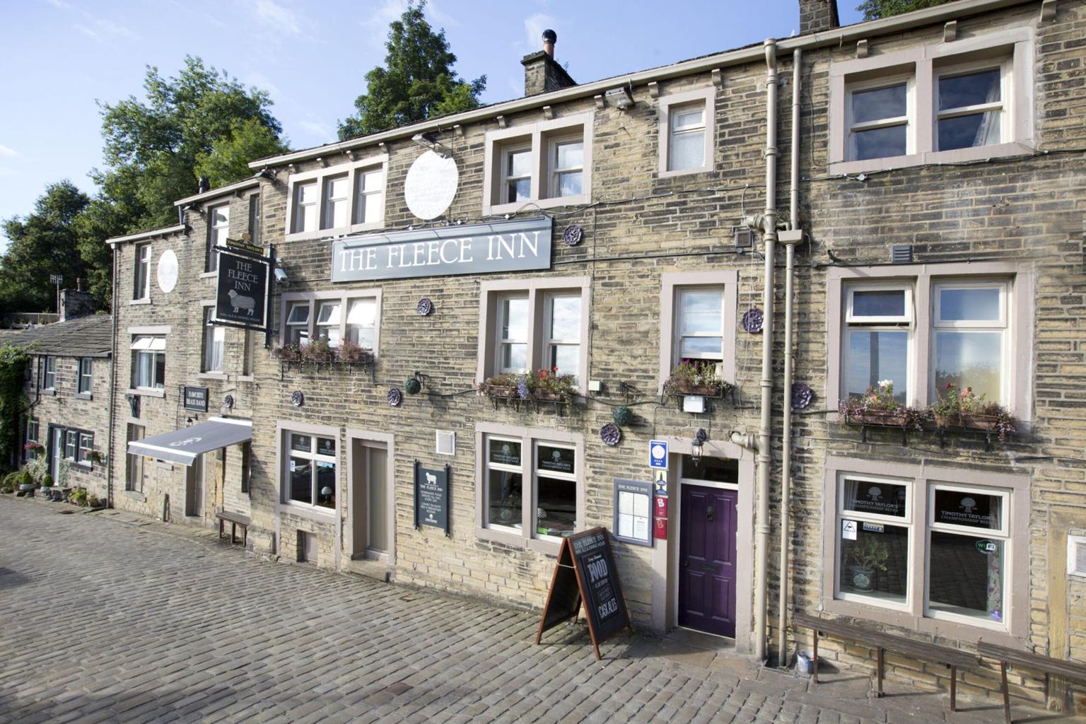
The Fleece Inn
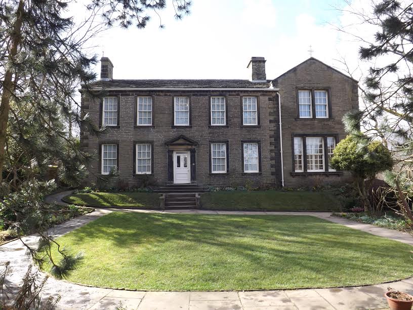
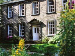
Most tourists visit Haworth for the Brontë Sisters. Now a museum, The Parsonage, where they…

The forgotten valley of Crimsworth Dean and an exquisite packhorse bridge.
Hebden Bridge
2.2 miles (3.5kms)
West Yorkshire might be rich in the kind of quarried sandstones that form the foundations of the Houses of Parliament and pave Trafalgar Square in London. Naturally occurring lime however, an important mineral for agriculture and building, is in short supply and for centuries has been imported into the county. Pulverised lime is used by farmers to neutralise acidic soils, and in construction as a component of mortar and plaster.
Limers Gate, which crosses Crimsworth Dean near Hebden Bridge, is a centuries-old packhorse route. The word ‘gate’ is derived from the middle-English term ‘geat’, for road or path, while ‘lime’ is a clue as to what cargo was borne along it by packhorse trains.
In the days before turnpike roads and the industrial revolution, travellers kept to the higher ground, which allowed easier travel than the damp valley bottoms. Limers Gate started in limestone country, in Lothersdale, near Skipton, and crossed the high moors above Wycoller and Walshaw Dean before dropping to Lumb Falls in Crimsworth Dean. It then rose again, on to Wadsworth Moor and the heights above Luddenden Dean, towards its final destination in Halifax.
Above Lumb Falls a delightful packhorse bridge spans Crimsworth Dean Beck above a waterfall which, when frozen in a hard winter, resembles the pipes of a giant church organ. Though its sides are now fenced, the bridge never had parapets as these would have impeded the progress of ponies laden with bulging panniers.
The small dell in which the bridge and falls sit is classified as a geological Site of Special Scientific Interest. The lip of the waterfall is Lower Kinderscout gristone, while the rock beneath is a softer mudstone, hence its slight overhang. Shales beneath the falls have been eroded to form a pool, popular with picnickers and wild swimmers though it’s too shallow to allow diving in.
Wildlife thrives here – kestrels hover above surrounding fields, and heron and grey wagtail can be seen around the falls – while the idyllic scene is credited with having inspired the late poet laureate Ted Hughes, born just a few miles away in Mytholmroyd, to put pen to paper.
Take the bridleway signed ‘Aire Link, Pennine Bridleway’, that follows Crimsworth Dean Beck gently downstream, soon passing through a latched wooden gate to cross a second beck near the confluence of the two. For the next 1,000yds (914m) the track rises gently. The track passes a collapsed farm building and, 550yds (503m) later, crosses the muddy yard of an abandoned farm known as Nook.
Keep ahead at the trail junction immediately beyond the farm. After 150yds (137m) bear sharp left, doubling back down a walled grassy bridleway signed for Lumb Bridge. This is Limers Gate, the ancient packhorse route, and in places is obstructed by dense reeds and running water but you can easily step off to the right, and follow it down on drier ground past the skeletal remains of Sunny Bank Farm. Firmer and clearer ground soon appears in the lane though care should be taken on grass-covered boulders. The lane drops to Lumb Falls, crossing Crimsworth Dean Beck on the ancient packhorse bridge.
On the opposite bank, leave Limers Gate by stepping over the stile on your left, then bearing right into an enclosed flight of stone steps. Emerging into an open field, continue uphill to another stile. Keep ahead beyond, up a pair of steps, then gently bear left to pass through a wooden gate and across a farm courtyard. Take the clearly marked path between barns, scaling a few steps beyond, and bearing right to a latched gate.
Cross the field ahead, aiming for the lower of two farmhouses. Beyond the stile through the far wall keep ahead, aiming for the far bottom field corner. Pass through a gated stile here and bear right on a flagged wallside path to a gate into the yard of Grains Farm. Ascend the surfaced driveway then turn left to return to the start point.
Good tracks and field paths; several stiles
Gritty Pennine valley with wooded sides and extensive views
Livestock grazes along the route so dogs should be under close control or on lead at all times
OS Explorer OL21 South Pennines
Quite limited at Grain Water Bridge, on Haworth Old Road. Park considerately, without blocking the lane or any field gates
None on route
<p>The start is near the end of a narrow lane with few passing places</p>
Read our tips to look after yourself and the environment when following this walk.
Discover more than 15,000 professionally rated places to stay, eat and visit from across the UK and Ireland.
Choose a place to stay safe in the knowledge that it has been expertly assessed by trained assessors.
Search by location or the type of place you're visiting to find your next ideal holiday experience.
Read our articles, city guides and recommended things to do for inspiration. We're here to help you explore the UK.