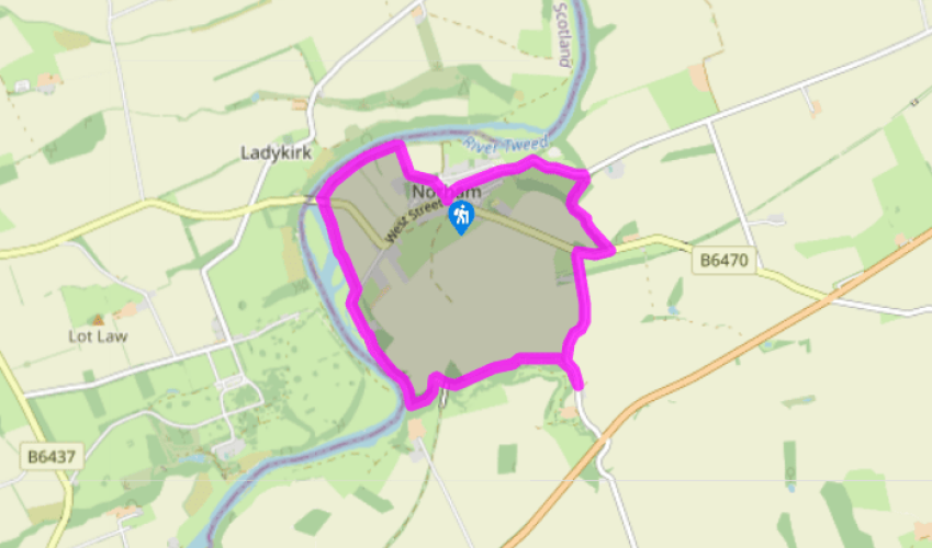
Additional information
Terrain
- Field and woodland paths, 3 stiles
Landscape
- Undulating river valley, agricultural land and woods
Dog friendliness
- On lead near livestock
Parking
- Roadside parking in Norham
Toilets en route
- Close to village centre
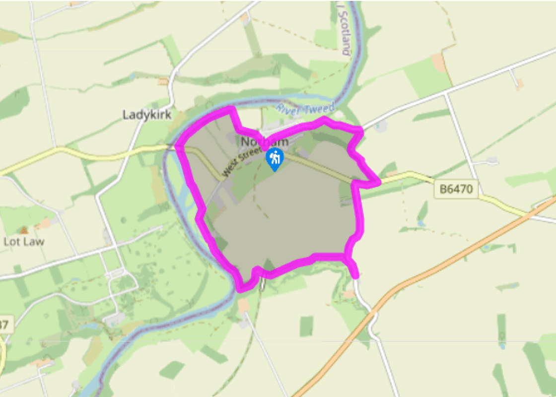
About the walk
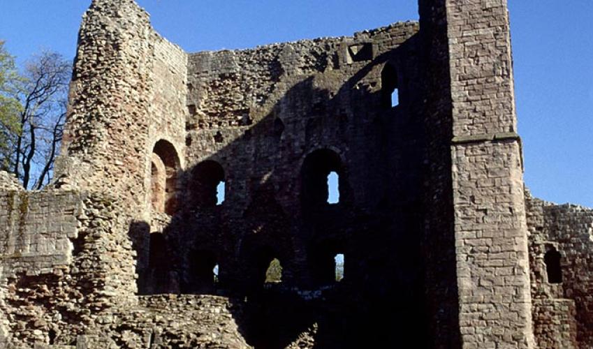
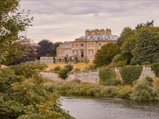
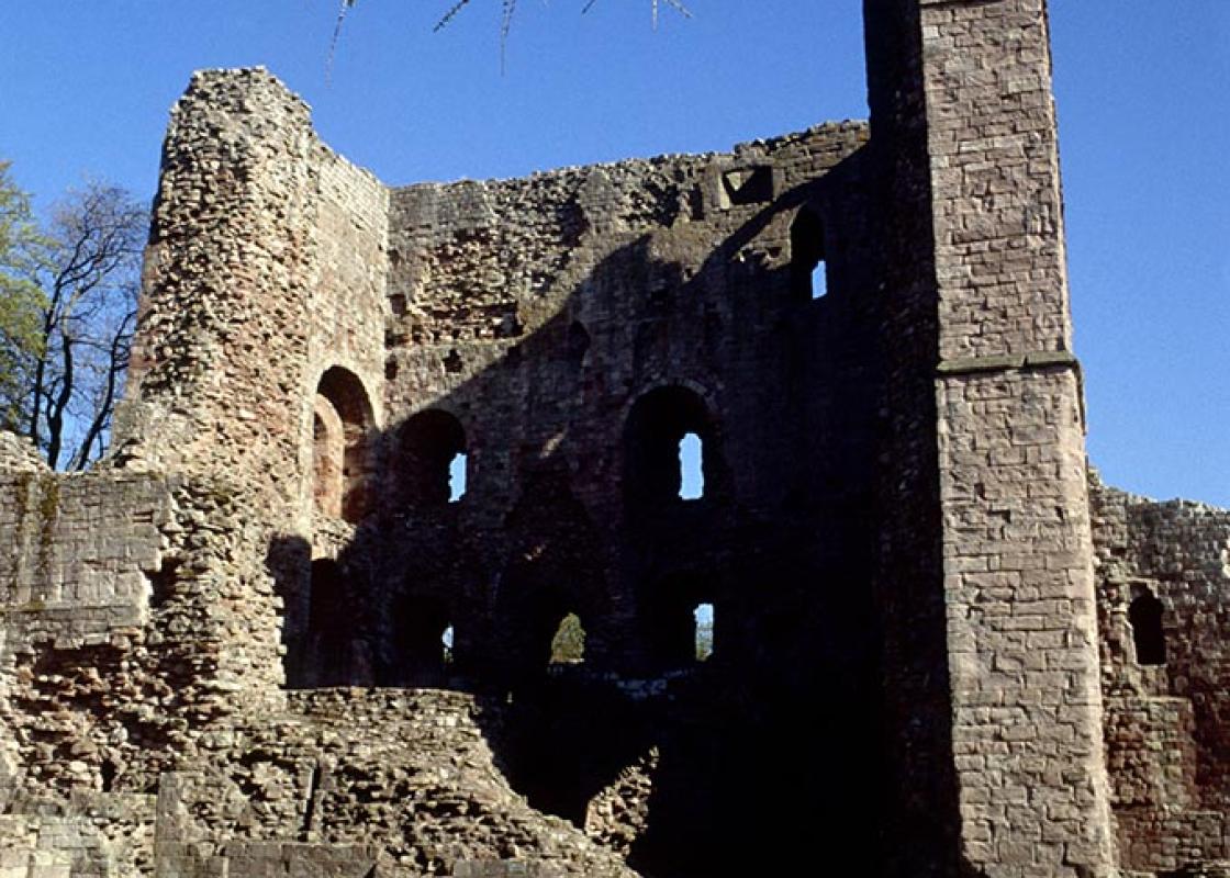
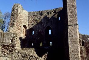
Walking through the spacious streets of Norham, where low cottages and splendid mini town houses lead to an open green graced by a cross that has stood there for centuries, it is hard to believe that this was once the most dangerous place in all England, or so we are told in Sir Walter Scott's epic... poem Marmion. Yet he was probably right, for when the bold knight, Sir William Marmion, actually came to Norham in 1319, it was indeed a troubled place, a state that had existed since the Norman Conquest in 1066 and was to continue into the 16th century. The Prince Bishops Once William I established himself in England, he assumed the country would buckle down to Norman order, but the North was not so inclined. A series of revolts incited William to embark upon a campaign of death and wholesale destruction that became known as the 'Harrying of the North'. However, even that was only effective in the short term and he delegated the job of governing these unruly people to the Bishops of Durham. Dubbed the Prince Bishops, they became very powerful and, in effect, ruled Northumbria as kings. However, the trouble didn't stop there, because the Scots had always regarded the land as theirs anyway, and for centuries the North was repeatedly devastated, either by battle or from the passage of one warring faction or the other, plundering food and anything else of any use as they passed through. The castle Norham's castle was founded by Bishop Ranulph Flambard in 1121 as a defence against the Scots. Despite its formidable situation on high cliffs above the Tweed, they still managed to take the castle twice during the next 16 years. Under the control of the bishops, the fortress was rebuilt and extended from 1157 into the 13th century, with such effect that it withstood a 40-day siege in 1215. A century of peace followed, but with the return of hostilities, Norham was again in the front line. During the next 200 years it was besieged six times and captured twice, the last occasion being in 1513 as the confident Scots made their fateful journey towards Flodden. Afterwards, the English undertook extensive repairs to strengthen the defences against the modern artillery that had been its downfall. However, the political wind changed and the castle passed to the Crown in 1559, after Bishop Tunstall refused to take the Oath of Supremacy. No longer required as a strategic outpost, it gradually declined to the spectacular ruin that it is today. Ancient settlers and Victorian visitors Archaeological work suggests that the area was probably first fortified during the early Iron Age. The high embankment towering above the field path, leading towards the castle near the end of the walk, is believed to be part of an earthen rampart defending the eastern aspect of the headland above the village. Traces of a third outer medieval bailey and more recent artillery emplacements were also found, indicating a much larger fortified enclosure than was previously considered. The field path to the castle is thought to have been created after Norham Station opened, to provide a ready access for Victorian visitors, eager to realise the romantic dreams inspired by Scott's poem and Turner's painting of the castle.
Read more