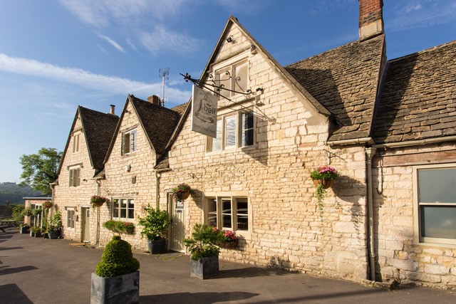
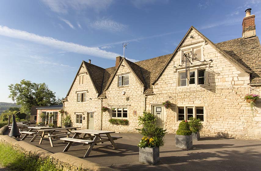

The Painswick
The Painswick has had a varied history since being built in the late 18th century, including…

From the Queen of the Cotswolds through the Washpool Valley.
Painswick
7.5 miles (12.1kms)
Local traditions continue to thrive in Painswick, the ‘Queen of the Cotswolds’. These are centred around its well-known churchyard, where the Victorian poet Sydney Dobell is buried. The churchyard is famously filled not only with the ‘table’ tombs of 18th-century clothiers, but also with 99 beautifully manicured yew trees planted in 1792. The legend goes that only 99 will ever grow at any one time, as Old Nick (the Devil) will always kill off the hundredth. Should you be minded to do so, try to count them. You will almost certainly be thwarted, as many of them have grown together, creating arches and hedges.
This old tale has become confused with an ancient ceremony that still takes place here on the Sunday nearest to the Feast of the Nativity of St Mary, in mid-September. This is the ‘Painswick Clypping’, which has nothing to do with cutting bushes or trees, but derives from the old Saxon word clyppan, meaning ‘embrace’. Traditionally, the children of the village join hands to form a circle around the church or churchyard, and advance and retreat to and from the church, singing the Clipping Hymn. Perhaps this ceremony is the distant descendant of a pagan ceremony involving a ritual dance around an altar bearing a sacrificed animal. The children wear flowers in their hair and are rewarded with a coin and a bun for their efforts. There was, and maybe still is, a special cake baked for the day, known as ‘puppy dog pie’, in which a small china dog was inserted.
There are yew trees in other gardens, many older than those in the churchyard, and one of which is said to have been planted by Elizabeth I. The other famous tradition that continues to be observed in the area takes place further along the escarpment, at Cooper’s Hill. Here, on Spring Bank Holiday Monday, the cheese-rolling races take place. From a spot marked by a maypole, competitors hurtle down an absurdly steep slope in pursuit of wooden discs, each of which contains a double Gloucester cheese.
Turn right out of the car park and right along the main street. Turn left along Gloucester Street, join another road and continue uphill, then go right onto Golf Course Road. Bear left onto a track (signed ‘Cotswold Way’), pass through the ramblers’ car park and turn left into a lane. After about 50 paces follow the Cotswold Way left into woodland, then immediately right across a fairway (watch out for flying golf balls).
Keep to the left of a cemetery, then cross another fairway to a woodland path. Join a track past a quarry and continue to a road. After 50 paces turn right on the Cotswold Way, then after 60 paces bear left onto an unsigned path along the left edge of the golf course. Climb to a trig point for panoramic views and start descending on the other side. After a short while turn left, aiming for a track visible below. Turn left onto the track and continue to a road.
Turn right to reach a 50mph sign and cross to a path diverging from the road amid trees. At a junction with a lane, turn left down a track to Spoonbed Farm, bearing right at a track junction. Go straight through the farm into a field, and in a second field keep left of an ash tree to enter a new copse through a hedge gap. Cross a field in the direction of a distinctive three-storey house, then cross a stile on the left.
Turn left onto a lane and descend as far as a stream before Holcombe House. Climb to Holcombe Farm and continue straight on along a track, passing some gates at a bend on the left. Continue round a right-hand bend, then turn left across a stile into a field. Follow the left-hand field edge to a second field; continue across the field to a stile and turn right onto a green lane and descend to a footbridge with stiles. Cross over the stream and bear right; and follow the path uphill through trees to cross a stile. Follow the left-hand field edge curving up to a stile.
Walk ahead and up to a drive towards Edge Farm. Turn left along this drive, then fork right at farm buildings to a gate and stile. Continue on a grassy path beside a wooden fence to another gate and stile, then keep ahead along the right-hand edge of a field to a gate by a house. Follow a track onto a lane and shortly bear right at a Y-junction after Packhurst Farm. Opposite a house (behind a dense hedge) turn left over a stile, then bear right to another stile and onto a path between a hedge and a fence to enter Edge.
Turn left, then sharp right at the postbox and go past the village hall. Before the farmhouse, turn left over a stile, then another, and descend along the field margin to a footbridge. Ascend a field to a stile in the opposite hedge, then bear right across a field towards the far corner. Before the end of the field, turn right through a gate signposted ‘Cotswold Way’, then turn left along the field edge to a kissing gate onto a lane. Go left for 30 paces, then right, through a gate onto a track. Keep ahead along the right-hand edge of a field to a stile, then bear left to a field gate. Go through another and past a house to a road.
Turn left, descend to cross the A46 with care and walk along Pincot Lane. At Primrose Cottage turn left over a stile and then cross to another. Descend to cross a footbridge, then climb and cross the field to a gate, left of Sheephouse. Walk along the drive and where it forks go left down to King’s Mill. Bear right through a gate and go over a weir. Cross a stile and follow the stream to a lane. Turn left to return to Painswick.
Fields, tracks, golf course and a green lane, many stiles
Hills and valleys with villages, isolated farmhouses and extensive views
May be off the lead along lengthy stretches, but lots of stiles
OS Explorer 179 Gloucester, Cheltenham & Stroud
Stamages Lane car park, just off A46
At car park
Read our tips to look after yourself and the environment when following this walk.
Gloucestershire is home to a variety of landscapes. The Cotswolds, a region of gentle hills, valleys and gem-like villages, roll through the county. To their west is the Severn Plain, watered by Britain’s longest river, and characterised by orchards and farms marked out by hedgerows that blaze with mayflower in the spring, and beyond the Severn are the Forest of Dean and the Wye Valley.
Throughout the county you are never far away from the past. Neolithic burial chambers are widespread, and so too are the remains of Roman villas, many of which retain the fine mosaic work produced by Cirencester workshops. There are several examples of Saxon building, while in the Stroud valleys abandoned mills and canals are the mark left by the Industrial Revolution. Gloucestershire has always been known for its abbeys, but most of them have disappeared or lie in ruins. However, few counties can equal the churches that remain here. These are many and diverse, from the ‘wool’ churches in Chipping Campden and Northleach, to the cathedral at Gloucester, the abbey church at Tewkesbury or remote St Mary’s, standing alone near Dymock.
Discover more than 15,000 professionally rated places to stay, eat and visit from across the UK and Ireland.
Choose a place to stay safe in the knowledge that it has been expertly assessed by trained assessors.
Search by location or the type of place you're visiting to find your next ideal holiday experience.
Read our articles, city guides and recommended things to do for inspiration. We're here to help you explore the UK.