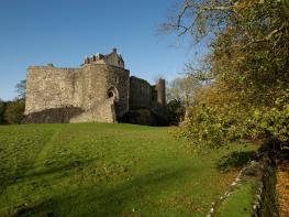
Mingary Castle
Built within the 13th-century curtain walls of Mingary Castle, this restaurant with rooms is…

Black rocks and golden sands at the western end of Britain.
Ardnamurchan
3.75 miles (6kms)
Aird nam Murchan means the Point of the Sea-hound or Sea-warrior – so that referring to Ardnamurchan 'Point' is technically unnecessary. Ardnamurchan Point is the most westerly point of the British mainland – excluding the Hebridean islands and Northern Ireland from the reckoning. On most maps, Land's End appears to the west of Ardnamurchan, but this is a distortion due to the way the Earth gets narrower as we go north: Ardnamurchan lighthouse is 20.5 miles (33km) west of Land's End. And from Corran Ferry near Fort William it's 49 road miles (79km), all on single-track road.
For the Vikings, the sea was their roadway and Ardnamurchan with its long lochs and seaways to the Hebrides wasn't remote at all, but could be considered a central communications hub. They occupied Ardnamurchan from AD 800 to 1300, leaving behind place-names like Grigadale (dale = valley) as well as Placaig, Acarsaig, Ormsaig (all originally ending with the Norse vic = harbour). The later sea warrior, MacDonald Lord of the Isles, with his sea galleys, defied the Kings of Scotland from Mingary Castle at Kilchoan.
The 120ft (36m) high Ardnamurchan Lighthouse, built in 1849, was designed by Alan Stevenson, the uncle of novelist Robert Louis Stevenson. The Stevenson family built most of Scotland's lighthouses over 150 years, and Robert Louis first got to know the Scottish Highlands touring them. This one is built of huge blocks of granite, with an elegant taper and a few touches of Egyptian-style ornament that make it handsome as well as strong. The pale stone, from the Ross of Mull, contrasts with the dark gabbro rocks it stands on. And the cheerful red foghorn provides the final ornament!
Until it was automated in 1988, two lighthouse-keepers and their families lived in the cottages that are now the visitor centre. Here they kept sheep and cows, and seldom saw anyone from the outside world except through their telescopes.
Ardnamurchan today can sometimes be chilly and damp. But 60 million years ago, when the American and European continental masses were moving apart as the Atlantic opened, this was the heart of a great volcano, at least twice the height of Ben Nevis. The black, crystalline gabbro rock under the lighthouse formed 7,000ft (2.1km) underground, in the heart of the magma chamber.
The worn-down volcano forms a structure 6 miles (9.7km) across, centred on the settlement at Achnaha. It is best seen from the air; but also when you take the geological map compiled outcrop by outcrop, and stand back from it to see the huge circular pattern. Such maps are displayed at Kilchoan Information Centre and at its pier.
Walk down the road which zig-zags to the shoreline, and fork left through Portuairk to a turning circle. A small gate ahead is signed as a footpath for Bay Macneil. Go through it to a fence corner, where you turn left to a little stream valley. Go up it for about 50yds (46m), to find a path off to the right, just above some birch trees. The rugged little path leads up above Sanna Bay. It passes to the left of a cairn, then up rocky ground past some metal posts to a large cairn. Just behind it are the low walls of a lookout point.
Turn slightly left, on a small path along the moorland ridge – the pointy hill called Sgurr nam Meann rises directly ahead. At the ridge end, bear down left, into a little grassy valley with a fence. A path runs down this valley to the right, to a ruin on your right. This is a former black house, with accommodation for the house cow at the far end: note the low doorway and rounded corners. The building would originally have been thatched with heather.
Keep ahead to the shoreline. Here a two-ended beach (a tombolo) links out to a tidal island. Unless the tide is right in, turn left along the shoreline, passing below two small cliff crags. Where you see a waymarker post on the grass just up on your left, follow a small path ahead and inland, to join a grassy track just beyond a tall steel-mesh gate. However, if the tide is right in, from the shoreline return to the black house. Take the stile opposite it, for a path running to the left of a fence and then through the tall steel-mesh gate to the track beyond.
Follow the track past a few caravans. Just after a disused toilet block you pass through a gateway. In another 60yds (55m) a waymarker indicates a path forking up left to a stile. More waymarkers trace the path ahead across the moor, to a gate onto a small road. (Ardnamurchan lighthouse is now 1 mile/1.6km away on your right.) Follow the road to the left for 1 mile (1.6km) to the top of a hill, with a house just ahead.
On your left is a small quarry with basalt rock weathered into rounded lumps like fossil onions – 'spheroidal weathering'. Here is a grey field gate with a 'walkers welcome' roundel. Through it, follow a fence on your right along the foot of a birch wood. At the fence corner, bear slightly right to a grey field gate, with a second gate ahead leading to the road above Portuairk.
Small moorland paths and quiet road, several stiles
Low, rocky hummocks overlooking beaches and sea
Keep on lead when passing livestock
OS Explorer 390 Ardnamurchan
Small pull-in at top of road descent to Portuairk, or verges within the village
Kilchoan visitor centre and pier
Read our tips to look after yourself and the environment when following this walk.
Apart from the Orkneys and the Shetlands, Highland is Scotland’s northernmost county. Probably its most famous feature is the mysterious and evocative Loch Ness, allegedly home to an ancient monster that has embedded itself in the world’s modern mythology, and the region’s tourist industry. Monster or no, Loch Ness is beautiful and it contains more water than all the lakes and reservoirs in England and Wales put together. The loch is 24 miles long, one mile wide and 750 feet deep, making it one of the largest bodies of fresh water in Europe.
At the very tip of the Highlands is John o’ Groats, said to be named after a Dutchman, Jan de Groot, who lived here in the early 16th century and operated a ferry service across the stormy Pentland Firth to Orkney. In fact, the real northernmost point of the British mainland is Dunnet Head, whose great cliffs rise imposingly above the Pentland Firth some two miles further north than John o’ Groats.
The Isle of Skye is the largest and best known of the Inner Hebrides. Its name is Norse, meaning ‘isle of clouds’, and the southwestern part of the island has some of the heaviest rainfall on the whole of the British coast. Despite this, it’s the most visited of all the islands of the Inner Hebrides. It’s dominated from every view by the high peaks of the Cuillins, which were only conquered towards the end of the 19th century.
Discover more than 15,000 professionally rated places to stay, eat and visit from across the UK and Ireland.
Choose a place to stay safe in the knowledge that it has been expertly assessed by trained assessors.
Search by location or the type of place you're visiting to find your next ideal holiday experience.
Read our articles, city guides and recommended things to do for inspiration. We're here to help you explore the UK.