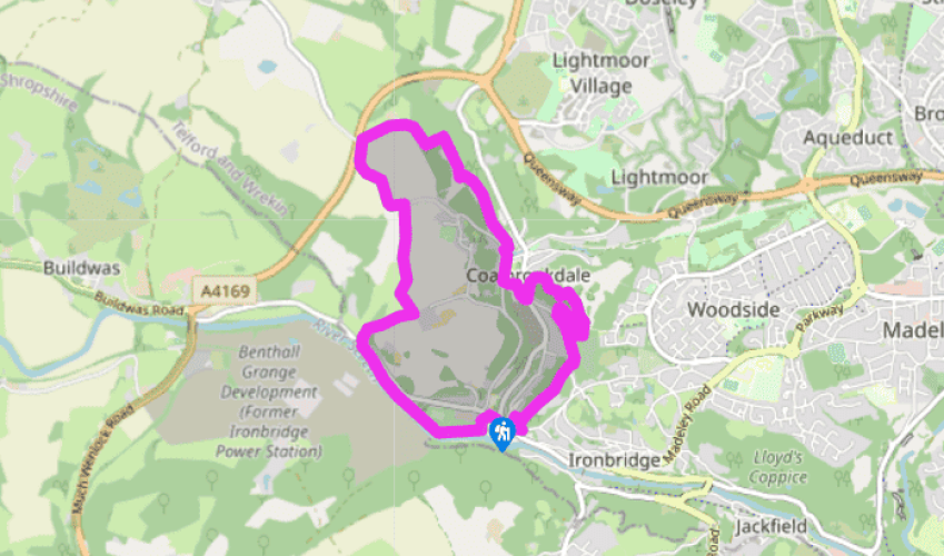
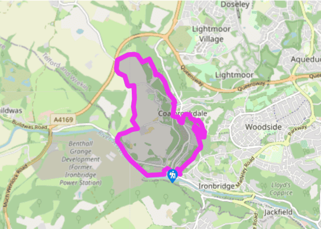
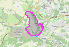
From either car park, walk to the river and turn right, upstream. Take care as the path is narrow and there’s a big drop to the river in places. Pass under two bridges. Keep following the path until three steps lead up to Buildwas Road. Turn left for a few paces, then cross to a footpath that ascends through woodland. The path keeps close to the edge at first, then climbs obliquely to the right.
Cross a stile and continue in the same direction over pastureland. Pass under a pylon, then join a farm track climbing to a gate and stile. Cross, then turn right and follow the hedge to a junction. Turn left within the same field and follow three field edges, then go up a steep meadow to a lane. Turn left.
Leave the lane just before it bridges the A4169, turning right on a tarmac track. Just before Leasows Farm, go through an iron gate on the right, then downfield to enter Lydebrook Dingle at a stile. A waymarked path descends through the wood, with numerous steps. Continue along a path called Rope Walk.
Turn left and descend Loamhole Brook Steps. Cross Loamhole Brook at a footbridge and climb 42 steps on the other side. Turn right and follow the undulating boardwalk to Upper Furnace Pool. Cross its far end on the first of two footbridges to meet the road.
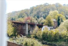
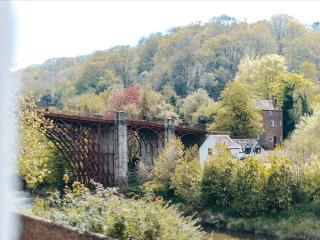
Your onward route is to the left, but a short detour right leads to the Darby Houses, Tea Kettle Row and the Quaker Burial Ground. Resuming the walk, go down to Darby Road and turn right alongside the viaduct. Turn left under the viaduct at a junction with Coach Road. Follow the road between the Museum of Iron and Enginuity to a junction.
Cross into Church Road. Immediately after a disused chapel turn left then go up steps to enter Dale Coppice. Follow a sign for Church Road at a junction, then follow more steps up through the woods. At the next junction go straight ahead, signed ‘Rough Park’. Leave the wood to enter grassland and go forward a few paces to meet a gritty path. Turn left, then shortly fork right, ignoring grassy paths. Bear left at another junction, then bear right at the next two to some gates. Walk along a track. Dale Coppice is on your right, a cemetery on your left.
Partway along the cemetery, a narrow gap accesses Dale Coppice. Turn right, then left, going downhill to a junction marked by a bench. Turn right, then left when a sign indicates Church Road, then left again up the road.
Turn right into Lincoln Hill Wood and follow signs to the Rotunda, presently arriving at a viewpoint where the Rotunda formerly stood. Descend a very steep flight of steps to a junction. Turn right, then left down more steps and left again, signposted to Lincoln Hill Road. Pass behind a house and along a track to a road. Cross to a footpath opposite, which descends to a drive beside the Lincoln Hill lime kilns. Turn right to return to the start.
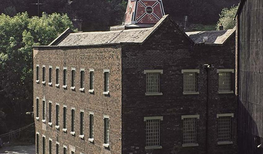
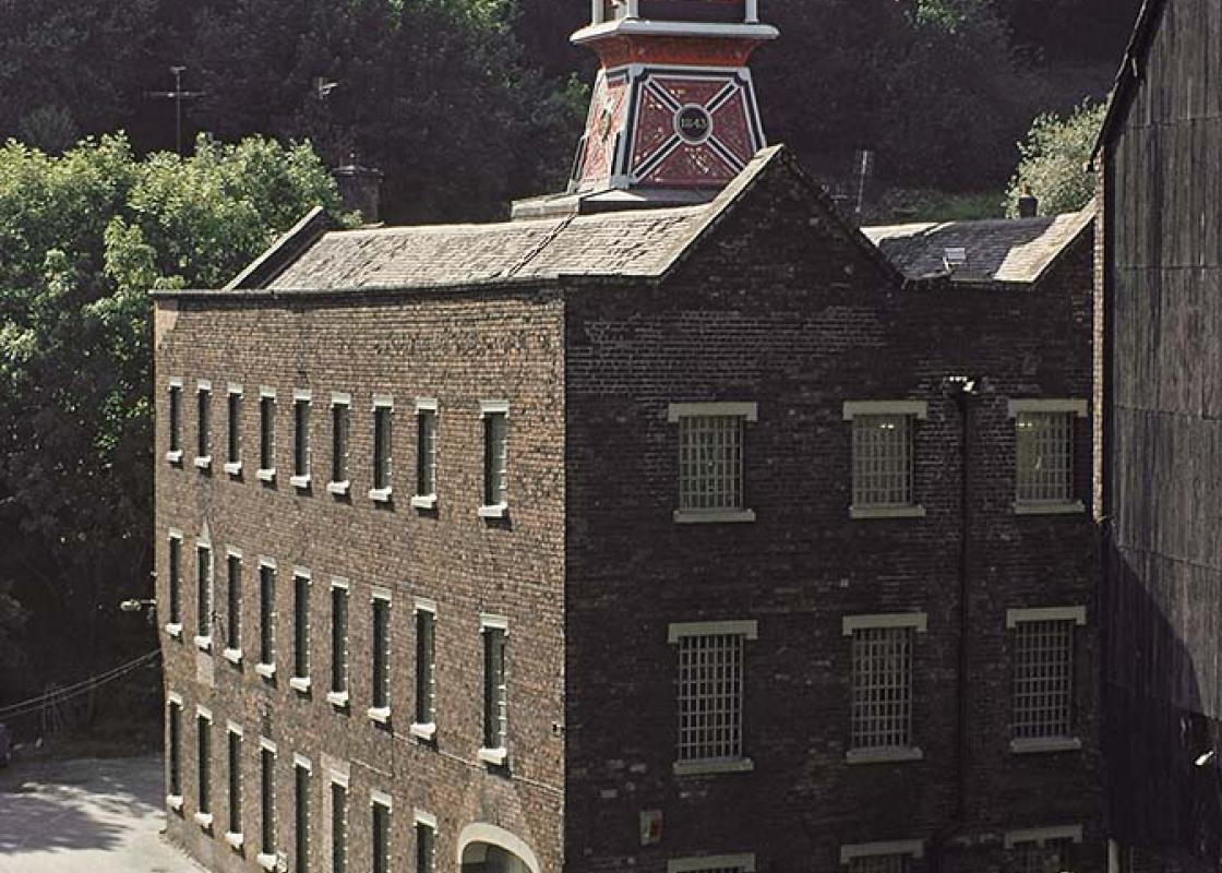
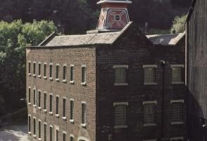
People have been smelting iron for many centuries, but production was originally small scale because smelting was dependent on timber which first had to be made into charcoal – a slow and laborious process. All that changed at Coalbrookdale in 1709 when Abraham Darby I perfected a method of... smelting iron with coke instead of charcoal. It may sound a small thing, but it sparked a revolution that changed the world. At long last iron could be made cheaply in large quantities and it came to be increasingly used in many areas of engineering. By 1785 the Coalbrookdale district had become the foremost industrial area in the world. It was particularly celebrated for its innovations: the first iron bridge, the first iron boat, the first iron rails and the first steam locomotive. Tourists came from far and wide to see the sights, and artists came to paint it all – furnaces lighting up the night sky was a favourite subject. Decline eventually set in due to competition from the Black Country and South Wales and the area fell into decay. Since the 1960s, the surviving industrial relics have been transformed into a fascinating collection of museums and the gorge has been designated a UNESCO World Heritage Site. Perhaps even more remarkable than the industrial heritage is the way nature has reclaimed sites of industrial despoliation and made them beautiful again. These regenerated woods and meadows are managed by the Severn Gorge Countryside Trust and are accessible to the public. The ironmasters were paternalistic types who built decent houses for their workers and took an interest in their moral well-being. When you walk through Dale Coppice and Lincoln Hill Woods you will be using the Sabbath Walks, designed by Richard Reynolds to provide healthy Sunday recreation for his workers. The idea was that this would keep them from drinking, gambling and sexual promiscuity. A rotunda was erected at one viewpoint, but has since been demolished, though you can still enjoy the view. It’s mostly woodland now, but you will see the remains of a great quarry that bit deep into Lincoln Hill. It extends so far underground that tours of its limestone caverns were popular with 19th-century day-trippers. Bands played in the illuminated caverns and thousands came on excursion trains from the Black Country and Birmingham.
Perhaps nowhere else in England will you find a county so deeply rural and with so much variety as Shropshire. Choose a clear day, climb to the top of The Wrekin, and look down on that ‘land of lost content’ so wistfully evoked by A E Housman.
From either car park, walk to the river and turn right, upstream. Take care as the path is narrow and there’s a big drop to the river in places. Pass under two bridges. Keep following the path until three steps lead up to Buildwas Road. Turn left for a few paces, then cross to a footpath that ascends through woodland. The path keeps close to the edge at first, then climbs obliquely to the right.
1 of 8
Cross a stile and continue in the same direction over pastureland. Pass under a pylon, then join a farm track climbing to a gate and stile. Cross, then turn right and follow the hedge to a junction. Turn left within the same field and follow three field edges, then go up a steep meadow to a lane. Turn left.
2 of 8
Leave the lane just before it bridges the A4169, turning right on a tarmac track. Just before Leasows Farm, go through an iron gate on the right, then downfield to enter Lydebrook Dingle at a stile. A waymarked path descends through the wood, with numerous steps. Continue along a path called Rope Walk.
3 of 8
Turn left and descend Loamhole Brook Steps. Cross Loamhole Brook at a footbridge and climb 42 steps on the other side. Turn right and follow the undulating boardwalk to Upper Furnace Pool. Cross its far end on the first of two footbridges to meet the road.
4 of 8
Your onward route is to the left, but a short detour right leads to the Darby Houses, Tea Kettle Row and the Quaker Burial Ground. Resuming the walk, go down to Darby Road and turn right alongside the viaduct. Turn left under the viaduct at a junction with Coach Road. Follow the road between the Museum of Iron and Enginuity to a junction.
5 of 8
Cross into Church Road. Immediately after a disused chapel turn left then go up steps to enter Dale Coppice. Follow a sign for Church Road at a junction, then follow more steps up through the woods. At the next junction go straight ahead, signed ‘Rough Park’. Leave the wood to enter grassland and go forward a few paces to meet a gritty path. Turn left, then shortly fork right, ignoring grassy paths. Bear left at another junction, then bear right at the next two to some gates. Walk along a track. Dale Coppice is on your right, a cemetery on your left.
6 of 8
Partway along the cemetery, a narrow gap accesses Dale Coppice. Turn right, then left, going downhill to a junction marked by a bench. Turn right, then left when a sign indicates Church Road, then left again up the road.
7 of 8
Turn right into Lincoln Hill Wood and follow signs to the Rotunda, presently arriving at a viewpoint where the Rotunda formerly stood. Descend a very steep flight of steps to a junction. Turn right, then left down more steps and left again, signposted to Lincoln Hill Road. Pass behind a house and along a track to a road. Cross to a footpath opposite, which descends to a drive beside the Lincoln Hill lime kilns. Turn right to return to the start.
People have been smelting iron for many centuries, but production was originally small scale because smelting was dependent on timber which first had to be made into charcoal – a slow and laborious process. All that changed at Coalbrookdale in 1709 when Abraham Darby I perfected a method of... smelting iron with coke instead of charcoal. It may sound a small thing, but it sparked a revolution that changed the world. At long last iron could be made cheaply in large quantities and it came to be increasingly used in many areas of engineering. By 1785 the Coalbrookdale district had become the foremost industrial area in the world. It was particularly celebrated for its innovations: the first iron bridge, the first iron boat, the first iron rails and the first steam locomotive. Tourists came from far and wide to see the sights, and artists came to paint it all – furnaces lighting up the night sky was a favourite subject. Decline eventually set in due to competition from the Black Country and South Wales and the area fell into decay. Since the 1960s, the surviving industrial relics have been transformed into a fascinating collection of museums and the gorge has been designated a UNESCO World Heritage Site. Perhaps even more remarkable than the industrial heritage is the way nature has reclaimed sites of industrial despoliation and made them beautiful again. These regenerated woods and meadows are managed by the Severn Gorge Countryside Trust and are accessible to the public. The ironmasters were paternalistic types who built decent houses for their workers and took an interest in their moral well-being. When you walk through Dale Coppice and Lincoln Hill Woods you will be using the Sabbath Walks, designed by Richard Reynolds to provide healthy Sunday recreation for his workers. The idea was that this would keep them from drinking, gambling and sexual promiscuity. A rotunda was erected at one viewpoint, but has since been demolished, though you can still enjoy the view. It’s mostly woodland now, but you will see the remains of a great quarry that bit deep into Lincoln Hill. It extends so far underground that tours of its limestone caverns were popular with 19th-century day-trippers. Bands played in the illuminated caverns and thousands came on excursion trains from the Black Country and Birmingham.
Perhaps nowhere else in England will you find a county so deeply rural and with so much variety as Shropshire. Choose a clear day, climb to the top of The Wrekin, and look down on that ‘land of lost content’ so wistfully evoked by A E Housman.