


Hedgerow Luxury Glamping
Located on a dairy farm, a warm welcome is assured at this adults-only destination. All the…

Gisburn
11.9 miles (19.1kms)
Gisburn, which sits astride the busy A59, is very old and possesses many attractive buildings, including the former Ribblesdale Arms, dated 1635, now apartments. The village is the venue for a weekly auction and an annual steeplechase. Parts of Gisburn Church date from Norman times.
Annually, on the Sunday nearest 20 November, spectators congregate on and around Paythorne Bridge, hoping to watch salmon spawning on the sandy gravel river bed. This is one of the two main spawning areas for Ribble salmon, the other being at Nappa Flatts.
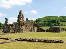
The Hammerton family held Hammerton Hall, above Slaidburn, and much of the River Hodder was theirs. They also lived at 14th-century Wigglesworth Hall, with its own chapel. To protect their dependants when raiding Scots swept through the Aire Gap, they built a pele tower at Hellifield. They worshipped in Long Preston Church, where the hammer heads of their family crest are carved on their tombs. The Hammertons were a bold family with a proud boast: ‘From Bowland to the Plains of York we ride over our own ground’. Their good fortune, however, came to an end when Sir Stephen Hammerton joined the ill-fated Pilgrimage of Grace and was executed for his pains. It is said that his son, on hearing of his father’s death, died of a broken heart. Badly damaged by fire in the 1950s, the tithe barn at Wigglesworth Hall was one of the largest in England; what remains is still impressive.
Celtic Rathmell, with its windbreak of sycamore and ash trees, sits on a hillside because the valley bottom was once a vast uninhabitable swamp. It is an unpretentious village of closely gathered stone-built cottages and farmhouses, all of which share fine views that embrace long, blue fells, the flat ‘Ings’ of the valley floor and the towering scars and mountains at the dale’s head. A Rathmell farmer, so the story goes, climbed on to a haystack to sleep, following a heavy drinking session. While he slept a storm broke at the dale’s head and the rising waters of the Ribble lifted the haystack, which was floated downstream for some considerable distance before being deposited on the river bank. The following morning the farmer woke to find himself surrounded by enquiring strangers in what was to him unknown country. When asked where he had come from the farmer shouted, ‘I come fra Rothmell – Ra’mell in England’. Dr Richard Frankland’s Non-Conformist Academy, one of the earliest Congregational centres, was founded at Rathmell in 1670.
To the left as the Ribble Way approaches Settle Bridge is Giggleswick, a delightful village with a gurgling beck, the Terns, cawing rooks, a quiet green, delightful cottages and lots of back lanes and paths. The name Giggleswick could have had a double derivation; Norse Farmer Ghikel had a farm, or wick, and it was sited near a bubbling or gugglian, spring.
Follow the A59 through Gisburn and turn left along the Settle road (A682). Follow it for 0.6 miles (1km) until the Pennine Bridleway joins in from the left. Follow a separate track – new and very welcome – alongside the road. As the road bends right continue ahead to a conspicuous mound on a ridge. This is Castle Haugh, a Norman motte. Descend and walk through a wood to Paythorne Bridge. Go left up the road to Paythorne.
Opposite the Buck Inn take the obvious track for about 0.25m (400m) to a waymarked junction where the Pennine Bridleway bears left on a green track. Follow this for about 0.6 miles (1km) to a bend where Pennine Bridleway goes ahead over a bridge and then bears left: the Ribble Way goes ahead, cutting a corner. Rejoin the Pennine Bridleway out onto Paythorne Moor.
At a bridge the Ribble Way leaves the main track, descending right to a footbridge. Bear left to another footbridge and cross to a stile. Cross a field then bear left in the next to a way-post and footbridge. Continue to meet a road near buildings at Halton West.
Go right then turn left before Town End Farm. Follow the track for 0.5 miles (800m) then follow waymarks skirting round Low Scale Farm. Continue along a wall and straight ahead to meet a track by Deep Dale Wood. Go right, rejoining the Pennine Bridleway, and continue to meet a road. Turn right then go left just before Cow Bridge. Walk to the river then bear left, beside Wigglesworth Beck.
Approaching Wigglesworth Hall, go right in front of a house with a huge barn behind. Cross a bridge then turn left on another track. Cross a cattle grid and bear right to a stile. Go over a rise and meet a track. When it splits go straight ahead to a stile and marker post. Follow a wall to its end then go left to a wood, down right to a footbridge then up and right to a stile. Follow a fence then bear left to a road and turn right.
After 200yds (118m), turn left to Far Cappleside Farm. Keep right of the buildings then go right over a stile and down to meet another track by a derelict cricket ground. Bear left past houses and farm buildings then follow waymarks down to a pretty little bridge. Climb a walled lane and go left, then bear left on a sunken track (Pennine Bridleway) for 30yds (27m). Go right up steps to a stile. Continue along a wall on the right then ahead to a facing wall-stile, with Rathmell below on your right.
Continue towards a large sycamore tree and Rathmell school. Turn left up the road then right, across the playing-field. Follow a wall and pass left of a large barn. Follow the right-hand wall to a stile, cross the corner of a garden and go right on a track between houses. Go through two gates and diagonally down the field to a stile near a farm. Go between buildings then turn right. At a fork in the track go left and when the track bends right go straight ahead over a stile to another stile and road.
Cross and go via footbridges and a stile to the river. Go upstream, under the railway and A65. Continue past a farm then leave the river as it curves away and cross a field to a road. For Settle railway station and town centre turn right here. To continue directly on the Ribble Way, cross and continue along a narrow passage between bungalows. Cross part of a housing estate, as signposted, to return to the riverside. Follow it upstream to Settle Bridge.
Field and moorland tracks and paths, occasionally indistinct
pasture and some rougher moorland with backdrop of high hills becoming more impressive as the stage progresses
Almost entirely across grazing land so opportunities to run free may be limited
OS Explorer OL 2, OL 21, OL 41
Free car-park off A682 in Gisburn; pay-and-display car-parks in Settle
In Settle Town Centre
Read our tips to look after yourself and the environment when following this walk.
Discover more than 15,000 professionally rated places to stay, eat and visit from across the UK and Ireland.
Choose a place to stay safe in the knowledge that it has been expertly assessed by trained assessors.
Search by location or the type of place you're visiting to find your next ideal holiday experience.
Read our articles, city guides and recommended things to do for inspiration. We're here to help you explore the UK.