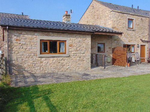
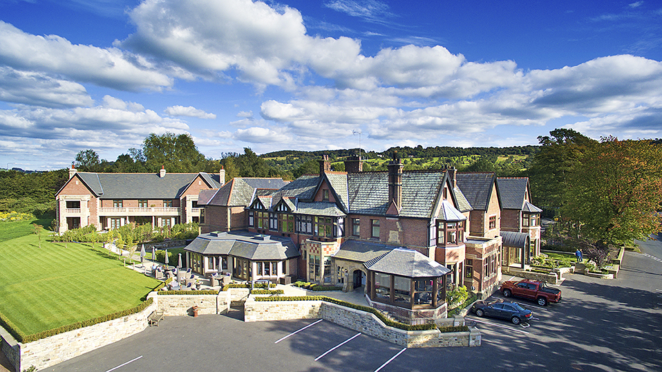

The Millstone, Mellor
Once a coaching inn, The Millstone is situated in a village just outside Blackburn. It provides…

Ribchester
10.3 miles (16.6kms)
Ribchester, ‘the walled town by the Ribble’, was a major Middle Bronze Age settlement that was occupied through the Iron Age. The Romans recognised its importance and established the cavalry fort of Bremetennacum there, at the hub of five great roads. It remained an active cavalry fort on Julius Agricola’s military highway linking Chester and Manchester with Hadrian’s Wall.
From just before the waterworks bridge to Lower Hodder Bridge, the Ribble Way coincides with the Tolkien Trail, a popular 5.5 mile (9km) walk starting at Hurst Green. Its premise is that J R R Tolkien based the landscape of The Shire, in The Hobbit and The Lord of the Rings, on the local countryside. It’s true that the pattern of the three rivers – Ribble, Calder and Hodder – bears some resemblance to Tolkien’s map of The Shire, and he did spend some time in the area in the early 1940s, when his son was a teacher at Stonyhurst. However, The Hobbit was published in 1937 and conceived even earlier. It’s also well known that Tolkien’s prime inspiration was the country of his boyhood in rural Warwickshire and Worcestershire. It certainly is possible, however, that the Ribble Valley did have an influence on details of the landscape, particularly as it was developed in The Lord of the Rings. Most likely of all, the ferry to Hacking Hall was still in operation when Tolkien visited the area, and could well be the original of Bucklebury Ferry.
A tablet on the side of the front door of Jumbles Farm dates the house to 1723. Built in the late Stuart style, it takes its name from Jumbles Rocks; an ancient ford that links the two Bronze Age sites of Winckley Lane and Brockhall Eases. Hacking Hall, on the Ribble’s eastern bank near the confluence of the River Calder, is a magnificent Jacobean mansion with a five-gabled, many-mullioned frontage.
Cromwell’s Bridge is a medieval bridge with three segmental arches, one of the prettiest over the Hodder. It is so named because it was there, in 1648, that Oliver Cromwell decided to advance westwards, along the Ribble, to cut off the Scots. The Battle of Preston was the result. Legend claims that Cromwell ordered the parapets removed to speed passage of the baggage-train. If true, this is a rare example of a structure being named after someone who vandalised it rather than the person who built it.
From the school, follow the riverside path along the Ribble, turn left along Huddle Brook to a back-street, then turn right, on to the Blackburn road. Follow this road until it turns sharp right across Ribchester Bridge, then continue straight on along a private road on the west bank of the river.
At Dewhurst House farmyard, turn right to the river, then turn left, along the riverbank, to Haugh Wood. Follow the path round the bend of the river and, on leaving the wood, go up the slope and over the ridge at its lowest point.
Descend to a gate and fingerpost. Go past another fingerpost and climb to the top corner of the field. Cross a farm track and descend another field boundary alongside Clough Bank Wood and cross Starling Brook. Continue eastwards, along a fence/hedge-line to a fenced track. Follow this to Trough House farmyard.
From Trough House climb the lane ahead then go right to follow a well-waymarked concessionary path. Where another footpath joins from the left, descend steeply to a footbridge. Follow the riverbank easily past a waterworks bridge to Jumbles and continue round a great meander, passing an isolated house – the former Hacking Ferry boathouse.
Follow the riverbank to where the River Hodder joins the Ribble. Continue up the Hodder, along a track through Winckley Hall Farm and up through the wooded grounds of Winckley Hall. When the drive curves left around Winckley Hall, go through a kissing-gate on the right and follow a field path to meet the edge of Spring Wood. The imposing buildings of Stonyhurst College, a major Catholic public school, are seen ahead. Reach the Longridge–Clitheroe road at a junction.
Turn right, descend, and cross Lower Hodder Bridge. Continue along the roadside, now using the verge, for 0.5 miles (800m) and turn right to Great Mitton. Cross Mitton Bridge and, just beyond the Aspinall Arms, turn left over a stile.
Follow a path along the line of the river, joining a track near a pipe-bridge over the Ribble. Follow the track, skirting a farm, to reach a road. Walk past a recycling centre and soon cross a small bridge, then turn left along a track. At a fork go right then join a fenced gravel path. Continue by a riverside path past a caravan site and picnic area to reach Edisford Bridge, on the outskirts of the town of Clitheroe.
Riverside paths; some indistinct sections across fields; can be muddy in places in winter
Fields and woods, sometimes well above the river.
Woodland sections give chances for dogs to run free
OS Explorer OL 41, 287
Pay-and-display car-parks in Ribchester and at Edisford Bridge
At car-park in Ribchester and beside Edisford Bridge
<p>Public Transport: Buses connect Ribchester and Clitheroe, at least every 2 hours; no Sunday service. Clitheroe has a railway station.</p>
Read our tips to look after yourself and the environment when following this walk.
Discover more than 15,000 professionally rated places to stay, eat and visit from across the UK and Ireland.
Choose a place to stay safe in the knowledge that it has been expertly assessed by trained assessors.
Search by location or the type of place you're visiting to find your next ideal holiday experience.
Read our articles, city guides and recommended things to do for inspiration. We're here to help you explore the UK.