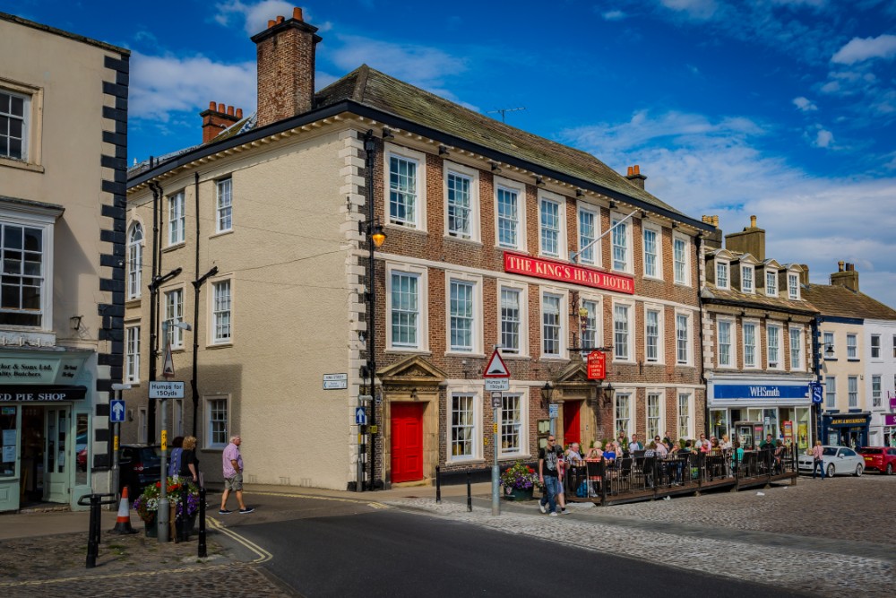


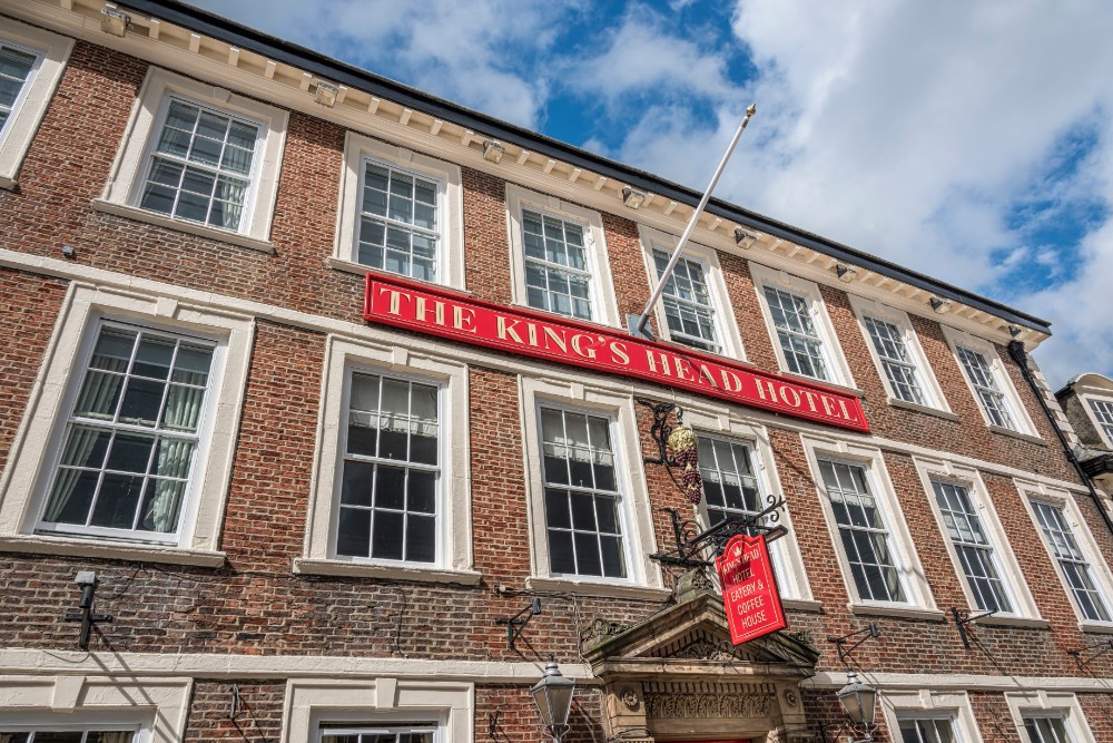
Kings Head
The Kings Head was built in around 1720 and has retained a rich history in the market town of…

Following in the steps of the Richmond Drummer to Easby Abbey.
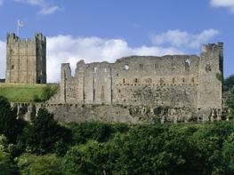
Richmond
3.75 miles (6kms)
The first part of the walk follows much of the route taken by the legendary Richmond Drummer Boy. At the end of the 18th century, the story goes, soldiers in Richmond Castle discovered a tunnel that was thought to lead from there to Easby Abbey. They sent their drummer boy down it, beating his drum so they could follow from above ground. His route went under the Market Square and along to Frenchgate, then beside the river towards the abbey. At the spot now marked by the Drummer Boy Stone, the drumming stopped. The Drummer Boy was never seen again. A version of the story is found in William Maynes’s novel Earthfasts (1966). The Green Howards Regimental Museum in the Market Square can tell you more about the drummer boy and his regiment.
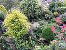
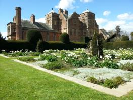
The remnants of Easby Abbey are seen on this walk. It was founded for Premonstratensian Canons in 1155 by the Constable of Richmond Castle. Although little of the church remains, some of the other buildings survive well, including the gatehouse, built about 1300. The refectory is also impressive, and you can see the infirmary, the chapter house and the dormitory. Just by the abbey ruins is the parish church, St Agatha’s. It contains a replica of the Anglo-Saxon Easby Cross (the original is in the British Museum), and a set of medieval wall paintings showing Old Testament scenes of Adam and Eve on the north wall, and the life of Jesus on the south, as well as depictions of activities such as pruning and hawking.
After the abbey, you’ll cross the River Swale on the old railway bridge and follow the track bed. This was part of the branch line from Richmond to Darlington, which opened in 1846. It was closed in 1970. The station has been restored as a cinema and shopping centre, with a cafe. Look right over Richmond Bridge after you have passed below the castle to see how the stonework differs from one end to the other. It was built by different contractors, one working for Richmond Council and one for the North Riding of Yorkshire.
In the hillside below Billy Bank Wood, which you enter beyond the bridge, were copper mines dating back to the 15th century. Friar’s Wynd, near the end of the walk, was once part of the ancient route up from the banks of the River Swale to the northeastern area of the town around Frenchgate – ‘Frankesgate’ in the Middles Ages. Both these names suggest that this part of the town was once occupied by foreign workers; they may have been helping to build the castle. Finkle Street, which runs northwest from the Market Place, has a name that is often found in Yorkshire towns and means ‘crooked’. West of the Market Square is Newbiggin, the ‘new settlement’ – new, that is in 1071, when the castle was begun.
Leave the Nuns Close car park and turn right, then left at the T-junction. At the roundabout go on, down Ryder’s Wynd. At the bottom turn left, then go right into Station Road. Just past the church, take Lombards Wynd on the left.
Turn right at the next junction, along a lane which becomes a track. Follow the track above the River Ure to a three-way fork. Take the middle path, which passes to the right of the Drummer Boy Stone. Follow this path to a gate into a field, then bear right along the edge nearest the river, to a gate. Follow a track which goes over a stile and runs beside the abbey in the village of Easby.
Just beyond the car park turn right along another track, and continue with the river on your right to Love Lane House. Turn right over the old railway bridge. Follow the trackbed, crossing a metalled lane, to the station. Go to the left of the station building to the road.
Turn left up the road, then turn right up Priory Villas, and bear right to pass in front of the houses. From a gate walk between two sheds to another gate, then along a clear path which rises, and after a gate gradually descends to run near the river. Walk beside a playing field and past the clubhouse to a road.
Turn right to cross Richmond Bridge, then turn right along a riverside lane. Where the lane bends left by a car park, go to the river bank to see the Foss, then return to the lane.
On a right-hand bend turn left up steps by the end of Castle Terrace, then turn right along a quiet cobbled street (signed 'Richmond Castle') to emerge near the castle entrance. Walk down the street directly opposite the entrance, left of the market hall, to emerge into the market square.
Turn left and walk to the town hall. Cross to Holy Trinity Church, which now houses the Green Howards Museum, and continue ahead to the narrow entrance of Friars Wynd (signed 'Georgian Theatre Royal'). At the end of the Wynd turn left to a zebra crossing, cross and continue along the road. Turn right up Hurgill Road to return to the car park.
Field and riverside paths, some town walking
Valley of the River Swale and its steep banks
Dogs should be on lead for most of walk
OS Explorer 304 Darlington & Richmond
Nuns Close long-stay car park
Nuns Close car park, Richmond town centre and former station
Read our tips to look after yourself and the environment when following this walk.
Discover more than 15,000 professionally rated places to stay, eat and visit from across the UK and Ireland.
Choose a place to stay safe in the knowledge that it has been expertly assessed by trained assessors.
Search by location or the type of place you're visiting to find your next ideal holiday experience.
Read our articles, city guides and recommended things to do for inspiration. We're here to help you explore the UK.