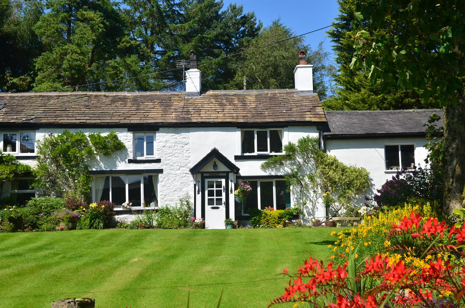
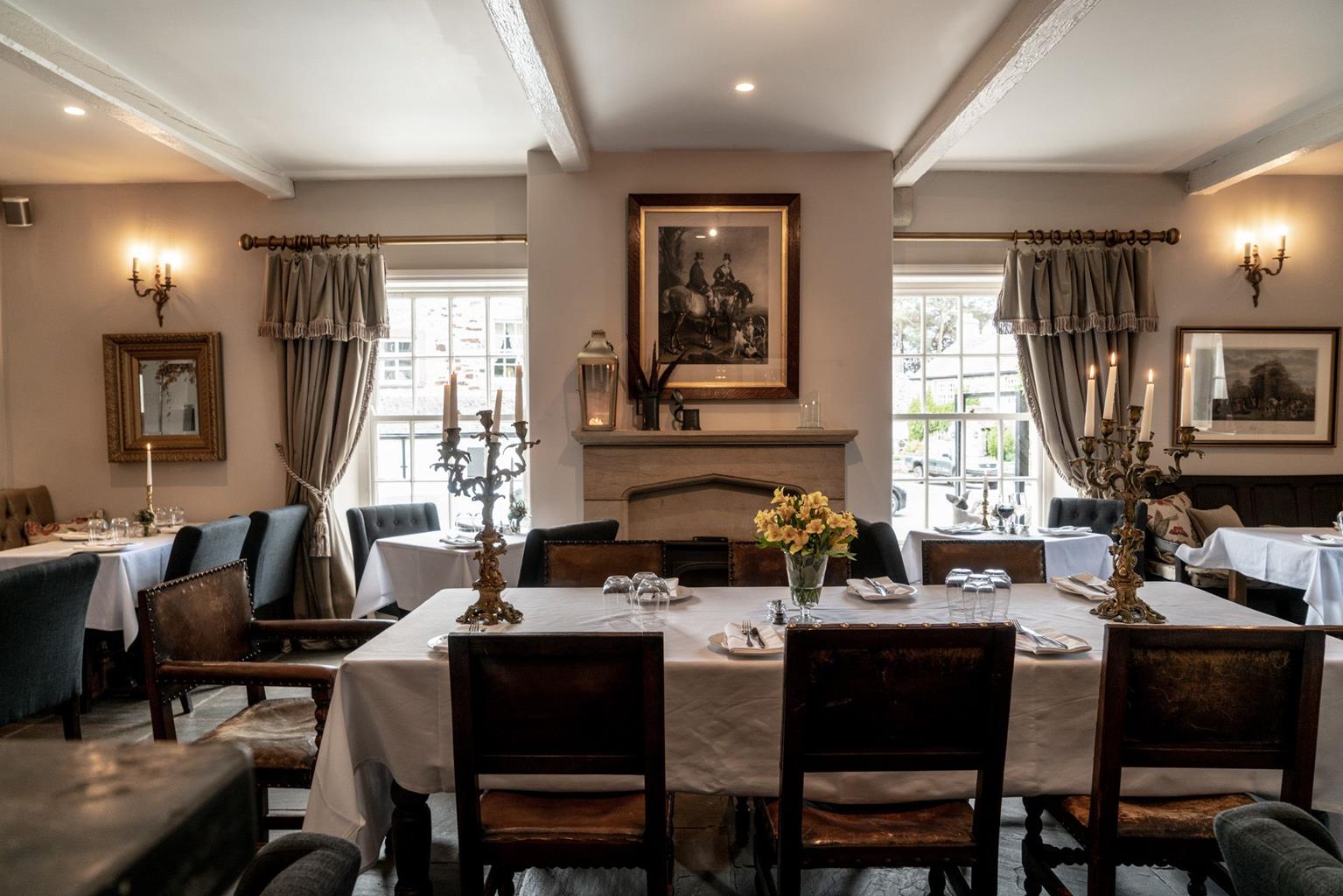
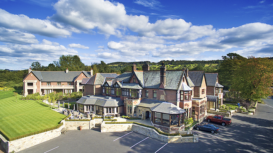


The Inn at Whitewell
Imperious old coaching inn lost in deep country with a river to fish, five-mile views, delicious…

A straightforward walk around the delightful heart of the Forest of Bowland
Hodder Valley
7.25 miles (11.7kms)
Whitewell sits deep within the Forest of Bowland, a Norman forest governed by Forest Law, which was not finally repealed until 1971. The forest is thought originally to have been administered from Radholme Laund on the hill to the southeast, the court moving to Whitewell during the 14th century. 'Forest' then meant something different, a legal term describing unenclosed land set aside for the hunt. It was managed to safeguard the game and vegetation on which they depended, and poaching or any detrimental activity could be severely punished. But by the later Middle Ages, there was a shift towards farming and the forest was assarted – that is, cleared and the land put to pasture.
While the upland moors of Bowland are dominated by gritstone, the Hodder valley around Whitewell is underlain by limestone. Unlike the acid soils of the high fells, it is generally well-drained and produces good grazing. Many of the limestone outcrops were quarried, the burnt stone being used as fertiliser. The largest of the quarries in the area was at Knot Hill, passed halfway through the walk.
Bridge-building in medieval times was a major undertaking and places where the river could safely be forded – often just below a bend to slow the flow – assumed importance, with a farm or settlement springing up beside them. Such was the case at Stakes, which has a particularly fine 17th-century farmhouse overlooking stepping stones placed beside the ford.
The final stretch of the walk lies around the hillside below Radolme Laund. The laund or hunting park covered an extensive area bounded by the river, but was deparked sometime during the 17th century. The high gates passed towards the end of the walk were nothing to do with deer but were erected by Matthew Brown, a brewer who held the estate during the 19th century.
Descend past the church to the river and go left to the stepping stones. Climb beside a wood to New Laund, continuing through the farmyard. Towards the far end, leave left by an old cheese press on a track to Tunstall Ing. Keep the line across a couple of fields, leaving through a gate onto a lane.
Go briefly left to a stile on the right. Strike out half left to a track. Walk right past Tunstall Ing, curving over a hill. Keep left at a fork to Higher Fence Wood Farm.
Pass through the farmyard to the track beyond. Over a footbridge, go through a gate and turn left along the field edge. Towards the far end, swing right to a gate and continue to Dinkling Green Farm, walking between the house and barn into the farmyard.
Leave beside a stone barn on the right. At a fork, keep left. Entering a field, continue by the right-hand fence. Through a gate in a dip, stay beside the left hedge, turning left through a gate by the corner. Reaching a gate in a stone wall, go through and head towards Lickhurst Farm, dropping across a footbridge in the intervening valley. Climb the track beyond and turn left through the yard.
Leave the far end along an old track. Beyond a ford curve right, then, approaching a gate, bear left and climb beside a stream. Through a gate in the corner, carry on from field to field to Knot Hill. Approaching the quarry, swing left past a lime kiln to a track. Follow it right to a lane and go left to a junction.
Turn left. Just past a house, leave through a gate on the right. Over a stream, turn right to the river, where stepping stones cross to Stakes Farm. Follow a track out left.
Alternatively, if the river is high, turn right, eventually crossing Loud Mytham Bridge to a junction. Go left to cross the Hodder. Immediately over Doeford Bridge, mount a stile on the left. Climb above the river and over the crest to a stile in the right corner. Continue by an outgrown hedge and through a gate, dropping with the boundary on your right to Stakes Farm. Turn out past a barn onto a track and follow it right.
Reaching a bend, go through the gate ahead and turn left downhill. Curve right across a stream, rising beyond to a kissing-gate. Walk ahead to a second kissing-gate near the far-left corner. Carry on to ford another stream, climbing away on a grass track and then above a tree-clad bank to the corner of Ing Wood. Walk on at its edge, maintaining the line across a large field to exit the far corner onto a lane.
Go left a short distance to a tall gate on the right, through which swing left to a field gate. Bear right across the hillside to another tall gate. Contour from field to field around the hill, eventually passing through a third tall gate. Briefly follow a wall before turning left through a field gate. Drop to join a track slanting down across the hillside. Passing Seed Hill Cottage, swing left, descending beside a small graveyard and down steps to a lane. Go left back to Whitewell.
Field paths, farm tracks and quiet lane, 15 stiles
Pasture and river valley, overlooked by high bare hills
Grazing land, keep dogs on leads
OS Explorer OL41 Forest of Bowland & Ribblesdale
Roadside parking near The Inn at Whitewell or below church
At Dunsop Bridge
<p>With two sets of stepping stones, this walk could be problematic when the river is in flood, but as long as the first set is clear, the second can be avoided by a detour.</p>
Read our tips to look after yourself and the environment when following this walk.
Lancashire was at the centre of the British cotton industry in the 19th century, which lead to the urbanization of great tracts of the area. The cotton boom came and went, but the industrial profile remains. Lancashire’s resorts, Blackpool, Southport and Morecambe Bay, were originally developed to meet the leisure needs of the cotton mill town workers. Blackpool is the biggest and brashest, celebrated for it tower, miles of promenade, and the coloured light ‘illuminations’. Amusements are taken very seriously here, day and night, and visitors can be entertained in a thousand different ways.
The former county town, Lancaster, boasts one of the younger English universities, dating from 1964. Other towns built up to accommodate the mill-workers with back-to-back terraced houses, are Burnley, Blackburn, Rochdale and Accrington. To get out of town, you can head for the Pennines, the ‘backbone of England’, a series of hills stretching from the Peak District National Park to the Scottish borders. To the north of the country is the Forest of Bowland, which despite its name is fairly open country, high up, with great views.
Discover more than 15,000 professionally rated places to stay, eat and visit from across the UK and Ireland.
Choose a place to stay safe in the knowledge that it has been expertly assessed by trained assessors.
Search by location or the type of place you're visiting to find your next ideal holiday experience.
Read our articles, city guides and recommended things to do for inspiration. We're here to help you explore the UK.