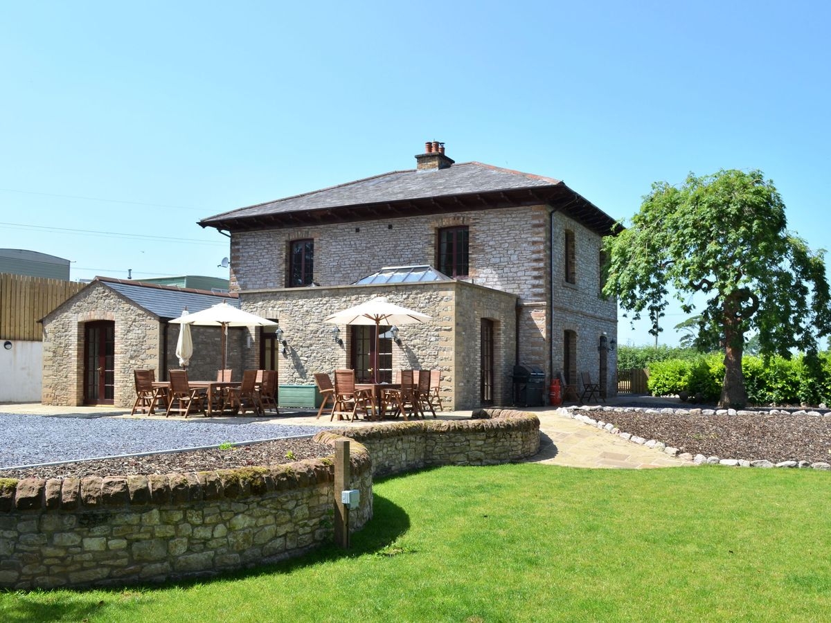
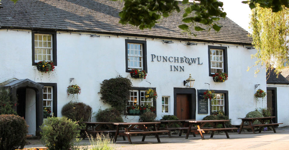


Brookfield House
In a quiet rural location within easy reach of the M6, inviting Brookfield Guest House stands in…

The quiet Lowther Valley was once the domain of an austere order of canons.
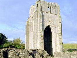
Shap Abbey & Rosgill
2.5 miles (4kms)
The Premonstratensians came to ‘Hepp’ (meaning ‘heap’) in 1199, from a site near Kendal at Preston Patrick. They craved solitude and austerity, and by the banks of the River Lowther they found both. The white-coated canons (they weren’t actually monks) set about building a church and developing the land around them to supply food and a trading surplus to fund their work. This was never a huge place – there would have been an abbot and only 12 canons, with perhaps a handful of lay brothers to act as servants. By comparison, the Cistercian house at Fountains in Yorkshire, which acquired significant landholdings throughout the Dales and Lake District, numbered as many as 52 monks and a veritable army of retainers.
The abbey building was founded with money from local noble families, and originally had a cross-shaped plan, with a range of outbuildings you can still discern today. In the 15th century the nave was extended and there was an attempt to put up a grand tower over the crossing. There were structural problems, however, and the idea was abandoned. It wasn’t until 1500 that the plans were revived. Under the instruction of the ambitious abbot Richard Redman (who went on to become Bishop of Ely), the masons who had recently worked on the impressive new towers at Furness and Fountains were engaged to deliver a similar product at Shap. Taking heed of lessons learned, they shunned the unstable crossing and built at the west end instead. The tower, in the typical Perpendicular style of the day, still stands pretty much at its original height.
Ironically the foundation it served was to last barely 40 more years. In 1540 the last abbot was pensioned off on £40 per year and became the vicar at Kirkby Thore near Penrith. Henry VIII’s administrators moved in and sold the estates to Sir Thomas Wharton, the governor of Carlisle. In the 18th century they came to the Lowther family and in 1896 the Earl of Lonsdale removed most of the good remaining carved stonework to decorate his garden at Lowther Park in anticipation of a visit that year from the German Kaiser. The ruins have been cared for by the state since 1948.
From the little car park, walk over the ancient bridge and through the wider of the two gates on the other side. To visit the abbey ruins, keep straight on here, making for the entrance beneath the tower. Otherwise turn immediately right, up the bank to a gate and follow the riverside path beyond, rounding the river bend before striking off left across the field. A faint field path heads for a gate in the wall ahead. As you go through this you’ll see the ongoing route, down into a dip then over a shoulder. Beyond the brow, keep to the right of the wall. As it bends left, maintain your direction to reach a stile. Cross and continue on a faint field path to a stile beside a gate. Cross this to reach a surfaced farm track.
Turn right, then as the path bends left, leave it for a small gate beside some tumbledown farm buildings on the right. On the far side of the old farmyard a stone stile leads through the wall. Head half left down the field towards a ence corner. Some steps lead to the gate at Parish Crag Bridge.
Cross the ancient packhorse bridge and on the other side bear right, following the fence around the outcrop of Fairy Crag. Soon you have a wall on your right, and beyond that you go over a high wall topped by a gate. Stay with the wall at the foot of a bank, soon to reach a pair of gates. Walk along the farm track beyond, which meets a road by a bridge.
Turn right, go over the bridge and up into Rosgill. Ascending the street, look for an opening on the right between Fell View and Hall Garth.
Squeeze through a stile and gate and another gate, then walk across the short field to another stile. Cross the middle of a narrow field to a gate. Take the right-hand option of two footpath arrows, and stay on this level field path. There are two gates on the far side of the field. Go through the one on the left. Pass a farm building and, staying on the level route, go through the left-hand wooden gate. A wall joins you briefly on the right, but it is soon lost again as your route follows the bank top through several more gates. Finally a ladder stile keeps you to the left of an old farm, and you emerge on the concrete access road to the abbey.
Turn right and walk down the hill to return to the car park.
Mostly grassy paths and tracks, 7 stiles
Fields and valley
Most fields grazed by sheep, so care must be exercised
OS Explorer OL5 The English Lakes (NE)
Parking area at Shap Abbey, follow signs from A6 in Shap village
None on route, nearest in Shap village (1 mile/1.6km)
Read our tips to look after yourself and the environment when following this walk.
Cumbria's rugged yet beautiful landscape is best known for the Lake District National Park that sits within its boundaries. It’s famous for Lake Windermere, England’s largest lake, and Derwent Water, ‘Queen of the English Lakes'. This beautiful countryside once inspired William Wordsworth and his home, Dove Cottage, in Grasmere is a popular museum. Another place of literary pilgrimage is Hill Top, home of Beatrix Potter, located near Windermere. Tom Kitten, Samuel Whiskers and Jemima Puddleduck were all created here.
Much of Cumbria is often overlooked in favour of the Lake Distirct. In the south, the Lune Valley remains as lovely as it was when Turner painted it. The coast is also a secret gem. With its wide cobbled streets, spacious green and views of the Solway Firth, Silloth is a fine Victorian seaside resort. Other towns along this coastline include Whitehaven, Workington and Maryport. Carlisle is well worth a look – once a Roman camp, its red-brick cathedral dates back to the early 12th century and its 11th-century castle was built by William Rufus.
Discover more than 15,000 professionally rated places to stay, eat and visit from across the UK and Ireland.
Choose a place to stay safe in the knowledge that it has been expertly assessed by trained assessors.
Search by location or the type of place you're visiting to find your next ideal holiday experience.
Read our articles, city guides and recommended things to do for inspiration. We're here to help you explore the UK.