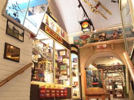
Dating back to 1563, The Bull is one of the oldest buildings in this famously pretty Sussex…
South Downs Way: Ditchling Beacon to Rodmell

11.2 miles (18kms)
About the walk
This section of the South Downs Way National Trail is an excellent one for those who prefer the easy descents to the challenge of climbs. Starting high and finishing low and with just one major ascent, most of this stage is either on the level or downhill. From Buckland Bank there are clear views over Lewes and its disused racecourse, looking out over an area where the Battle of Lewes was fought between King Henry III and Simon de Montfort in 1264. The walk ends in the small village of Rodmell, once home to Virginia and Leonard Wolff.
Walk directions
Cross the narrow road from the Ditchling Beacon car park with care. There is a blind bend near the top. From here, the South Downs Way continues eastwards over the grassy top of the Downs, passing a V-shaped plantation which commemorated Queen Victoria’s Jubilee. Beyond lonely Streathill Farm, the view looks north across Plumpton towards the famous racecourse, with Plumpton church and the agricultural college close by the foot of the Downs. To the south the huge mass of Brighton, its
marina jutting out into the sea, dominates this part of the coast.
Just over 2 miles (3km) from Ditchling Beacon, the South Downs Way takes a major change in direction, following the line of the Downs to the southeast. However, first it turns to the southwest, leaving the bridleway which goes straight ahead at a clearly signposted gate. This is just before the track reaches Ashcombe Bottom, the only extensive patch of woodland on this part of the Downs. Beyond is the 676ft (206m) trig point at Blackcap, and almost a mile (1.6km) further on are the electricity pylons that march across the Downs.
Along Balmer Down, the path crosses the site of an important early Romano-British field system. The route turns down a track with wire fences on either side, before bearing left to head southeast down
the edge of a field, passing beneath the overhead electricity cables. The route now turns southwest before reaching Ashcombe Plantation and drops down to Bunkershill Plantation, where it climbs very
steeply and descends along the edge of an arable field to the A27 at Housedean Farm.
Here the route turns west for 100yds (90m) and crosses the A27 via a farm bridge. There is a drinking water tap at Housedean Farm. Once over the bridge the route runs parallel to the railway line and then ducks under the line through a short tunnel and then follows a downland bank before heading up through a small wood to come out above the Newmarket Inn. The route continues climbing the side of the valley by Loose Bottom.
Near the top of the Down, the South Downs Way turns left by the Newmarket Plantation, a grove of beeches badly damaged in the 1987 gale, and left again by the side of Castle Hill, before turning right to resume its southeasterly course towards Eastbourne, above Kingston village, near Lewes.
Past a large dewpond, the route crosses Swanborough Hill, with views over Swanborough Manor below. Once the grange of Lewes Priory and later owned by Sir Philip Sidney, the manor has fine carved griffons in the driveway, a 13th-century hall and a chapel with a 15th-century dormitory.
Heading on along the top of the Downs, the route eventually comes to a concrete track that runs straight as a die along Ilford Hill and Front Hill. From here, a narrow enclosed track leads along the side of woods at Mill Hill by a large house in a fine position on the right, emerging with views towards Newhaven to the south.
A lane leads down to the village of Rodmell where overnight accommodation is available. The actual SDW heads down to Cricketing Bottom and then over the hill to the Telescombe village road, crossing the Newhaven road to head down into Southease village. This avoids the need to walk along the main road. Many of the older houses have an ‘A’ marked on them, in homage to the Marquess of Abergavenny, who was the landowner until 1919. Beyond lies the River Ouse.
Additional information
Chalk, flint, concrete, grass and earthy paths
Open hills, farmland and plantations
On lead when near livestock or on roads
OS Explorer 122
At start
None on route
WALKING IN SAFETY
Read our tips to look after yourself and the environment when following this walk.
Find out more
Also in the area
About the area
Discover
Nearby stays
Restaurants and Pubs
Nearby experiences
Recommended things to do
Why choose Rated Trips?
Your trusted guide to rated places across the UK
The best coverage
Discover more than 15,000 professionally rated places to stay, eat and visit from across the UK and Ireland.
Quality assured
Choose a place to stay safe in the knowledge that it has been expertly assessed by trained assessors.
Plan your next trip
Search by location or the type of place you're visiting to find your next ideal holiday experience.
Travel inspiration
Read our articles, city guides and recommended things to do for inspiration. We're here to help you explore the UK.


