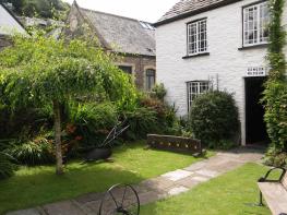
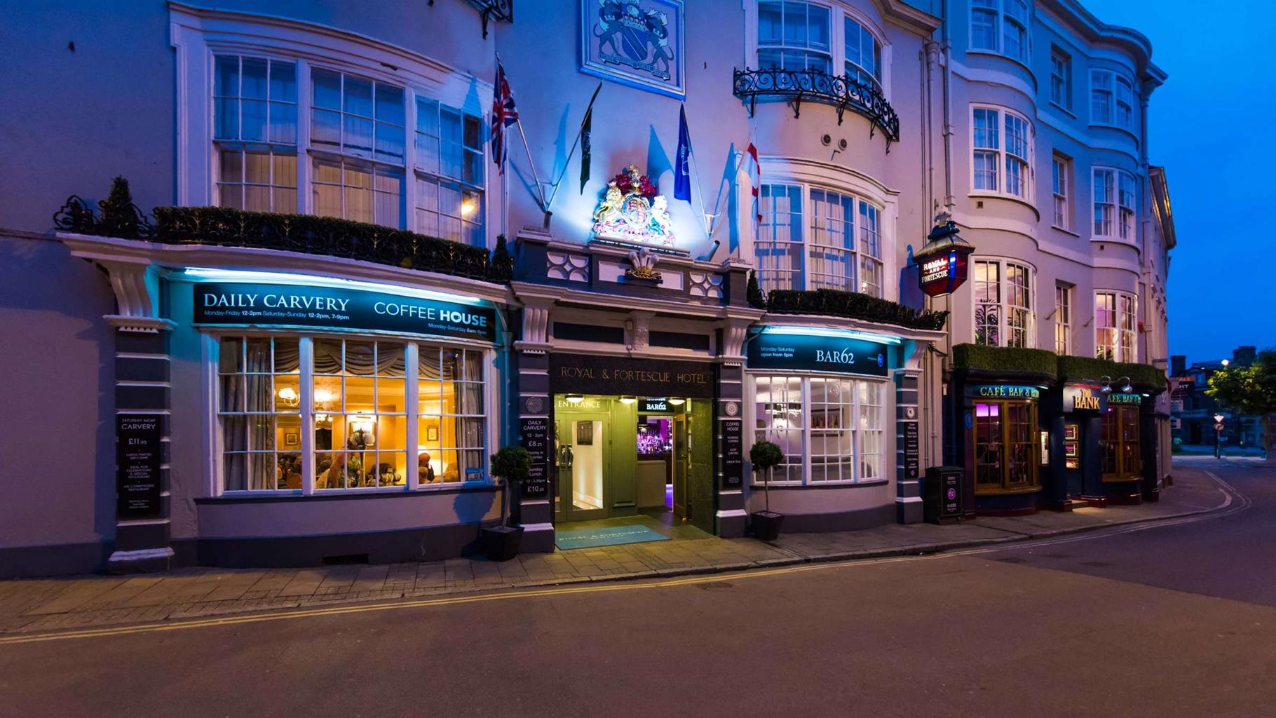


Clooneavin Holidays
Located in the harbour town of Lynmouth, Clooneavin Holidays offers eight apartments in one…

A long and strenuous stage through some of North Devon’s most picturesque and dramatic coastal landscapes.
Lynmouth, Devon
13.5 miles (21.7kms)
Lynmouth is an attractive village at the mouth of the combined East and West Lyn rivers. A disastrous flood occurred here in 1952, reminders of which can be seen at the Glen Lyn Gorge and Flood Memorial Hall on The Esplanade. Lynmouth retains its Victorian character, with some older cottages above flood level on Mars Hill and around Shelley’s Cottage, where the English Romantic poet Percy Bysshe Shelley (1792–1822) lived for a while.
The walk starts from the Pavilion (Exmoor National Park Visitor Centre, opened in the autumn of 2013), the former steamboat terminal. Wonderful archive photos in the Centre portray Lynmouth in Victorian times when visitors frequently arrived by sea – inland communications being almost non-existent due to the terrain – and were then carried up the cliffs by pony or donkey. Horse-drawn carriages could not be used until 1828, when the road from Lynmouth to Lynton was built. Westerway, the original path to Lynton from Lynmouth harbour, was the route used by smugglers to carry goods up the cliffs. The steep slopes above the harbour were at one time cultivated; before the inland road system developed villagers had to be largely self-sufficient.
Since 1976 Lynmouth has been celebrated as the start (or finish!) of the Two Moors Way, a long-distance walking route from Ivybridge on the southern edge of Dartmoor. In 2005 the route was linked to part of the Erme–Plym Trail to Wembury on the south coast, thus producing the Devon Coast-to-Coast route.
Towards the Cliff Railway turn left up steps ‘Westerway’ (unsigned). Follow tarmac zigzags very steeply uphill, crossing the Cliff Railway twice. Reach the North Walk (built in 1817) and turn right. To save the climb use the railway, turning left at Lee Road at the top, and left again at the church and down to North Walk. Continue along the cliff edge; at a path junction keep straight on towards the impressive ‘Castle Rock’.
Pass Castle Rock on the landward side. Follow the road briefly downhill then take a path to the right of the road to reach the edge of the Lee Abbey estate; turn left and climb steeply to meet the road at the old tollhouse.
Turn right down the toll road to Lee Abbey (a Christian retreat founded in 1946). At a fork by the entrance keep ahead, downhill, to reach the parking area for the sandy beach at Lee Bay. Follow the lane past The Tea Cottage.
At a Coast Path sign (you can stay on the lane or drop right here) take the pretty path below right through woodland. Keep along the right edge of fields to round Crock Point, then bear inland to reach a farm building at Crock Pits. The old path ahead is closed, so follow diversion signs very steeply uphill to meet the lane again. Turn right, keeping ahead at a junction. Drop into a combe and bear right as signed just before the Woody Bay Hotel. Meet the drive to Martinhoe Manor and turn left, climbing steeply.
Where the lane bends sharp left keep ahead under oak trees on a track signed to Hunter’s Inn. Pass Hollow Brook waterfall and walk along the cliffs to Highveer Point from where the path descends to the River Heddon and meets a path (here a detour can be made downstream to the pebbly beach with its limekiln or upstream to the Hunters Inn: refreshments and public toilets).
The main path crosses the river a short distance upstream, then zigzags out of the cleave and out to Peter Rock and an exposed section of the route, soon turning inland to meet a junction (Trentishoe Church left).
Turn right and follow clear signs along the heads of various ‘guts’, or gullies, to Holdstone Down. This heath-clad hill is believed by many to have mystical qualities and reports of UFO sightings here are common. The path continues along the broad grassy estate drive known as Sea View Road, bearing inland then dropping steeply into Sherrycombe. A tough ascent leads to Blackstone Point Cross, from where a detour can be made to Blackstone Point, where there were iron mines in the 19th century. The main path gains the cairn on Great Hangman and fantastic 360-degree views.
Dropping gently enjoy amazing views over the exceptionally elongated village of Combe Martin. Cross the neck of Little Hangman and pass Wild Pear Beach and Lester Cliff. At a fork in a blackthorn thicket keep left and descend to the Kiln car park at Combe Martin.
Undulating cliff-edge path, uneven and exposed in places
Quiet lanes and wooded combes
Under control at all times; unfenced cliffs and livestock
OS Explorer OL9 Exmoor
Pay-&-display car parks in Lynmouth and Combe Martin
Lynmouth, Lee Bay, Combe Martin
<p>Risk of vertigo; two very steep descents/ascents: feral goats in the Valley of Rocks</p>
Read our tips to look after yourself and the environment when following this walk.
Discover more than 15,000 professionally rated places to stay, eat and visit from across the UK and Ireland.
Choose a place to stay safe in the knowledge that it has been expertly assessed by trained assessors.
Search by location or the type of place you're visiting to find your next ideal holiday experience.
Read our articles, city guides and recommended things to do for inspiration. We're here to help you explore the UK.