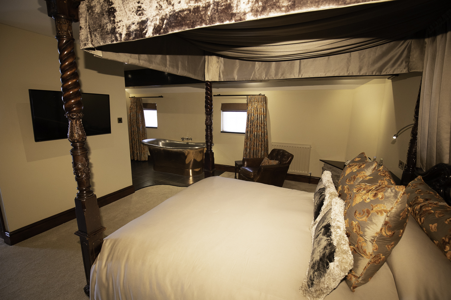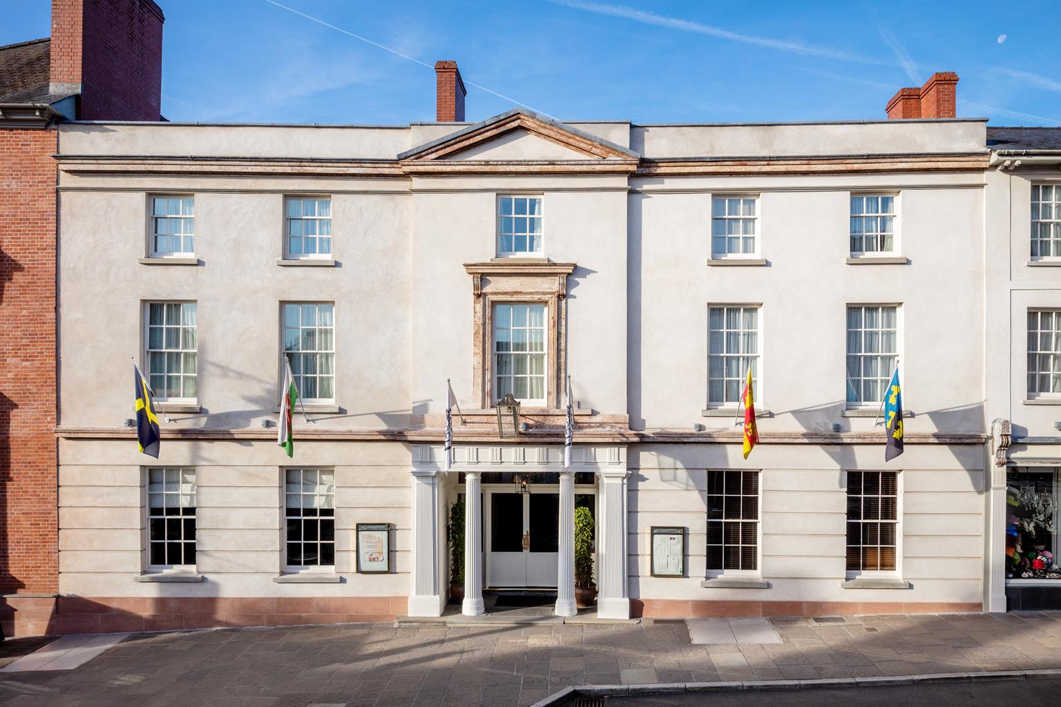
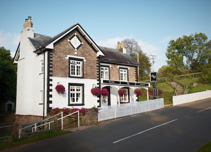


Angel Hotel
Once a coaching inn, this has long been a popular venue for both locals and visitors, with the…

See another side of the most distinctive of the Abergavenny peaks
Sugar Loaf
4.5 miles (7.2kms)
The Sugar Loaf, or Mynydd Pen-y-fal to give it its Welsh name, is without a doubt one of the most popular mountains in the National Park. The distinctive, cone-shaped outline of the rock-strewn summit is visible from miles around and the convenient placing of a car park on the southern flanks of the mountain makes it easy for those who just want to ‘climb a mountain’. To follow the well-trodden route is to miss the best of the hill, which, despite its popularity, remains a formidable and dignified peak. This walk takes a more subtle approach, leaving the masses on Mynydd Llanwenarth and dipping into a lonely combe, before making an enjoyable push, up the less-walked west ridge. The steep walls of the valley give a much better sense of scale to the gentle giant you’re about to climb. The descent follows the more ordinary route back to the car park.
The Sugar Loaf, and some of the land that surrounds it, belongs to the National Trust, who own around 4 per cent of the land within the National Park. The Trust currently acts as a guardian for over 500 properties and gardens, nearly 620,00 acres (250,00ha) of countryside, including the Bannau Brycheiniog’s highest peaks of Pen y Fan and Corn Du, and over 780 miles (1,255km) of coast.
Wales has one of the highest densities of sheep in the world. In the Bannau Brycheiniog (Brecon Beacons) National Park, they outnumber people by 30 to 1. Most of the farms in the National Park are sheep farms. The sheep you’ll see while walking across the upland commons are mainly the hardy Welsh mountain sheep, the smallest of the commercially bred sheep with a small head, small ears and a white or tanned face with dark eyes. They thrive in the harsh mountain environment – the ewes spend as many as 36 weeks every year on the high ground – and can eke out food from the very poor grazing available. Typically, the ewes celebrate the New Year by being returned to the hill – around 80 per cent of them will be carrying lambs. They’re scanned for twins in February and those carrying two lambs will be retained on the low ground with supplementary food until they’ve given birth
Standing in the car park and looking up the slope, you’ll see three obvious tracks leading away. The lowest, down to the left, is a tarmac drive; above this, but still heading out left, is a broad grassy track. Take this and follow it for 500yds (457m) to the corner of a dry-stone wall.
This marks a crossroads where you keep straight ahead, to follow the wall on your left. Continue along this line for another 0.5 miles (800m), ignoring any right forks, and keeping the wall down to your left. Eventually, you’ll start to drop down into a valley, where you leave the wall and head diagonally towards a wood. At the end of the wood, keep left to descend a grassy path to the stream.
Climb out of the valley, keeping to the main, steepest, right-hand path. This leads up and around a shoulder and meets another dry-stone wall. Follow this, still climbing a little, until it levels by a corner and gate in the wall. Turn right here, cross some lumpy ground and follow the grassy path up.
As the track levels, you’ll be joined by another track from the left. Continue ahead and climb on to the rocks at the western end of the summit ridge. Follow the ridge to the white-painted trig point.
Looking back towards the car park, you’ll see that the hillside is crisscrossed with tracks. Most will lead you back eventually, but the easiest route follows a path that traverses right, from directly below the trig point. This veers left and drops steeply down a blunt spur.
Follow this down until it levels and pass two right forks and a path crossing at right angles. As the track veers left, take the right fork to follow an almost sunken track along a broke wall, which leads to a junction by a wall. This is the track that you followed on the outward leg. Bear left and retrace your steps back to the car park.
Grassy tracks
Bracken-covered hillsides, secluded valley and rugged mountain top
Care needed near sheep
OS Explorer OL13 Brecon Beacons National Park
Northwest of Abergavenny, at the end of lane beyond Sugar Loaf vineyards
None on route
Read our tips to look after yourself and the environment when following this walk.
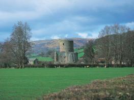
In their bid to control the borderlands of Monmouthshire – also known as the Marches – the Normans built a triangle of castles: Grosmont, Skenfrith and White. At first, they were simple wooden structures strengthened by earthworks, but when the lively Welsh refused to stop attacking them, it was decided more permanent fortresses were needed. All three are worth a visit and the views from the battlements at White Castle over the surrounding countryside to the Black Mountains are stunning, as is all the scenery in this area – consisting of a patchwork of low hills, hidden valleys, fields criss-crossed with hedgerows and small belts of woodland.
Monmouth itself makes a great base to explore the beautiful Wye Valley, as well as being known as the home of Rockfield Studios, where Queen recorded Bohemian Rhapsody in 1975. The largest town in the county, Abergavenny is creating a name for itself as the foodie capital of the Usk Valley, and has held a weekly cattle market on the same site since 1863. Its location just six miles from the English border means it’s often described as the ‘gateway to Wales’.
Discover more than 15,000 professionally rated places to stay, eat and visit from across the UK and Ireland.
Choose a place to stay safe in the knowledge that it has been expertly assessed by trained assessors.
Search by location or the type of place you're visiting to find your next ideal holiday experience.
Read our articles, city guides and recommended things to do for inspiration. We're here to help you explore the UK.