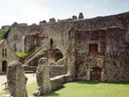
Just by the Esplanade, this hotel has an enviable outlook. Bedrooms are comfortable and very…
The Allies’ giant Lepe

Explore one of Hampshire’s most important wartime sites at Lepe Country Park.
2 miles (3.2kms)
About the walk
More than two years of military planning went into the invasion of France on D-Day, 6 June, 1944. To move some 160,000 men across the English Channel on a single day would have been an extraordinary feat in peacetime. To have achieved it in wartime under heavy fire seems little short of miraculous, Yet, within three months, the Allies had over 2 million men in northern France. By the end of June, the Allies would need a cross-Channel harbour roughly the size of Dover to handle 12,000 tons of stores and 2,500 vehicles each and every day – so they took a couple with them.
Operation Mulberry and PLUTO
The Mulberry harbours were a civil engineering project of epic proportions. At least ten of the country’s largest construction companies were called in to manufacture the many different components that were needed, including the massive ‘Phoenix’ caissons built here at Lepe. They were built at various locations around the British coast, launched on slipways like the ones you’ll see on your walk, then towed to Selsey or Dungeness where they were stored on the seabed to avoid detection. When the invasion came, the caissons were re-floated and towed across the Channel to France.
Besides vehicles, stores and personnel, an advancing army needs fuel. Tankers were considered vulnerable to enemy attack, the vagaries of the weather and, in any case, were needed elsewhere. The military solution, developed in partnership with the Anglo-Iranian Oil Company, was PLUTO – the pipeline under the ocean.
In September 1944 these two pipelines began delivering 100,000 gallons (454,600 litres) of fuel a day to the Allied forces in France. Eventually a further 17 lines were laid from Dungeness and by VE Day in May 1945 the network had supplied more than 172 million gallons (167.5 million litres) of fuel.
You’ll see plenty of reminders of Lepe’s former wartime role as you walk along the beach. It’s worth checking out the information boards beside the beach cafe before setting out, to help you interpret what you’re looking at.
Walk directions
From the beach car park, walk up the gravelled slope to the right of the café and then turn right along the gravelled path at the top of the low cliff. (From the upper car park, just head towards the cliff and then urn left). Pass the war memorial anchor and continue between the gateposts to reach the wide sandy track behind the beach.
Pass the yellow gas pipeline markers at Stansore Point, where the track merges with the shingle bank and continue past the ‘Dolphins’. These two historic offshore structures are all that remains of the former pierhead and mark the start of the D-Day construction area.
Walk to the end of the construction platforms. The seaward side is badly eroded at the northern end but you can still see the rolling track walls and get a good idea of the scale of this project.
Turn and retrace your steps to Point 2. Rejoin the gravelled path as it bears inland past the gate on your right; then 60yds (55m) further on, turn right through the gap into the wildflower meadows. Follow the right-hand hedge until the faint grassy path swings left through the trees into the upper car park. Walk past the children’s play area and down the slope to the beach car park.
Additional information
Sand and shingle beach, also gravel and grassy paths
Coastal scenery with adjoining meadowland
No dogs on the adjoining family beach (just off this route) April–September
AA Walker's Map 3 New Forest
Country Park car parks (pay-and-display)
By cafe at the start
WALKING IN SAFETY
Read our tips to look after yourself and the environment when following this walk.
Find out more
Also in the area
About the area
Discover Hampshire
Hampshire’s varied landscape of hills and heaths, downlands and forests, valleys and coast is without rival in southern England. Combine these varied landscapes and terrains with secluded and idyllic villages, complete with thatched and timber-framed cottages and Norman churches, elegant Georgian market towns, historic ports and cities, restored canals and ancient abbeys, forts and castles, and you have a county that is paradise for lovers of the great outdoors.
If you’re a walker, stride out across the high, rolling, chalk downland of the north Hampshire ‘highlands’ with far-reaching views, walk through steep, beech-clad ‘hangers’ close to the Sussex border. Or perhaps take a gentler stroll and meander along peaceful paths through unspoilt river valleys, etched by the sparkling trout streams of the Test, Itchen, Avon and Meon. Alternatively, wander across lonely salt marshes and beside fascinating coastal inlets or, perhaps, explore the beautiful medieval forest and heathland of the New Forest, the jewel in Hampshire’s crown.
Nearby stays
Restaurants and Pubs
Nearby experiences
Recommended things to do
Why choose Rated Trips?
Your trusted guide to rated places across the UK
The best coverage
Discover more than 15,000 professionally rated places to stay, eat and visit from across the UK and Ireland.
Quality assured
Choose a place to stay safe in the knowledge that it has been expertly assessed by trained assessors.
Plan your next trip
Search by location or the type of place you're visiting to find your next ideal holiday experience.
Travel inspiration
Read our articles, city guides and recommended things to do for inspiration. We're here to help you explore the UK.


