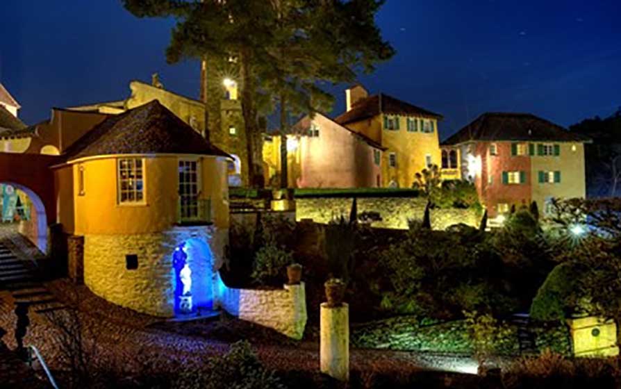


Aberdunant Hall
Part of the Aberdunant Hall holiday park, which is set on 200 acres of ancient woodland, that…

Aberglaslyn
4 miles (6.4kms)
This route heads for the rugged hills forming one side of the great Aberglaslyn gorge, which has graced many a postcard and book jacket. At the back of the car park you pass under a railway bridge that belonged to the Welsh Highland Railway, and pass the site of an old crushing plant. Here, copper ore from the mountain would have been prepared for shipment, using the railway.
Beyond the plant, the path follows a stream and climbs steadily through the lonely Cwm Bychan. Here, beneath craggy mountains patched with heather and bracken, you come across a line of rusting gantries. They’re part of an old aerial ropeway, built to carry ore down to the crushing mill. Mining had taken place hereabouts since Roman times, but after World War I the extraction became uneconomical, and in 1922 the mines closed.
Continuing to the col above, the route comes to a huge area of mining spoil and a meeting of routes. Ours turns south, and soon we’re following a rocky path zigzagging down to a grassy basin below, before continuing along a craggy ridge. Here the ground drops away steeply into the valley of the Afon Glaslyn. If it’s early summer the scene will be emblazoned by the vivid pink blooms of rhododendrons, which cover the hillside. Hundreds of feet below lie the rooftops of Beddgelert, and what lies in between is a glorious little path twisting through those rhododendrons and the rocks into the village. If you get that feeling of déjà vu, the hillsides around here were used for the setting of the Chinese village in the film, The Inn of the Sixth Happiness (1958), starring Ingrid Bergman.
Beddgelert itself is a pretty village with a fine two-arched bridge spanning the Glaslyn and a handful of busy craft shops and cafes, which throng with visitors in the summer. Around here they’re all too fond of telling you the story of Prince Llewelyn’s brave dog, Gelert, and pointing to the grave which gave the village its name. Don’t be misled; a past landlord of the Royal Goat devised the plausible story to boost his trade.
The way back to Aberglaslyn used to be via the old Welsh Highland Railway trackbed, but since this has been reopened the only route is now a rough track by the raging river. The hard bit with handholds comes early on. If you can manage that, you can enjoy the walk through the gorge and through the attractive woodland that shades its banks. If you want to see that postcard view though, you’ll have to make a short detour to the roadside at Pont Aberglaslyn. It’s stunning.
The path starts to the left of the toilet block and goes under the railway bridge, before climbing through Cwm Bychan. After a steady climb the path reaches the iron pylons of the aerial cableway.
Beyond the pylons, keep straight on, ignoring paths forking left. A grassy corridor leads to a col and a stile in a fence. Bear left beyond the stile and head for a three-way footpath signpost by the rocks of Grib Ddu.
Follow the path on the left signed ‘To Beddgelert and Sygun’ and go over a ladder stile. Turn left immediately, then follow the path round a rocky knoll and slant down the hillside to a green bowl. Bear right onto a level green path to a cairn and turn left, over a rocky rise, to a larger cairn at Bwlch-y-Sygyn.
The path now heads southwest along the mountain’s northwestern ridge, overlooking Beddgelert. Ignore any lesser paths along the way.
Midway along the ridge, a large cairn overlooks the turn-off right for Beddgelert. The clear, stony path weaves through rhododendron and rock, goes through a kissing gate in a wall halfway down, then descends further to the edge of Beddgelert, where a little lane between cottages leads to the Afon Glaslyn.
Turn left to follow the river for a short way. Don’t cross the footbridge over the river but turn left to follow the Glaslyn’s east bank. Cross the restored railway line and then continue between it and the river.
Below the first tunnel, the path is pushed right to the water’s edge. Handholds screwed into the rocks assist passage on a difficult but short section. The path continues through riverside woodland and over boulders until it comes to Pont Aberglaslyn, the main road bridge.
Here, turn left up some steps and follow a dirt path through the woods. Just before the railway, at a path junction, turn right and down to the car park.
Well-maintained paths and tracks (see note below), several stiles
Rocky hills and river gorge
Dogs should be on a lead at all times
OS Explorer OL17 Snowdon / Yr Wyddfa
National Trust pay car park, Aberglaslyn
At car park and in Church Street, Beddgelert
Short section of riverside path in Aberglaslyn gorge is difficult and requires use of handholds
Read our tips to look after yourself and the environment when following this walk.
The county of Gwynedd is home to most of the Snowdonia National Park – including the wettest spot in Britain, an arête running up to Snowdon’s summit that receives an average annual rainfall of 4,473mm. With its mighty peaks, rivers and strong Welsh heritage (it has the highest proportion of Welsh-speakers in all of Wales), it’s always been an extremely popular place to visit and live. The busiest part is around Snowdon; around 750,000 people climb, walk or ride the train to the summit each year.
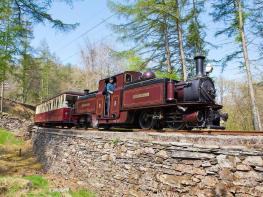
Also in Gwynedd is the Llyn Peninsula, a remote part of Wales sticking 30 miles out into the Irish Sea. At the base of the peninsula is Porthmadog, a small town linked to Snowdonia by two steam railways – the Welsh Highland Railway and the Ffestiniog Railway. Other popular places are Criccieth, with a castle on its headland overlooking the beach, Pwllheli, and Abersoch and the St Tudwal Islands. Elsewhere, the peninsula is all about wildlife, tranquillity, and ancient sacred sites. Tre’r Ceiri hill fort is an Iron Age settlement set beside the coastal mountain of Yr Eifl, while Bardsey Island, at the tip of the peninsula, was the site of a fifth-century Celtic monastery.
Discover more than 15,000 professionally rated places to stay, eat and visit from across the UK and Ireland.
Choose a place to stay safe in the knowledge that it has been expertly assessed by trained assessors.
Search by location or the type of place you're visiting to find your next ideal holiday experience.
Read our articles, city guides and recommended things to do for inspiration. We're here to help you explore the UK.