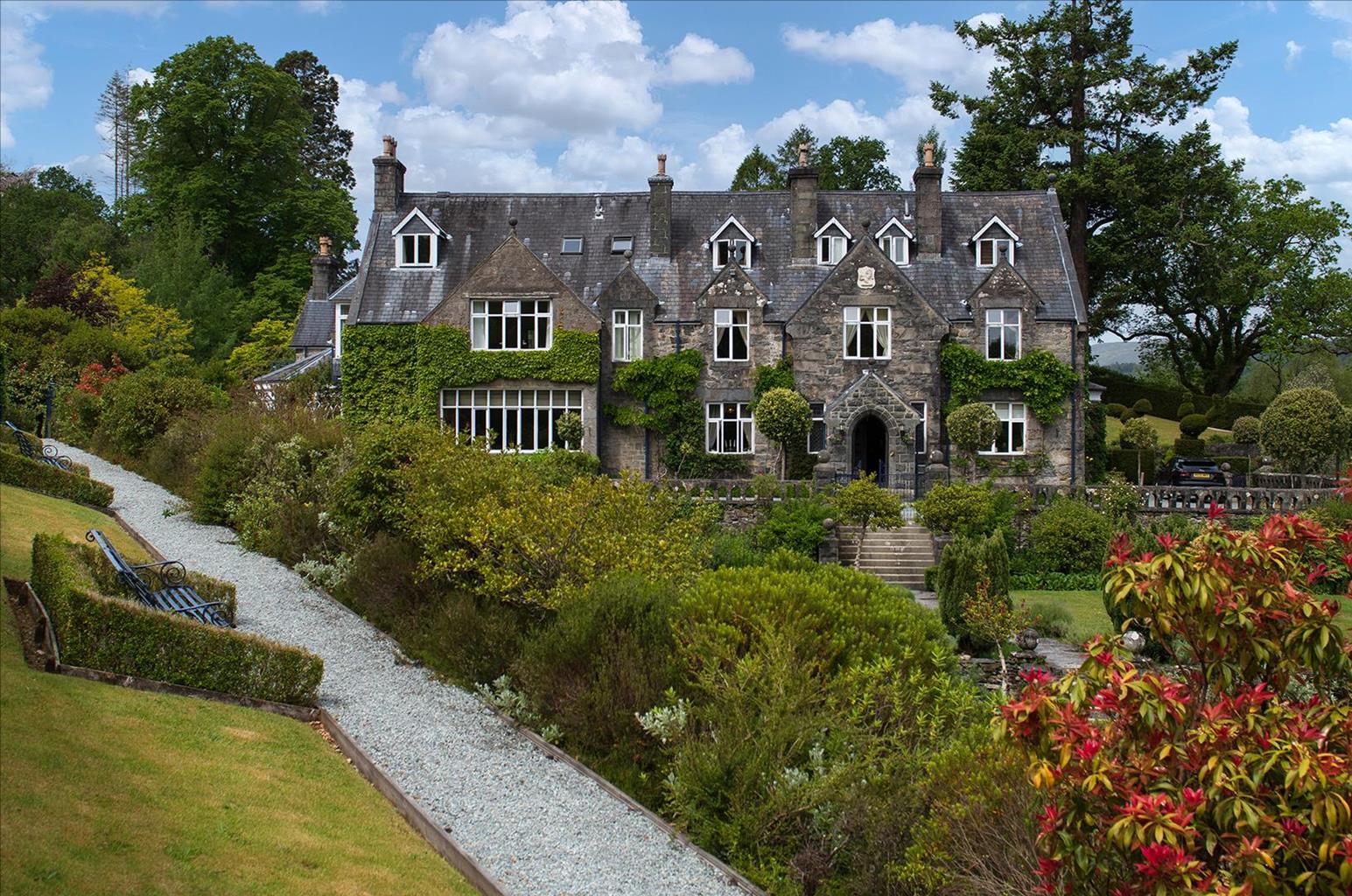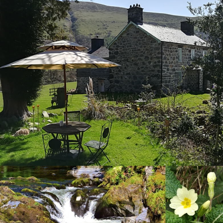

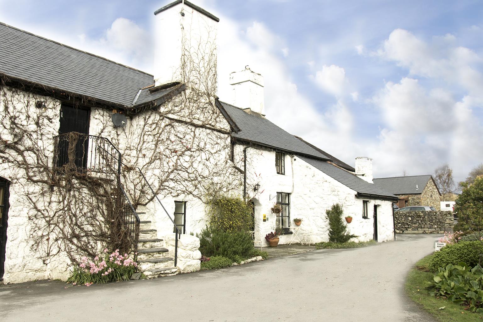
Dolgun Uchaf Bed & Breakfast
Located in a peaceful area with stunning views of the surrounding countryside, this 500-year-old…

Precipice Walk
3 miles (4.8kms)
There’s been a house at Nannau since the 12th century, when the estate was owned by descendants of Cadwgan, Prince of Powys. That original building was burned down in 1404 after trouble between the owner, Hywel Sele, the 8th Lord of Nannau, and his cousin Owain Glyndwr. The pair had never liked or trusted each other, mainly due to Hywel’s allegiance to England’s House of Lancaster, but they were brought together by the Abbot of Cymer (from the abbey in the valley below).
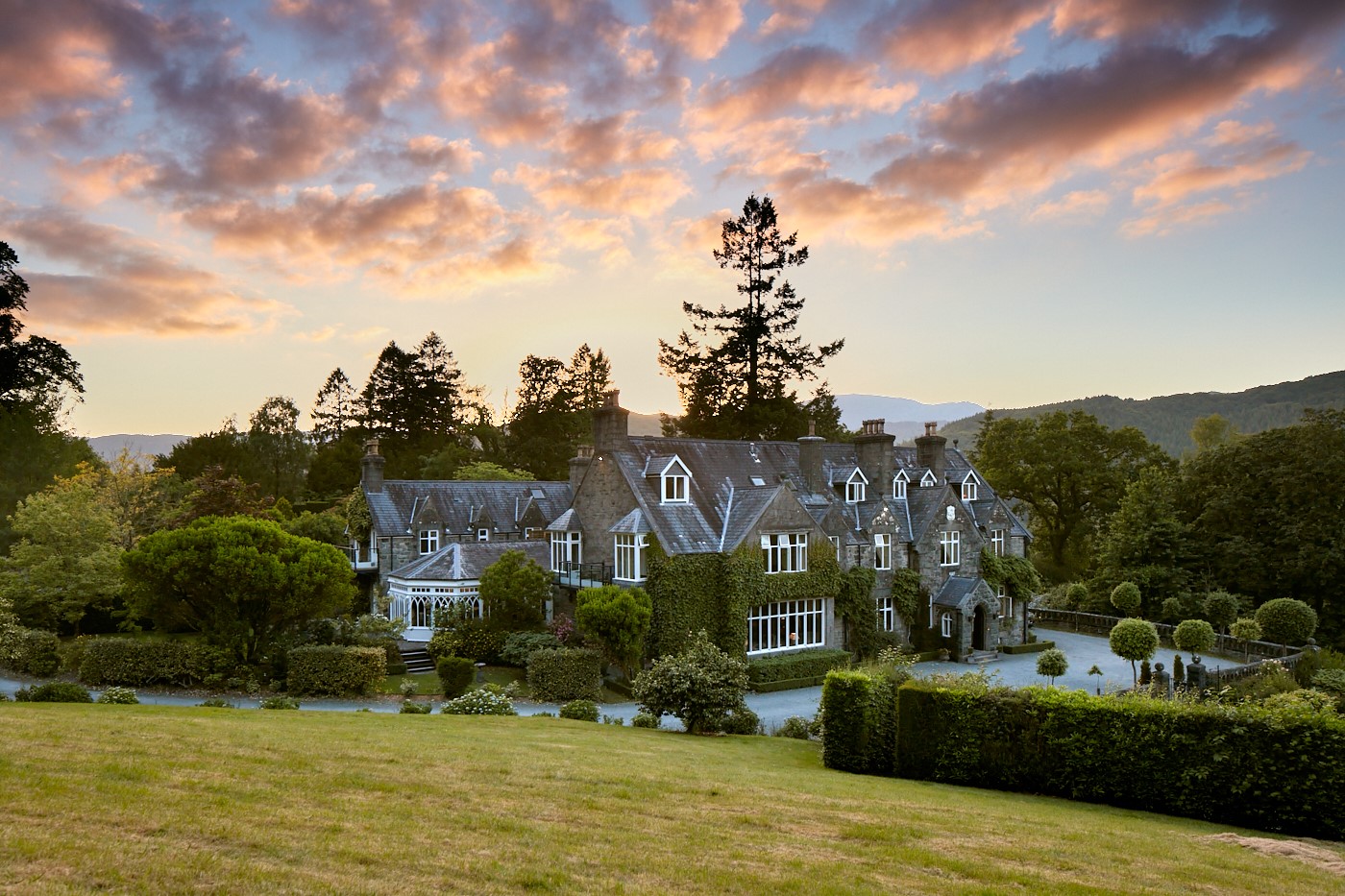
While the pair were out hunting together, Glyndwr spotted a doe and pointed it out for Hywel – a fine bowman – to kill. Hywel pretended to aim at the animal but then suddenly swung around towards Owain. The arrow was straight and true, but Glyndwr had been wearing armour under his tunic so it failed to pierce his skin. After burning down the house, it is said that Glyndwr killed his cousin and disposed of his body in a hollow tree. The skeleton wasn’t found for 40 years and the house wasn’t rebuilt until 1693. The Nannau family, who became the Nanneys, still lived on the estate, but had financial problems. Hugh Nanney was heavily fined and imprisoned for trying to resolve his difficulties by felling 10,000 oaks. When the male line died out the female line, which had married into the powerful Vaughan family, took over. The Vaughans replanted many of the trees, and in 1796 built the grand mansion seen today.
As you start high there’s very little ascent, and the early part of the walk eases across woodland and farm pastures. As the path rounds Foel Cynwch and past the Sitka spruce of Coed Dôl-y-clochydd, spectacular views of the wooded Mawddach and Wen valleys open up. The high ridge seen on the other side of the Mawddach is Y Garn, one of the Rhinog outliers. It looks gentle enough from here, but Y Garn’s other face is of thick heather and precipitous rock. Once on the open hillside, the path itself gets spectacular, taking the form of a terrace, high above the river. Crag, the odd birch and rowan, and flecks of pink from rhododendron bushes all decorate a magnificent scene, which soon adds the great northern cliffs of the Cadair Idris mountains to its repertoire. The precipice lasts an exquisite mile (1.6km) with little twists and turns to add a little spice to the walk. Before long you can trace the Mawddach past Dolgellau’s plains, past the sandbars of its estuary, to the sea beyond. It seems a shame to leave all this behind, but the little path veers left and descends to the shores of Llyn Cynwch, where anglers will be casting for trout. The lake also has an avenue of old oak trees, all that remains of what was quite a large forest until Hugh Nanney took to his axe. When you reach the far shores of the lake, stop to take one last look south. Here you will see the cliffs of Cadair Idris reflected and rippling with the lapping waters of the lake.
From the top end of the car park, turn right on a level footpath which curves around to join another wide track. The Precipice Walk is a private path around the Nannau Estate, but its use has been authorised by the estate owners since 1890, on the basis that all walkers observe the country code. It’s probably one of the finest short routes in Wales and, as such, has been one of Dolgellau’s most famous attractions since those early days when Victorian tourists came for their constitutional perambulations. The track swings right at the edge of some fields.
Where the track comes to an estate cottage, Gwern-offeiriaid, turn left and walk uphill to a gate. There you see the grand mansion of Nannau, built for the Vaughans in 1796. Follow a clear path leading to the hillside north of Llyn Cynwch.
When you see the lake fork right towards a footpath sign halfway up the hill. The path climbs the hillside and turns northwards away from the lake by the side of a dry-stone wall.
The footpath curves around a crag-studded hill, with open slopes that give fine views across a green valley below to the village of Llanfachreth and the rugged mountainsides of Rhobell Fawr and Dduallt that lie behind. The footpath edges round Foel Cynwch and passes the Sitka spruce woodlands of Coed Dôl-y-clochydd. Ignore a path signed to Glasdir and keep left, reaching the dramatic, but even, ledge path traversing the high hill slopes above the Mawddach Valley. Where the slopes finally ease, there’s a promontory on the right, with a bench placed to enjoy the view. The path now arcs round to the southern side of Foel Faner, drops to the lake and turns sharp left where it follows the western shore.
The path meets the outward route below the hill footpath sign. Retrace the outward route past the estate cottage of Gwern-offeiriaid and through the woods back to the car park.
Stony tracks and good paths, occasionally rough
Mountainside and pasture
Private land – dogs must always be on a lead
OS Explorer OL18 Harlech, Porthmadog & Bala
Coed y Groes car park (free) on Dolgellau–Llanfachreth road, 1 mile (1.6km) south of Llanfachreth
At car park
Part of route follows a narrow path with steep drops down to the Mawddach Valley – not a walk for vertigo sufferers
Read our tips to look after yourself and the environment when following this walk.
The county of Gwynedd is home to most of the Snowdonia National Park – including the wettest spot in Britain, an arête running up to Snowdon’s summit that receives an average annual rainfall of 4,473mm. With its mighty peaks, rivers and strong Welsh heritage (it has the highest proportion of Welsh-speakers in all of Wales), it’s always been an extremely popular place to visit and live. The busiest part is around Snowdon; around 750,000 people climb, walk or ride the train to the summit each year.
Also in Gwynedd is the Llyn Peninsula, a remote part of Wales sticking 30 miles out into the Irish Sea. At the base of the peninsula is Porthmadog, a small town linked to Snowdonia by two steam railways – the Welsh Highland Railway and the Ffestiniog Railway. Other popular places are Criccieth, with a castle on its headland overlooking the beach, Pwllheli, and Abersoch and the St Tudwal Islands. Elsewhere, the peninsula is all about wildlife, tranquillity, and ancient sacred sites. Tre’r Ceiri hill fort is an Iron Age settlement set beside the coastal mountain of Yr Eifl, while Bardsey Island, at the tip of the peninsula, was the site of a fifth-century Celtic monastery.
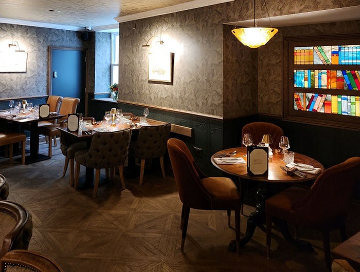
Discover more than 15,000 professionally rated places to stay, eat and visit from across the UK and Ireland.
Choose a place to stay safe in the knowledge that it has been expertly assessed by trained assessors.
Search by location or the type of place you're visiting to find your next ideal holiday experience.
Read our articles, city guides and recommended things to do for inspiration. We're here to help you explore the UK.