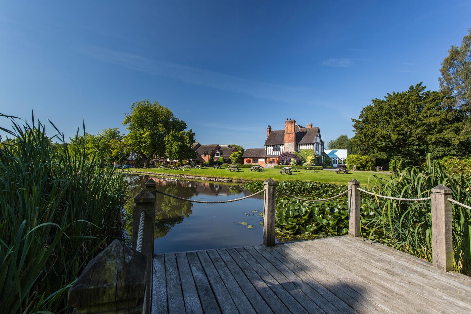


Goldstone Hall
Situated in extensive grounds, Goldstone Hall is a family-run hotel, providing traditionally…

A short walk taking in one of the last great engineering feats of the canal-building era
Norbury
2.75 miles (4.4kms)
The Shropshire Union Canal, or ‘Shroppie’, runs 60 miles (96km) from the edge of Wolverhampton to the Mersey at Ellesmere Port, north of Chester. The canal is named after the Shropshire Union Railways and Canal Company, which was an amalgamation of a number of local canal companies.
The canal almost wasn't one. The intention was to build a railway using canal foundations, as it was believed – quite rightly – that railways were a viable alternative to canals. However, Welsh resistance to railways meant that a canal was built instead using railway foundations, or, to be more precise, the foundations of railway engineering techniques. Instead of following a river, the canal took a direct route across country, through cuttings and on embankments, ostensibly to shorten journey times. The embankments in particular were major undertakings, as it was considerably harder to raise a wide watertight channel 60ft (18m) above the surroundings than it was to lay a railway line in the same way. One embankment on the Shroppie nearly scuppered the entire scheme – and it wasn’t even necessary. Local landowner Lord Anson wanted to keep his wood unmolested for pheasant shooting, so he refused permission for the canal to pass through. The diversion involved building this vast embankment over a mile (1.6km) long and 60ft (18m) high.
The man responsible for the embankment, along with the rest of the canal, was Thomas Telford. Today Telford is remembered more as a bridge engineer than a canal builder, counting the Menai Suspension Bridge (then the longest in the world) among his many achievements. But the Shelmore Embankment caused him more than its fair share of problems. Even after moving millions of tons of earth from the 100ft (30m) cutting at nearby Woodseaves to build it, he had to cope with collapse after collapse. It took six years to build this embankment, and it was only made sound in 1835, a year after Telford’s death.
The Shroppie was the last great canal to be built in Britain, and despite the increasing popularity of railways it remained in use until World War I. At the beginning of the 20th century, for example, a chocolate maker called Mr Cadbury used it to pick up milk from farms between Norbury Junction and his factory at Knighton. Farmers would leave churns at collecting points along the tow path and they would be returned empty at the end of the day.
From the Junction Inn, follow the road towards Gnosall over the main canal and bear right, past the canal boat chandlers (and boat hire). On your right you pass one of the Norbury Boulders, originally transported by glacier from Scotland some 20,000 years ago, then the final 2 miles (3km) from nearby Gorse Farm rather more recently by low-loader. It's part of a linked walk past five boulders, the Norbury Millennium Boulder Trail. This one is the biggest, and shows dark 'xenoliths', fragments of the magma chamber wall incorporated into the granite as it solidified 400 million years ago. Continue to the point where the road heads sharp right under the canal, and go straight on up the wide gravel track that’s signed for the Shelmore Trout Fishery.
When this track veers right into Shelmore Wood, keep going straight on along the edge of the wood, shortly coming to a gap in a high, tree-dotted hedge. Go through this gap onto an earth path with a line of conifers on the left masking a plantation of young oak trees, and the much older Shelmore Wood on your right. In spring and early summer, listen out for woodpeckers.
The path joins the concrete driveway from Norbury Park Farm on your left. Keep ahead, carrying on along the edge of Shelmore Wood as far as the Gnosall road. The cottage at the corner here shows a patchwork of stone and two ages of brickwork, the more regular patterning of the extension being less ancient than the main house.
Turn hard right on the road down a short hill. The cutting here shows the erosive power of people: the roadway has carved itself into the bedrock during the couple of millennia that people have been using it. At the bottom beware of cars as you walk through the tunnel (stop here and shout or sing: the acoustics are extraordinary).
Go through a gate on the left and up some steps to the canal. At the top turn left along the tow path. Follow the canal along its high embankment, finally crossing a brick arch over the disused side canal and back to the Junction Inn.
Roads, dirt tracks and canal tow paths
Farmland, woodland and canal
Keep on lead on road
OS Explorer 243 Market Drayton
Roadside parking at Norbury Junction
None on route
Read our tips to look after yourself and the environment when following this walk.
It was Staffordshire that bore the brunt of the largest non-nuclear explosion of World War II, when a munitions dump at RAF Fauld went up in 1944. It was also the county’s regiment that once boasted within its ranks the most decorated NCO of World War I, in the person of William Coltman (1891-1974). Going back a little further, George Handel penned his world-famous masterpiece The Messiah on Staffordshire soil. During another chapter of Staffordshire history, the county was home to the first canals and the first factory in Britain, and it had front-row seats for the drama surrounding one of the most notorious murder trials of the 19th century, that of Doctor William Palmer.
In outline, Staffordshire looks not unlike the profile of a man giving Leicestershire a big kiss. The man’s forehead is arguably the best region for hillwalking, as it comprises a significant chunk of the Peak District. This area is characterised by lofty moors, deep dales and tremendous views of both. Further south are the six sprawling towns that make up Stoke-on-Trent, which historically have had such an impact on Staffordshire’s fortunes, not to mention its culture and countryside. This is pottery country, formerly at the forefront of the Industrial Revolution and the driving force behind a network of canals that still criss-cross the county.
Discover more than 15,000 professionally rated places to stay, eat and visit from across the UK and Ireland.
Choose a place to stay safe in the knowledge that it has been expertly assessed by trained assessors.
Search by location or the type of place you're visiting to find your next ideal holiday experience.
Read our articles, city guides and recommended things to do for inspiration. We're here to help you explore the UK.