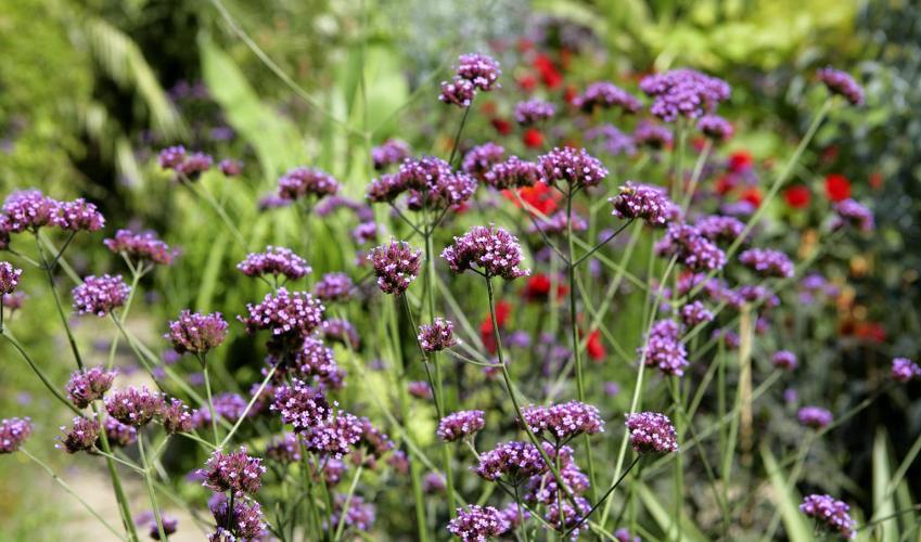
"Enjoy a walk in pastoral Sussex with cattle grazing and oak trees in the hedges."
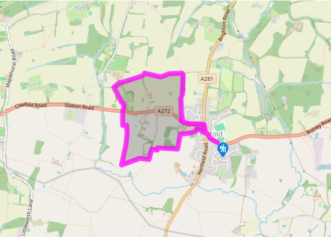
Walk directions
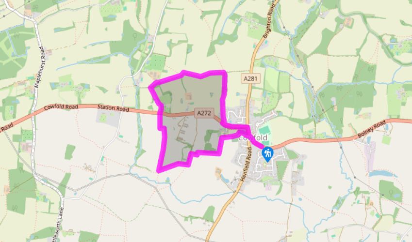
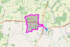
From the car park cross to the A272 and head right, passing the Village Hall of 1896. At the roundabout cross to the footpath into the churchyard passing between the Co-op and Cowfold Cottages. The path skirts to the right of the church and at the end bears left and immediately right onto a footpath on a path between hedges, soon through a kissing gate. The path bears left in the field corner by a school.
Halfway along the filed, at a signpost bear right through a gate, over a footbridge, then through another gate. Continue ahead along the field-edge, crossing a stile. At the corner of the field bear left to a stile near a tile-hung cottage. Over this stile pass the cottage and turn right over another stile into cattle pasture and continue ahead along the left-hand side of the hedge. After a few paces go half left across the next pasture.
Reaching a stile do not cross but bear right alongside the hedge. Through a field gate continue ahead along the hedge to the field corner. Here cross a plank footbridge, then go through a hand gate and turn left to a stile in the far corner and continue ahead through a field gate.
Cross the A272 and keep ahead on the access lane to Browning’s Farm and through a field gate. A gravel track skirts left of the converted farm buildings to a stile. Carry on to a second stile in the corner of a paddock, then descend within the edge of a newly planted copse. Beyond the next stile this turns right alongside a paddock.
In the corner of the field go right by a signpost and large hedgerow trees at a footpath post and cross a footbridge. Follow the enclosed path, emerge into a field and go forward along its left edge to a footpath junction. Here avoid the path to the left, but cross a stile into the next paddock and keep along the field-edge. Go through a hedge gap and cross a footbridge to continue ahead in the next field, now on the right hand side of a field.
Halfway along the field go right at a footpath post and over a footbridge into a narrow tree belt, mainly coppiced hazel with oak trees. At the end continue onto a lane that leads to the A272. Go left along the pavement. Go right at the roundabout, then left at the next and back to the car park.
Terrain
- Field paths and pavements in Cowfold village, many stiles
Landscape
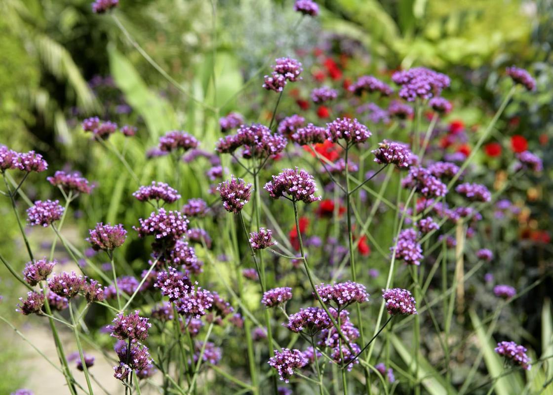
- Gently rolling countryside, many oaks in hedges
Dog friendliness
- On lead in the village and in many of the fields where there are cattle
Parking
- Cowfold Playing Fields car park, on A272 east of crossroads
Toilets en route
- None on route
About the walk
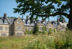
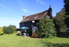
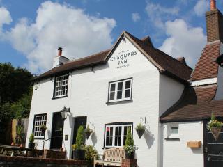
A village of cattle Cowfold’s name is self-explanatory: there was a fold or enclosure for cattle, probably west of the church, and it is known that the village was on one of Sussex’s many drove roads along which cattle and sheep were herded towards London and other towns. The fold was used for the... manor’s cattle as well. The earliest record of the village name is ‘Cufaude’ in 1255, becoming Cowfolde by 1589. Most of the inhabitants earned their living from farming the heavy Wealden clays until relatively recently, producing wheat and cattle, for both dairy and beef. The parish is well wooded, and in earlier times much was sold to the local iron masters for charcoal making or even to produce ship’s planks. The village is small, with relatively little modern expansion – the best part is around the church, with a row of houses on the north side turning their backs on the busy A281 and A272 and facing into the churchyard. This gives almost a cathedral close feel, albeit on a miniature scale. Many of these houses are old, and this area is delightful. Some houses are timber-framed and 16th- and 17th-century in date, while later ones are in brick or colour washed render. Several have the characteristic Horsham stone slab roofs. In the centre of the churchyard is the Church of St Peter. Built in mellow golden sandstone, with Horsham stone roof slabs, it sits very comfortably and is mostly Early English and Perpendicular Gothic. It has no spire, only a solid and battlemented west tower, with a stair turret rising higher. St Hugh’s Monastery South of Cowfold is a very large monastery, with a huge cloister court and a 203ft (62m) high spire to its chapel, which you see at various points on the walk. This is a Carthusian monastery and the only one in England, but not open to visitors. The first monastery to be built here since the Reformation, it’s a robust example of French Victorian Gothic Revival, constructed between 1875 and 1883. The original monks were French and their architect was from Calais.
"Enjoy a walk in pastoral Sussex with cattle grazing and oak trees in the hedges."
Walk details
1hr 15min
Difficulty:
Easy
Gradient:
Gentle
Distance:
2.5 miles (4kms)
Ascent:
50ft (15m)
Walk directions
From the car park cross to the A272 and head right, passing the Village Hall of 1896. At the roundabout cross to the footpath into the churchyard passing between the Co-op and Cowfold Cottages. The path skirts to the right of the church and at the end bears left and immediately right onto a footpath on a path between hedges, soon through a kissing gate. The path bears left in the field corner by a school.
1 of 6
Halfway along the filed, at a signpost bear right through a gate, over a footbridge, then through another gate. Continue ahead along the field-edge, crossing a stile. At the corner of the field bear left to a stile near a tile-hung cottage. Over this stile pass the cottage and turn right over another stile into cattle pasture and continue ahead along the left-hand side of the hedge. After a few paces go half left across the next pasture.
2 of 6
Reaching a stile do not cross but bear right alongside the hedge. Through a field gate continue ahead along the hedge to the field corner. Here cross a plank footbridge, then go through a hand gate and turn left to a stile in the far corner and continue ahead through a field gate.
3 of 6
Cross the A272 and keep ahead on the access lane to Browning’s Farm and through a field gate. A gravel track skirts left of the converted farm buildings to a stile. Carry on to a second stile in the corner of a paddock, then descend within the edge of a newly planted copse. Beyond the next stile this turns right alongside a paddock.
4 of 6
In the corner of the field go right by a signpost and large hedgerow trees at a footpath post and cross a footbridge. Follow the enclosed path, emerge into a field and go forward along its left edge to a footpath junction. Here avoid the path to the left, but cross a stile into the next paddock and keep along the field-edge. Go through a hedge gap and cross a footbridge to continue ahead in the next field, now on the right hand side of a field.
5 of 6
Halfway along the field go right at a footpath post and over a footbridge into a narrow tree belt, mainly coppiced hazel with oak trees. At the end continue onto a lane that leads to the A272. Go left along the pavement. Go right at the roundabout, then left at the next and back to the car park.
Terrain
- Field paths and pavements in Cowfold village, many stiles
Landscape
- Gently rolling countryside, many oaks in hedges
Dog friendliness
- On lead in the village and in many of the fields where there are cattle
Parking
- Cowfold Playing Fields car park, on A272 east of crossroads
Toilets en route
- None on route
About the walk
A village of cattle Cowfold’s name is self-explanatory: there was a fold or enclosure for cattle, probably west of the church, and it is known that the village was on one of Sussex’s many drove roads along which cattle and sheep were herded towards London and other towns. The fold was used for the... manor’s cattle as well. The earliest record of the village name is ‘Cufaude’ in 1255, becoming Cowfolde by 1589. Most of the inhabitants earned their living from farming the heavy Wealden clays until relatively recently, producing wheat and cattle, for both dairy and beef. The parish is well wooded, and in earlier times much was sold to the local iron masters for charcoal making or even to produce ship’s planks. The village is small, with relatively little modern expansion – the best part is around the church, with a row of houses on the north side turning their backs on the busy A281 and A272 and facing into the churchyard. This gives almost a cathedral close feel, albeit on a miniature scale. Many of these houses are old, and this area is delightful. Some houses are timber-framed and 16th- and 17th-century in date, while later ones are in brick or colour washed render. Several have the characteristic Horsham stone slab roofs. In the centre of the churchyard is the Church of St Peter. Built in mellow golden sandstone, with Horsham stone roof slabs, it sits very comfortably and is mostly Early English and Perpendicular Gothic. It has no spire, only a solid and battlemented west tower, with a stair turret rising higher. St Hugh’s Monastery South of Cowfold is a very large monastery, with a huge cloister court and a 203ft (62m) high spire to its chapel, which you see at various points on the walk. This is a Carthusian monastery and the only one in England, but not open to visitors. The first monastery to be built here since the Reformation, it’s a robust example of French Victorian Gothic Revival, constructed between 1875 and 1883. The original monks were French and their architect was from Calais.