"Choose between a wildlife wander or a spectacular aircraft display"
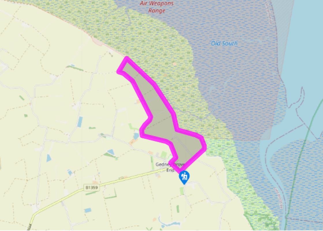
Walk directions
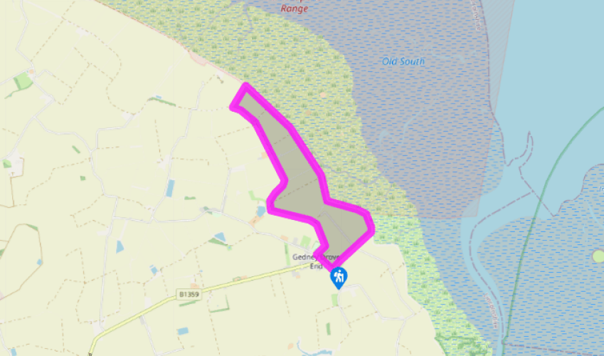
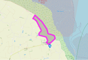
With your back to The Rising Sun pub, turn left and walk along Dawsmere Road past the junction and take the signposted public footpath on the right, between bungalows, opposite the playground sign. At the far side of the field go across a small footbridge and up some steps in order to turn left into a wide field.
For 1 mile (1.6km) walk along the edge of this field, which is in fact the line of the former sea wall, keeping more or less parallel with the present and much higher sea bank over to your right. And as a sign indicates, continue straight ahead at the point where the old sea bank veers invitingly away to the right.
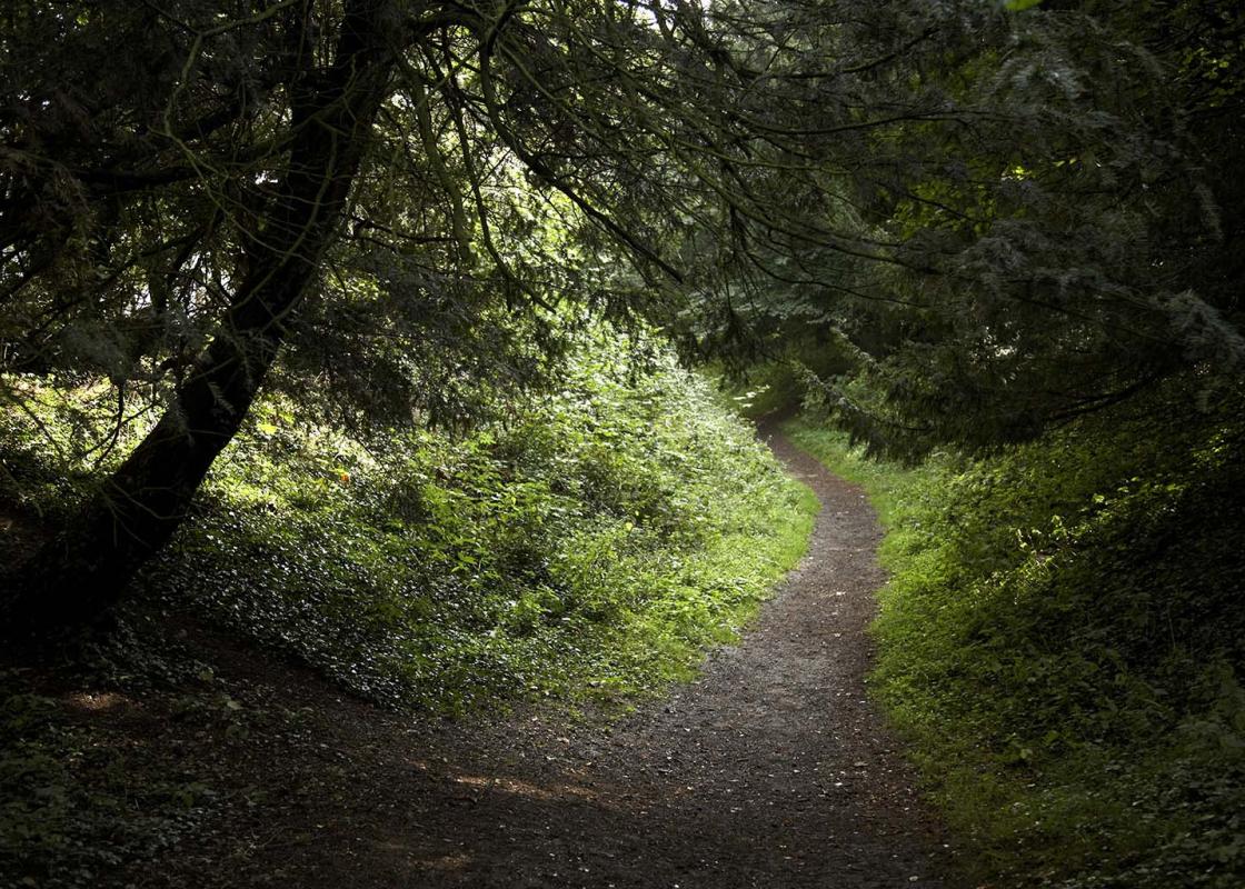
When the field eventually ends near a strip of woodland turn right for 50yds (46m) then, faced with a small thicket, drop down to join the wide farm track on your left. Turn right, and follow the broad, raised route alongside a narrow shelter-belt of woodland which includes apple, cherry, hazel and birch. This wide, gravel track heads out towards the sea bank then bends left and continues past Browns Farm.
Stay on the main track for about 0.75 miles (1.2km) beyond the farm, going on to a grassier strip beyond a junction, then go right by an old wartime pill box for a short path over to the sea wall.
Turn right and follow either the grassy top of the sea bank (a public right of way) or the surfaced lane just below it past a succession of military observation towers. The bombing range is spread out before you, with the low Norfolk coast over to your right and the Lincolnshire seaboard towards Boston and Skegness leftwards.
After the third tower ignore the gated road that heads off inland (a short cut back to Gedney), but instead continue along the sea bank past one final watchtower until you reach a stile. Cross the stile and continue for another 400yds (366m).
Turn right at a public footpath sign, down some steps, for a direct path along a field-edge to the junction of an open lane. Here continue straight ahead into Gedney, turning right at the end back on to Dawsmere Road. However, if you want to prolong your Wash-side wander continue beyond the stile for 1.25 miles (2km) until the sea bank divides. Bend right, on the inland arm, and join a small lane before turning right on to Marsh Road back into Gedney Drove End.
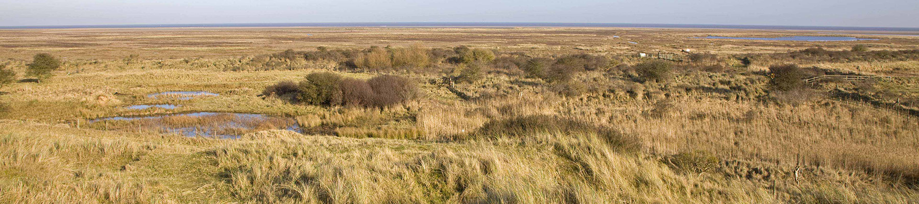
It has to be said that The Wash is a peculiar sort of place. On the Norfolk side is Hunstanton, England's only east coast resort where you can watch the sun setting across the water (it faces west). The rivers Welland, Witham, Nene and Great Ouse all issue out into this vast shallow lagoon covering... 300 square miles (776sq km), which is sometimes covered by water but more often than not by endless tidal mudflats. These have built up over a long period as the four rivers have deposited huge quantities of clay and silt. The various burrowing and surface invertebrates here have attracted a healthy bird population. In fact The Wash supports more birds than any other estuary in Britain, plus one of Europe's largest concentrations of common seals, and comprises England's largest national nature reserve. Pushing back the sea Much of the walking around the edge of The Wash is along high embankments, which mark more than 300 years' of reclaiming farmland from the sea. This particular route around Gedney Drove End follows both the old and the current sea bank, which as you will see has allowed the rich agricultural belt to be extended right up to the sea wall. Dykes and drainage channels, controlled by sluices and pumping stations continue to keep the salt water at bay and maintain this artificially fertile land. Target practice A number of military airfields dot the Lincolnshire coast, and planes from nearby RAF Holbeach in particular use a range off the Gedney coast for bombing practice. As you walk along the sea bank, past a number of official observation towers, the small but brightly coloured targets are scattered offshore across the salt marsh. Red flags fly all along the shore when bombing is taking place (weekdays between 9am and 5pm), but it is safe and legal to walk along the sea bank and watch the proceedings (as indeed many people do), as long as you obey official signs and don't venture beyond the sea wall or pick up any unusual-looking souvenirs from the ground.
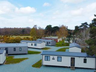
Much of the fenland around the Wash has been drained of its marshes and reclaimed as highly productive farmland. Further north, the coastline, with its sandy beaches, has been developed to accommodate the holiday industry, with caravans, campsites and the usual seaside paraphernalia.
"Choose between a wildlife wander or a spectacular aircraft display"
Walk details
2hrs 30min
Difficulty:
Easy
Gradient:
Flat
Distance:
5.75 miles (9.2kms)
Ascent:
0ft (0m)
Walk directions
With your back to The Rising Sun pub, turn left and walk along Dawsmere Road past the junction and take the signposted public footpath on the right, between bungalows, opposite the playground sign. At the far side of the field go across a small footbridge and up some steps in order to turn left into a wide field.
1 of 7
For 1 mile (1.6km) walk along the edge of this field, which is in fact the line of the former sea wall, keeping more or less parallel with the present and much higher sea bank over to your right. And as a sign indicates, continue straight ahead at the point where the old sea bank veers invitingly away to the right.
2 of 7
When the field eventually ends near a strip of woodland turn right for 50yds (46m) then, faced with a small thicket, drop down to join the wide farm track on your left. Turn right, and follow the broad, raised route alongside a narrow shelter-belt of woodland which includes apple, cherry, hazel and birch. This wide, gravel track heads out towards the sea bank then bends left and continues past Browns Farm.
3 of 7
Stay on the main track for about 0.75 miles (1.2km) beyond the farm, going on to a grassier strip beyond a junction, then go right by an old wartime pill box for a short path over to the sea wall.
4 of 7
Turn right and follow either the grassy top of the sea bank (a public right of way) or the surfaced lane just below it past a succession of military observation towers. The bombing range is spread out before you, with the low Norfolk coast over to your right and the Lincolnshire seaboard towards Boston and Skegness leftwards.
5 of 7
After the third tower ignore the gated road that heads off inland (a short cut back to Gedney), but instead continue along the sea bank past one final watchtower until you reach a stile. Cross the stile and continue for another 400yds (366m).
6 of 7
Turn right at a public footpath sign, down some steps, for a direct path along a field-edge to the junction of an open lane. Here continue straight ahead into Gedney, turning right at the end back on to Dawsmere Road. However, if you want to prolong your Wash-side wander continue beyond the stile for 1.25 miles (2km) until the sea bank divides. Bend right, on the inland arm, and join a small lane before turning right on to Marsh Road back into Gedney Drove End.
It has to be said that The Wash is a peculiar sort of place. On the Norfolk side is Hunstanton, England's only east coast resort where you can watch the sun setting across the water (it faces west). The rivers Welland, Witham, Nene and Great Ouse all issue out into this vast shallow lagoon covering... 300 square miles (776sq km), which is sometimes covered by water but more often than not by endless tidal mudflats. These have built up over a long period as the four rivers have deposited huge quantities of clay and silt. The various burrowing and surface invertebrates here have attracted a healthy bird population. In fact The Wash supports more birds than any other estuary in Britain, plus one of Europe's largest concentrations of common seals, and comprises England's largest national nature reserve. Pushing back the sea Much of the walking around the edge of The Wash is along high embankments, which mark more than 300 years' of reclaiming farmland from the sea. This particular route around Gedney Drove End follows both the old and the current sea bank, which as you will see has allowed the rich agricultural belt to be extended right up to the sea wall. Dykes and drainage channels, controlled by sluices and pumping stations continue to keep the salt water at bay and maintain this artificially fertile land. Target practice A number of military airfields dot the Lincolnshire coast, and planes from nearby RAF Holbeach in particular use a range off the Gedney coast for bombing practice. As you walk along the sea bank, past a number of official observation towers, the small but brightly coloured targets are scattered offshore across the salt marsh. Red flags fly all along the shore when bombing is taking place (weekdays between 9am and 5pm), but it is safe and legal to walk along the sea bank and watch the proceedings (as indeed many people do), as long as you obey official signs and don't venture beyond the sea wall or pick up any unusual-looking souvenirs from the ground.
Much of the fenland around the Wash has been drained of its marshes and reclaimed as highly productive farmland. Further north, the coastline, with its sandy beaches, has been developed to accommodate the holiday industry, with caravans, campsites and the usual seaside paraphernalia.