Elveden Inn
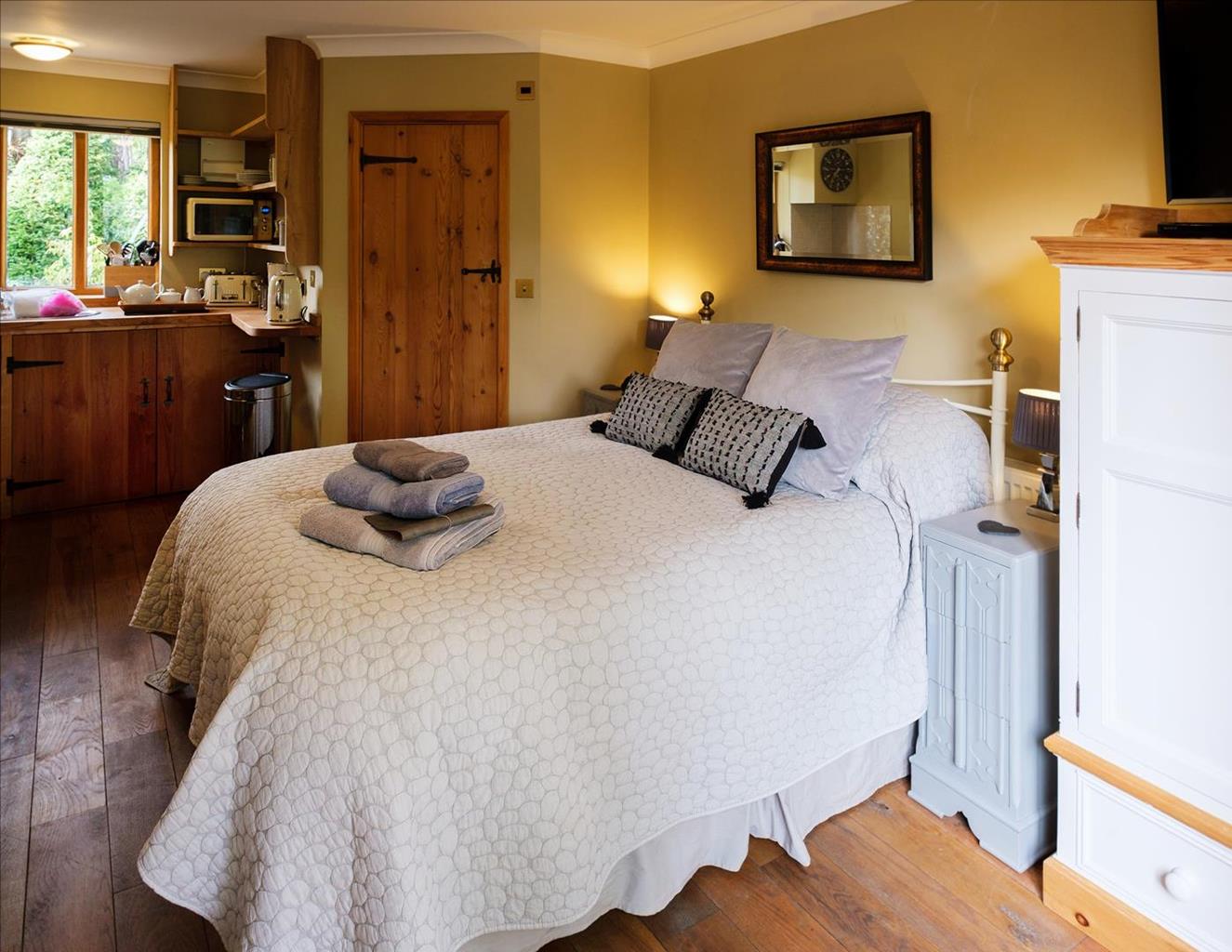
Elveden Inn offers a range of beautifully presented bedrooms and sleek modern bathrooms.…

A pleasant riverside and forest walk on the borders of Norfolk and Suffolk.
Brandon
5.5 miles (8.8kms)
Brandon lies at the heart of the Brecks, a large area of heathland and pine forest straddling north Suffolk and south Norfolk. Beneath the sandy soil lie vast amounts of flint, a fact that has played a major role in the history of the town.
Flint was mined near Brandon in Neolithic times, and in the 19th century more than 200 knappers were employed locally to produce gun flints for the Napoleonic Wars. Even today, many buildings in Brandon are built of flint and brick. Prehistoric farmers used flint axes to create the large open heathland, which was kept clear for centuries by grazing rabbits and sheep. The nature of the Brecks changed for ever with the planting of Thetford Forest, Britain's largest lowland pine forest, in the 1920s. This easy-to-follow walk takes you along the Little Ouse River from Brandon to Santon Downham, returning on a forest path. Although the walk begins and ends in Suffolk, much of it is actually in Norfolk, on the north bank of the river.
The small town, whose northern reaches this walk skirts, has been around since at least the 11th century when it was known as Bromdun (meaning 'the hill where broom grows'). The Domesday Book notes that the manor here comprised 25 dwellings. Since then it has found modest and fleeting fame as a producer of rabbit fur and flints for guns. While for most people the year 1789 might conjure up thoughts of the French Revolution, in Brandon the townsfolk will point you to 14 May of that year, the date of the town's Great Fire. It coincided with the Date of a fair in nearby Thetford and, as a result, the young people of Brandon were away when the fire started. It is said to have been sparked off when lightning struck the house of the local surgeon, setting it on fire. The flames were soon licking at neighbouring properties. The conflagration eventually accounted for 11 houses, eight of which were completely destroyed - a devastating tragedy for a small community. A detailed history of the Great Fire can be read at Brandon Heritage Centre.
On its return to Brandon from Santon Downham this walk makes use of a long-distance footpath called St Edmund Way. This footpath itself piggybacks a series of other long-distance paths such as the Lark Valley Path, the Icknield Way and the Hereward Way as it makes its 79-mile (127km) journey from Manningtree in Essex to Brandon in Suffolk. As far as we know, Saint Edmund - a one-time king of the East Angles who was killed by the Danes after losing in battle to them in 869 - never walked from Manningtree to Brandon, but the footpath commemorates the life of one of East Anglia's most eminent personalities.
From the car park, follow the signs to the town centre, emerging on Market Hill, a large square where a market is held twice a week. Cross the road here and continue along the High Street until you come to a bridge over the Little Ouse. Cross the bridge and take the first turning right along Riverside Way, then leave the road by turning right along a narrow path that runs down towards the river. This is the start of the Little Ouse Path, a riverside footpath connecting Brandon to Thetford. Turn left along the riverbank to cross a footbridge and pass a landing stage that marks the limit of navigation on the river. Stay on this path for about 2.5 miles (4km) as it follows the twists and turns of the river, with views of marshes, pine forest and meadows on the far bank. This is a very peaceful stretch of the walk and the silence is only disturbed by the splashing of ducks or the occasional sound of a train on the railway line that runs parallel to the river and the landing of RAF Tornadoes at the nearby airfield.
Eventually the river straightens out before sweeping round to the right in a wide arc. When you reach a bridge, climb the steps and turn right over the bridge into the village of Santon Downham. This lovely village, deep in the forest, is the headquarters of Thetford Forest Park. In 1668, the entire village was engulfed by a sand storm, once a common occurrence in these parts. Pass the forest centre and the village shop, and continue up the hill to St Mary's Church, otherwise known as the Church in the Forest. Turn right opposite the church to walk briefly alongside the road to Brandon, facing the village green. When the road bends left, keep straight ahead on a surfaced track leading to a telephone box and the village hall. When the track ends, continue straight ahead on a footpath into the forest, following a sign marked 'St Edmund Way'.
Stay on this path as it bends to the right and crosses a wide sandy track. Shortly afterwards, you pass an old gatepost and follow the path round to the left. The path winds gently through the forest, passing a metal barrier before reaching the stables and paddocks of a riding school. Follow the track past the school, but when the track bends left, turn right along a narrow path between the paddocks and the woods.
The route from here back to Brandon is straightforward. Stay on this path as it gradually widens to become a track with a flint-faced wall on the left. The track, known as Gashouse Drove, continues all the way to the High Street, passing a housing estate and then a group of large modern houses on the left. Turn left at the High Street to return to the car park at the start of the walk.
Riverside and forest paths, some roads
Brandon, Thetford Forest and Little Ouse River
Dogs should be kept under control in Thetford Forest Park
OS Explorer 229 Thetford Forest in the Brecks
**Either at Bury Road (IP27 8BU) or George Street (IP27 0BZ) not quite as Dixe suggesting**
Thetford Forest Park centre
Read our tips to look after yourself and the environment when following this walk.
The North Norfolk Coast is designated an Area of Outstanding Natural Beauty and probably the finest of its kind in Europe. Here you’ll find a string of quaint villages and small towns – Holkham, Wells-next-the-Sea and Cley next the Sea are 21st-century favourites, while Sheringham and Cromer are classic examples of a good old-fashioned seaside resort where grand Victorian hotels look out to sea. Further round the coast you'll find Great Yarmouth, one of the most popular resorts in the UK and packed full of amusements, shops and seashore entertainment. And let's not forget Norwich, the region's only city.
Norfolk prides itself on its wealth of historic houses, the most famous being Sandringham, where Her Majesty the Queen and her family spend Christmas. Many of Norfolk’s towns have a particular charm and a strong sense of community. The quiet market towns of Fakenham and Swaffham are prime examples, as well as Thetford, with its popular museum focusing on the TV comedy series Dad’s Army which was filmed in the area.
Discover more than 15,000 professionally rated places to stay, eat and visit from across the UK and Ireland.
Choose a place to stay safe in the knowledge that it has been expertly assessed by trained assessors.
Search by location or the type of place you're visiting to find your next ideal holiday experience.
Read our articles, city guides and recommended things to do for inspiration. We're here to help you explore the UK.