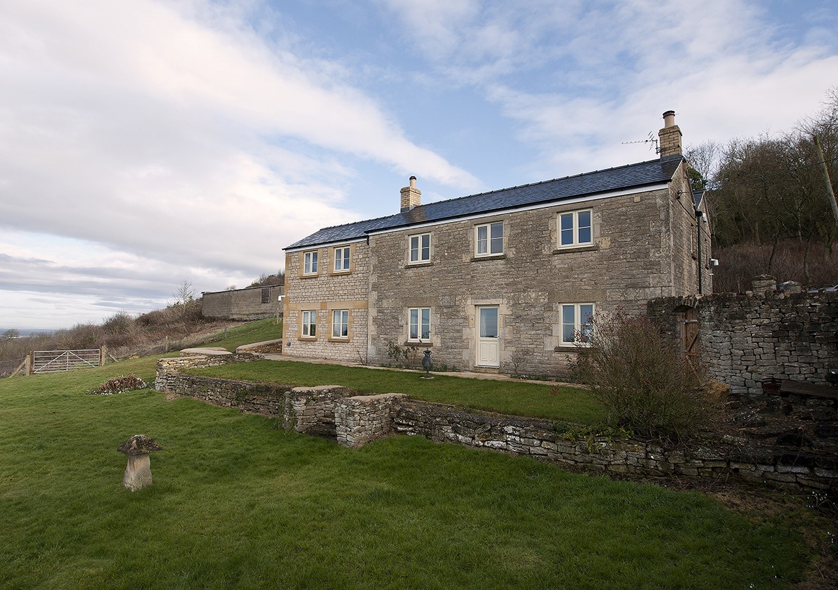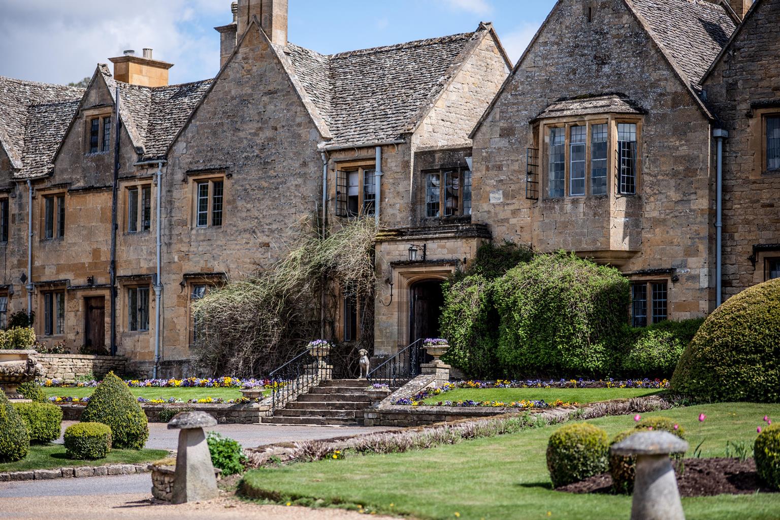
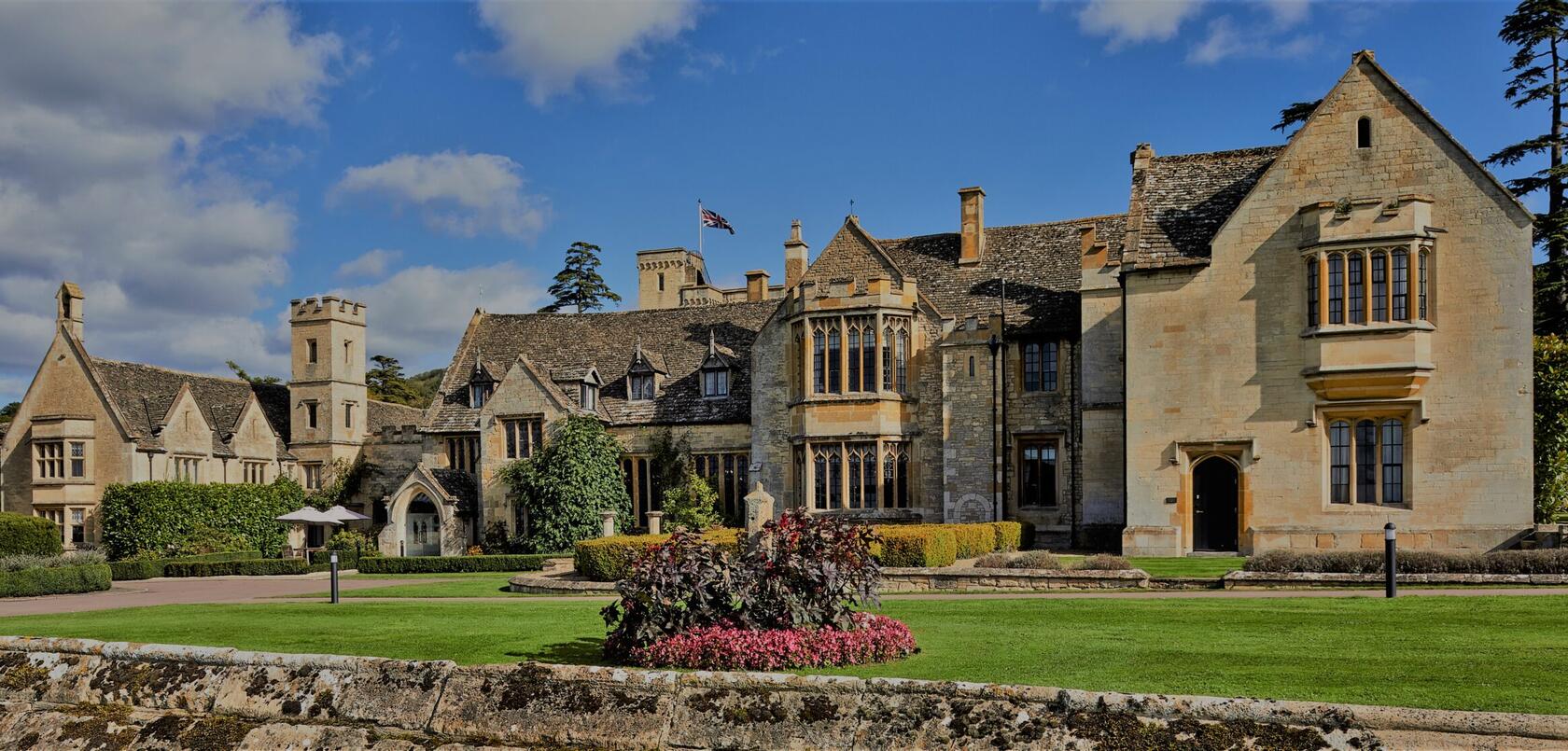

Buckland Manor
Buckland Manor is a grand 13th-century manor house, surrounded by well-kept and beautiful…

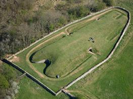
How an important abbey was destroyed by a King's Commissioner
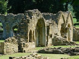
Hailes Abbey
5 miles (8kms)
In the decade from 1536 to 1547 just about every English religious institution that was not a parish church was either closed or destroyed. This was the Dissolution, Henry VIII’s draconian policy to force the Church to give up its wealth. The smaller monasteries went first, then the larger ones and finally the colleges and chantries. All their lands and tithes became Crown property. Many of them were sold off, usually to local landowners. The Church as a parish institution was strengthened as a result of the Dissolution, but at the expense of wider religious life. The suppression of the chantries and guilds meant many people were deprived of a local place of worship.
This abbey was one of the most powerful Cistercian monasteries in the country, owning 13,000 acres (5,265ha) and 8,000 sheep. In 1270, Edmund, Earl of Cornwall, the son of its founder, had given the monastery a phial supposed to contain the blood of Christ. Thomas Cromwell was the King’s Commissioner responsible for overseeing the closure of the monasteries. He is reputed to have surveyed the destruction of the monastery from a vantage point near Beckbury Camp. There is still a fine view of the abbey from here, as you should find at Point 5 on the map. According to Hugh Latimer of Worcester, who had been working with him, Cromwell also spent an afternoon in 1539 examining the so-called blood. Cromwell concluded that it was nothing more than an ‘unctuous gum and compound of many things’.
The monastery lands were confiscated by the Crown, and then sold to a speculator who sold the land on in lots. In about 1600, the site of the abbey was bought by Sir John Tracy, the builder of Stanway House. The monks were dispersed: a few managed to secure positions as part of the parish clergy, while others took up posts with the cathedrals at Bristol and Gloucester.
Hailes Church is all that remains of the village of Hailes. It predates the abbey and survived the Dissolution, perhaps because it was a parish church and not directly linked to the neighbouring monastery. It has real charm, often overlooked by the many visitors to the monastery’s ruins. It has a panelled chancel – floored with tiles from the monastery – and a nave with 14th-century wall paintings. Didbrook Church also survived the upheavals. Built in Perpendicular style, it was rebuilt in 1475 by the Abbot of Hailes, following damage caused by Lancastrian soldiers after the Battle of Tewkesbury.
From Hailes Church turn right and follow the lane to a left-hand bend 200yds (183m) after a road on the left. Leave the lane through a gate on the right to join a footpath. Walk across an area of concrete and follow a track as it goes right and left, turning at an old oak tree, eventually becoming a grassy path beside a field. At the end go through a kissing gate, and in a few paces turn left over a stile amid bushes, ignoring a gate leading straight on. Cross the corner of the field to reach a gate at a road.
Turn right and follow the road as it meanders through the pretty village of Didbrook, and onto a stretch of countryside. At a junction, turn right for Wood Stanway. Walk through this village, bearing left at a cherry tree on a grass island, to reach the yard and barns of Glebe Farm.
Ignore a bridleway sign and gate on the left, and at another gate, go onto a track on the left of a field and walk ahead, aiming for a gate on the left. You are now on the Cotswold Way, well marked by posts with black acorn symbols. Cross into a field and go slightly right, keeping to the left of some electricity poles, to a gate in a hedge. Bear slightly left across the next field, heading towards farm buildings. Through a gate turn sharp right, up the slope (guide posts) to a gate on your right. Once through this, turn immediately left up the field to a guide post. Go through a gate. Follow the footpath as it wends its way gently up the slope. At the top, walk along the crest, with a dry stone wall to your right, to reach a gate at a road.
Turn right and right again through a gate to a track. Follow this for 0.5 miles (800m), passing through a gate, until at the top (just before some trees) you turn right to follow another track for 50yds (46m). Turn left through a gate into a field and turn sharp right to follow the perimeter of the field as it goes left and passes through a gate beside the ramparts of an Iron Age fort, Beckbury Camp. Continue ahead to pass through another gate, which leads to a stone monument with a niche. According to local lore, it was from here that Thomas Cromwell watched the destruction of Hailes Abbey in 1539.
Turn right to follow a steep path down through the trees. At the bottom go slightly left and across down the field to a gate. Pass through, continue down to go through another gate and head down to a gate beside a signpost.
Turn right and follow the lane (Cotswold Way). Pass a sign for Hayles Fruit Farm with its café to the left. Continue ahead along the road to return to Hailes Abbey and the start point by the church.
Fields, tracks, farmyard and lanes, several stiles
Wide views, rolling wolds and villages
Mostly on lead as livestock in fields
OS Explorer OL45 The Cotswolds
Park at Hailes Church or Abbey only if you are planning to visit them, otherwise park by the road in Didbrook.
None on route
Read our tips to look after yourself and the environment when following this walk.
Gloucestershire is home to a variety of landscapes. The Cotswolds, a region of gentle hills, valleys and gem-like villages, roll through the county. To their west is the Severn Plain, watered by Britain’s longest river, and characterised by orchards and farms marked out by hedgerows that blaze with mayflower in the spring, and beyond the Severn are the Forest of Dean and the Wye Valley.
Throughout the county you are never far away from the past. Neolithic burial chambers are widespread, and so too are the remains of Roman villas, many of which retain the fine mosaic work produced by Cirencester workshops. There are several examples of Saxon building, while in the Stroud valleys abandoned mills and canals are the mark left by the Industrial Revolution. Gloucestershire has always been known for its abbeys, but most of them have disappeared or lie in ruins. However, few counties can equal the churches that remain here. These are many and diverse, from the ‘wool’ churches in Chipping Campden and Northleach, to the cathedral at Gloucester, the abbey church at Tewkesbury or remote St Mary’s, standing alone near Dymock.
Discover more than 15,000 professionally rated places to stay, eat and visit from across the UK and Ireland.
Choose a place to stay safe in the knowledge that it has been expertly assessed by trained assessors.
Search by location or the type of place you're visiting to find your next ideal holiday experience.
Read our articles, city guides and recommended things to do for inspiration. We're here to help you explore the UK.