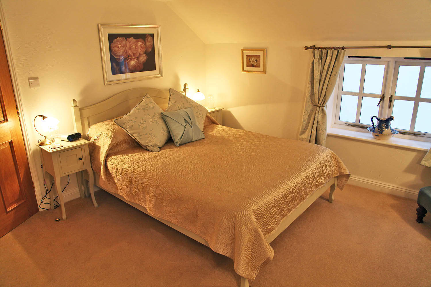


Summer Valley Touring Park
Summer Valley is situated in picturesque parkland with far-reaching views of farms and woodland…

Bishop's Wood
3.5 miles (5.6kms)
The woods in Cornwall are always a delightful antidote to the county’s surfeit of sea. Bishop’s Wood near Truro is a part of the much larger St Clement Woods, and acquired its name from the time it was owned by the Bishop of Exeter during the late medieval period. Long before this, when the ancient woodland of the area had already been stripped bare by the early farmers, the highest point of the wood was crowned by a fortified Iron Age settlement.
Today, the substantial banks of the settlement survive, muffled by dense woodland cover. In later centuries, when tree cover was re-established here, the area would have been a typical working woodland. The Iron Age site is densely covered with coppiced oaks, identifiable by multiple trunks at the base. When the woods were actively managed for coppicing, the trunks would be cut so that new growth started in several places at once. They would be allowed to grow like this for up to 20 years or so before being harvested for charcoal making, basket making or a host of other wood products. Up to the beginning of the 20th century many woods were managed in this way. The practice is beginning to be re-introduced in some areas in Cornwall because of its beneficial effects on wildlife habitats.
The walk starts from the forestry car park at the south end of the woods and leads along its eastern edge through Lady's Wood, on a track that is wonderfully eerie and enclosed. A robust little stream runs below the track. Beech trees dominate here and further into the wood, oak, hazel, birch, Japanese larch and holly lie to either side of the track. In spring the trees are bright with fresh leaves and the rich earth beneath the trees supports a wealth of plants, ferns and mosses. Look particularly for wood sorrel, bluebells, three-cornered leeks, and the feathery fronds of male ferns. The track leads on to the top end of the wood just before Lanner Mill. Here you turn uphill and on to a broad forestry road that leads back south along the higher ridge of the woods. Halfway along you can divert left from the track to visit the site of the Iron Age settlement. The large bank and ditch that encircled the site is still visible. The rigid upper branches of the numerous coppiced oak trees enclose the central trunks of the trees like cages. This is a well-preserved site, although the trees and scrub blur the impact of the large bank and ditch construction. Such hilltop sites date from between the Bronze and Iron Ages and reflect a growing territorialism.
These were not forts in the narrow sense of being built purely for defence. They were defensible sites, certainly, but they were commercial and cultural centres as much as anything else, being the focus of a large territory of scattered farmsteads and settlements from which the unforested hilltop site would be easily seen. The hilltop 'fort' or 'castle' represented a central refuge in times of trouble, but served also as a place to bring livestock to market and to exchange household goods and to socialise and celebrate. From the Iron Age site, the last part of the walk takes you on to even higher ground through mature conifers and then through deciduous woodland.
Leave the top end of the car park via the wooden barrier and go along a broad track. In a few paces at a fork, keep to the right and follow the track above Woodpark and along the inside edge of the wood.
Keep ahead on the main track, walking parallel to the river, ignoring branch tracks leading off to the left. Keep ahead past the next three forks in the track.
Just at the northern end of the wood, with a glimpse of a tarmac road ahead, you reach a fork. Keep to the main track as it bends left and uphill. Keep left at a crossing which continues uphill and soon merges with a broad forestry road. Keep ahead along this road.
In about 0.4 miles (0.6km) look for three adjacent tracks on your left. These lead in about 20yds (18m) to the Iron Age fort, now very overgrown, but still discernible. Return back along the track to rejoin the main route.
At a bend beside a wooden bench, where tracks lead off to left and right, go right by a signpost and follow a narrow trench-like track uphill between trees and follow a public footpath. At a path crossing turn left. Follow a rutted, muddy path/track through trees for about 0.4 miles (0.6km).
At a fork near the edge of the woods, bear sharp left. Soon bear right at the next fork to go steeply downhill. Shortly afterwards, reach another fork. Either way will take you to the car park just below but the right-hand path will guide you past picnic tables first.
Forest tracks and paths, can be very muddy after rain
Mixed woodland
Dogs are welcomed throughout the woods, but the authorities ask that owners clear up their dog's mess
OS Explorer 105 Falmouth & Mevagissey
Forestry car park, north of Idless, near Truro
None on route
<p>Car park gates close at sunset. Working woodland, please take note of signs advising work in progress</p>
Read our tips to look after yourself and the environment when following this walk.
Cornwall has just about everything – wild moorland landscapes, glorious river valley scenery, picturesque villages and miles of breathtaking coastline. With more than 80 surfing spots, there are plenty of sporting enthusiasts who also make their way here to enjoy wave-surfing, kite surfing and blokarting.
In recent years, new or restored visitor attractions have attracted even more visitors to the region; the Eden Project is famous for its giant geodesic domes housing exotic plants from different parts of the globe, while nearby the Lost Gardens of Heligan has impressive kitchen gardens and a wildlife hide.
Discover more than 15,000 professionally rated places to stay, eat and visit from across the UK and Ireland.
Choose a place to stay safe in the knowledge that it has been expertly assessed by trained assessors.
Search by location or the type of place you're visiting to find your next ideal holiday experience.
Read our articles, city guides and recommended things to do for inspiration. We're here to help you explore the UK.