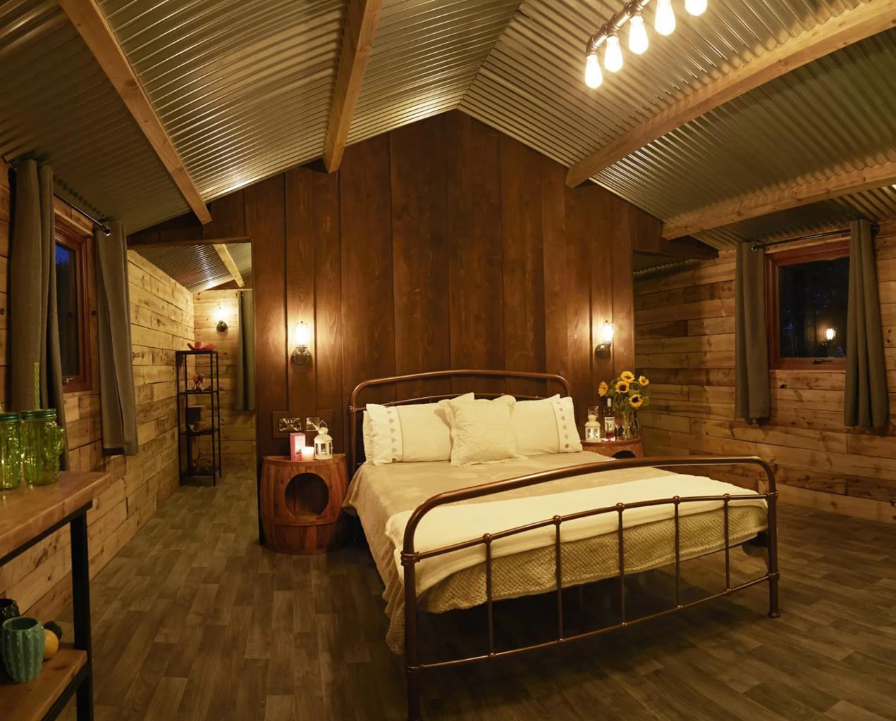

Five Star Stays, Scalby
Five Star Stays is a small collection of luxury self-catering holiday cottages, nestled in the…

Just outside Scarborough, a walk through woodland leads to the remains of a glacial lake.
Raincliffe
3.5 miles (5.7kms)
The steep hillside of Raincliffe Woods overlooks a deep valley carved out during the ice ages. Although mostly replanted in the 1950s and 60s, the woods retain remnants of ancient oak and heather woodland – look out for the heather and bilberry bushes growing beneath the oak trees.
The woods have long been open to the public, though in the 19th century they were privately owned by the First Earl of Londesborough. Some of the roads and tracks were named after his family – Lady Edith’s Drive after his wife, and Lady Mildred’s Ride after her sister. Lord Londesborough was the grandfather of Edith, Osbert and Sacheverell Sitwell. Osbert recalled in his autobiography, Left Hand Right Hand!, how he and Edith were taken in the early years of the 20th century on hair-raising drives by their grandfather in his buckboard wagon through Raincliffe Woods. They would then walk up the steep hillsides through columbine and honeysuckle. Unfortunately, they often became lost, and the Earl’s language was, for a time, immoderate, until he remembered the children’s presence.
Beetle enthusiasts wax lyrical about Throxenby Mere. The last vestiges of the huge glacial lake that formed more than 15,000 years ago, after the ice age, it contains species of rare water beetles, and is one of the places in the north of England to which coleopterists (or beetle studiers) make tracks. You will also find the distinctive pinky-purple flowers and wide leaves of the broadleaved willowherb on its fringes.
Throughout the walk you will come upon humps and banks, depressions and pits that show that this hillside has been a hive of human activity in the past. As the path approaches Throxenby Mere it crosses part of a Bronze Age dyke system, while elsewhere are medieval banks and the remains of pits for charcoal burning. You will also pass a small quarry which was used for local building stone.
In the valley below Raincliffe Woods is the Sea Cut, or North Back Drain, a flood relief channel that runs for 3 miles (4.8km) from the River Derwent to Scalby Beck. Engineered in 1806 by local man, Sir George Caley, it takes excess water from the Derwent to the sea at Scalby to prevent flooding in the Vale of Pickering. Operation is by means of a sluice gate (now remotely-controlled) 825yds (754m) west of Mowthorpe Bridge. When in operation, it restores the Derwent’s link to the sea that was lost when glacial deposits blocked its original route.
Go up through the car park, bearing left towards a signboard, then go uphill on the path ahead. Where the main path bends right, with green and blue waymarks, go straight ahead, more steeply, to reach a crossing track which runs into a grassy space on the left. Turn left and follow the path. Where it forks, take the right-hand path and continue for 500yds (475m).
Look out for a path on the left, near a post with a red disc and white arrow. The path goes down into a small valley. Turn left, downhill, then follow the obvious path as it bends right again, past an old quarry. The path descends to reach Throxenby Mere. Turn right along the edge of the pool – this part of the path is on boardwalks.
Just before you reach a picnic place, go through a gate and immediately turn right. Follow the path up steeply, ignoring all joining paths until it reaches a track at the top of the hill.
Turn right and go beside a metal gate, then follow the path just inside the edge of the wood. After about a mile (1.6km) look out for a walled enclosure, tumbled down in places, just left of the path. This is known as Wilkinson’s Shed.
The track goes through several clearings with fine beech trees then reaches a gateway (no gate, but a redundant stile); BR is painted in blue on one gatepost.
Don’t go through the gateway, but instead turn sharp right down a sunken path. If this first bit is muddy, there’s a bypass just to its left. The track becomes deeply sunken as it slants down the steep slope. At a marker post go through an opening on the left; walk a few paces to a Forge Valley Woods sign, then go right up six steps and down a narrow path to rejoin the track (this bypasses a potentially muddy section).
The track, no longer sunken, runs across a gentler slope then bends left to meet a broad, clear track known as Middle Road. Turn right on this, and at a large carved face sculpture take the left fork, downhill. It bends left to run directly down the slope, rejoining the outward route back to the car park.
Woodland paths and rides, some steep and sometimes muddy
Farmland and hillside woods
Can be off the lead in most of the woodland
OS Explorer OL27 North York Moors: Eastern
Raincliffe Gate car park on Low Road, near road junction
None on route
Read our tips to look after yourself and the environment when following this walk.
Discover more than 15,000 professionally rated places to stay, eat and visit from across the UK and Ireland.
Choose a place to stay safe in the knowledge that it has been expertly assessed by trained assessors.
Search by location or the type of place you're visiting to find your next ideal holiday experience.
Read our articles, city guides and recommended things to do for inspiration. We're here to help you explore the UK.