


Bobby's Nook
Adjacent to the Cotswold Way, this ground-floor apartment has a level lawn area and safe on-site…

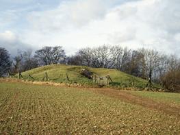
The vast bulk of the ancient fort of Uley Bury forms the centerpiece for this walk along the Cotswold escarpment.
Uley
3 miles (4.8kms)
Uley is a pretty village, strung along a wide street at the foot of a high, steep hill. It is distinctive for several reasons: it has its own brewery, which produces some fine beers including Uley Bitter and Uley Old Spot; in the past, the village specialised in the production of ‘Uley Blue’ cloth, which was used in military uniforms; and then there is Uley Bury, dating back to the Iron Age and one of the finest hillforts in the Cotswolds.
There are many hundreds of Iron Age forts throughout England and Wales. They are concentrated in Cornwall, southwest Wales and the Welsh Marches, with secondary concentrations throughout the Cotswolds, North Wales and Wessex. Although the term ‘hillfort’ is generally used in connection with these settlements, the term can be misleading. There are many that were built on level ground and others that were not used purely for military purposes – often they were simply settlements located on easily defended sites.
Broadly speaking, there are five types, classified according to the nature of the site on which they were built, rather than their construction date. Contour forts were built more or less along the perimeter edge of a hilltop; promontory forts were built on a spur, surrounded by natural defences on two or more sides; valley and plateau forts (two types) depended heavily on artificial defences and were located, as their names suggest, in valleys or on flat land respectively; and multiple-enclosure forts were usually built in a poor strategic position on the slope of a hill and were perhaps used as stockades.
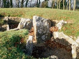
Uley Bury, covering about 38 acres (15.4ha), is classified as an inland promontory fort and was built in the 6th century bc. It falls away on three sides, and the fourth side, which faces away from the escarpment, is protected by specially constructed ramparts that would have been surmounted by a wooden palisade. The natural defences – that is, the Cotswold escarpment, facing west – were also strengthened by the construction of a deep, wide ditch, as well as two additional ramparts, an inner one and an outer one, between which the footpath largely threads its course. The three main entrances were at the northern, eastern and southern corners. These vulnerable parts of the fort would have been fortified with log barriers. Some tribespeople would have lived permanently in huts within the fort, but most would have lived outside. In an emergency, therefore, there was space for those who lived outside the fort to take shelter within. Eventually the fort was taken over by the Dobunni tribe – Celtic interlopers from mainland Europe who arrived about 100 bc – and appears to have been occupied by them throughout the Roman era.
On the main street, locate The Uley Stores (the post office, on your left as you walk up the street), and take the narrow lane to their right. Pass between houses as the lane dwindles to a track. Some 13yds (12m) before a stile, turn right along a public footpath towards the church.
When you see the churchyard on the right, turn left up a narrow path beside a cottage. This rises fairly sharply and brings you to a kissing gate – pass through it into a meadow. Climb steeply up the grassland towards woodland.
At the treeline, keep left of the woods. In a corner on the far left, go through a gate and follow a winding woodland path ahead uphill. When you come to a fence stay on the path as it bears left. Pass through a gate and continue straight on uphill to exit the woods. In 40yds (37m), bear left as the path rises across grassland to a junction.
Turn right to follow the contour of the hill – the edge of the ancient fort. You are following the perimeter of the fort in an anticlockwise direction, with steep drops to your right. Pass through a gate to meet a junction of paths. Go left along the edge of the hill, with views to the west, disregarding a stile to your right that invites you to descend.
At the corner, go through a gate and continue to follow the edge of the fort. When you get to the next corner, at the fort’s southeastern point, bear right on a bridleway (look for the waymark post) that descends through hillocks. Keep ahead through a gate and drop steeply through trees to a stile into a meadow and the access path to Whitecourt underground reservoir.
Follow the path down to a cottage and kissing gate. Go through this and pass beside the cottage to arrive at a lane. Turn left down this, passing the Uley Brewery. On reaching the main road, turn left to return to the start.
Tracks and fields
Valley, meadows, woodland and open hilltop
Lead required around livestock
OS Explorer 168 Stroud, Tetbury & Malmesbury
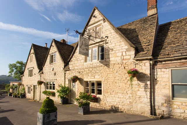
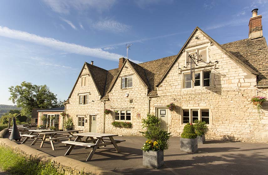
Main street in Uley
None on route
Read our tips to look after yourself and the environment when following this walk.
Gloucestershire is home to a variety of landscapes. The Cotswolds, a region of gentle hills, valleys and gem-like villages, roll through the county. To their west is the Severn Plain, watered by Britain’s longest river, and characterised by orchards and farms marked out by hedgerows that blaze with mayflower in the spring, and beyond the Severn are the Forest of Dean and the Wye Valley.
Throughout the county you are never far away from the past. Neolithic burial chambers are widespread, and so too are the remains of Roman villas, many of which retain the fine mosaic work produced by Cirencester workshops. There are several examples of Saxon building, while in the Stroud valleys abandoned mills and canals are the mark left by the Industrial Revolution. Gloucestershire has always been known for its abbeys, but most of them have disappeared or lie in ruins. However, few counties can equal the churches that remain here. These are many and diverse, from the ‘wool’ churches in Chipping Campden and Northleach, to the cathedral at Gloucester, the abbey church at Tewkesbury or remote St Mary’s, standing alone near Dymock.
Discover more than 15,000 professionally rated places to stay, eat and visit from across the UK and Ireland.
Choose a place to stay safe in the knowledge that it has been expertly assessed by trained assessors.
Search by location or the type of place you're visiting to find your next ideal holiday experience.
Read our articles, city guides and recommended things to do for inspiration. We're here to help you explore the UK.