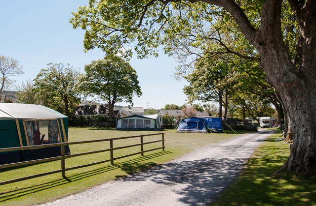

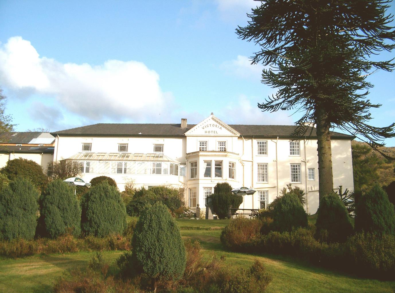
The Royal Victoria Hotel Snowdonia
This well-established hotel sits near the foot of Snowdon, between the Peris and Padarn lakes.…

Resist taking the train and enjoy this hard walk up Snowdon
Llanberis
10 miles (16.1kms)
Llanberis is a slate town – you can see that by looking across Llyn Padarn to the purple-grey terraces built into the mountainside. However it’s easy to look the other way, to where Snowdon reigns supreme in the skies. In Victorian times the interest in mountains was in its infancy. Being Wales’ highest peak, attention was centred on Snowdon and the village at its foot. The Snowdon Mountain Railway was built, and opened in 1896 with a fanfare of publicity. Unfortunately, on the first day, a descending train ran out of control and was derailed round a bend, before tumbling down steep slopes. One passenger who jumped from a falling carriage was killed. Since then the steam engines on the rack-and-pinion railway have chugged up the mountain pushing their red and cream carriages for 4.5 miles (7.2km) to the summit without incident. In 2022, Snowdonia National Park Authority decided to use the welsh names for both the highest summit (Yr Wyddfa or Snowdon) and the National Park (Eryri or Snowdonia).
The route through the Arddu Valley is a pleasing and peaceful way into the hills. In the early stages you’ll ease by the shaly flanks of Moel Eilio before climbing to a dark pass on the Eilio–Snowdon ridge. The mile-long (1.6km) route from the pass to Moel Cynghorion is a bit of a grind, but the summit reveals your prize – a headlong view of Clogwyn Du’r Arddu’s black cliffs and several remote tarns basking in two cwms below. The route joins the Snowdon Ranger Path and zigzags up Cloggy’s rocky arm to Bwlch Glas, where you meet the crowds. Here, you gaze into Cwm Dyli, where the blue-green lakes of Glaslyn and Llydaw lie beneath the ridges of Garnedd Ugain, Crib Goch and Y Lliwedd. Now those crowds will lead you alongside the railway to gain the pile of rocks capping Snowdon, where the ugly old summit buildings have been replaced with a visitor centre, Hafod Eryri. Snowdon’s summit panorama is stunning with several peaks in view: you can see half of Wales laid out at your feet. Look further to the distant misty mountains in Ireland and the Isle of Man stretching across the horizon.
From the end of the High Street (Stryd Fawr) walk northwest before turning left up Capel Coch Road. Go straight ahead at a junction and keep following the road past the youth hostel and camping fields. The road winds and climbs towards Braich y Foel, the northeast spur of Moel Eilio.
Where the tarmac ends just above Hafod Uchaf, continue along the track, which swings left (southeast) into the wild cwm (cirque) of the Afon Arddu. On the other side of the cwm you’ll see the trains of the Snowdon Mountain Railway, puffing up and down the line. Pass through two gates and skirt round Foel Goch.
On reaching the base of Foel Goch’s northern spur, Cefn Drum, the track swings right into Maesgwm and climbs to a pass, Bwlch Maesgwm, between Foel Goch and Moel Cynghorion. Go through the gate here, then turn left and follow a faint path, climbing steeply by the fence and up the lattermentioned peak.
From Cynghorion’s summit the route descends steeply above the cliffs of Clogwyn Llechwedd Llo via a ladder stile to another pass, Bwlch Cwm Brwynog, which overlooks the small reservoir of Llyn Ffynnon-y-gwas. Here you join the Snowdon Ranger Path.
Turn left and follow the zigzag route up Clogwyn Du’r Arddu, whose cliffs, on the left, plummet to a little tarn, Llyn Du’r Arddu, which sits uneasily in a dark, stony cwm. Near the top the wide path veers right, away from the edge, crosses the Snowdon Mountain Railway, and follows the line to the monolith at Bwlch Glas. Here you are met by both the Llanberis Path and the Pyg Track, and look down on the huge cwms of Glaslyn and Llyn Llydaw.
The path now follows the line of the railway to the summit. Retrace your steps to Bwlch Glas, but this time follow the wide Llanberis Path traversing the western slopes of Garnedd Ugain and above the railway. (Make sure you don’t take the higher ridge path to Garnedd Ugain’s summit by mistake.)
Near Clogwyn Station you come to Cwm Hetiau, where cliffs fall away into the chasm of the Pass of Llanberis. The path goes under the railway and below Clogwyn Station, before recrossing the line below Halfway Station.
The path meets a lane, which descends back into Llanberis near The Royal Victoria Hotel. To complete the walk, turn left along the main road, back to the town centre.
Well-defined paths and tracks, several stiles
High mountain cwms and tarns
Sheep, trains and crags – best on lead throughout
OS Explorer 263 Anglesey East & OS Explorer OL17 Snowdon / Yr Wyddfa
Several pay car parks throughout Llanberis, including one at Electric Mountain
Llanberis and at Summit Visitor Centre (seasonal)
Read our tips to look after yourself and the environment when following this walk.
The county of Gwynedd is home to most of the Snowdonia National Park – including the wettest spot in Britain, an arête running up to Snowdon’s summit that receives an average annual rainfall of 4,473mm. With its mighty peaks, rivers and strong Welsh heritage (it has the highest proportion of Welsh-speakers in all of Wales), it’s always been an extremely popular place to visit and live. The busiest part is around Snowdon; around 750,000 people climb, walk or ride the train to the summit each year.
Also in Gwynedd is the Llyn Peninsula, a remote part of Wales sticking 30 miles out into the Irish Sea. At the base of the peninsula is Porthmadog, a small town linked to Snowdonia by two steam railways – the Welsh Highland Railway and the Ffestiniog Railway. Other popular places are Criccieth, with a castle on its headland overlooking the beach, Pwllheli, and Abersoch and the St Tudwal Islands. Elsewhere, the peninsula is all about wildlife, tranquillity, and ancient sacred sites. Tre’r Ceiri hill fort is an Iron Age settlement set beside the coastal mountain of Yr Eifl, while Bardsey Island, at the tip of the peninsula, was the site of a fifth-century Celtic monastery.
Discover more than 15,000 professionally rated places to stay, eat and visit from across the UK and Ireland.
Choose a place to stay safe in the knowledge that it has been expertly assessed by trained assessors.
Search by location or the type of place you're visiting to find your next ideal holiday experience.
Read our articles, city guides and recommended things to do for inspiration. We're here to help you explore the UK.