"Discover the secrets of lead and gold mining in 'God's Treasure House'."
Walk directions
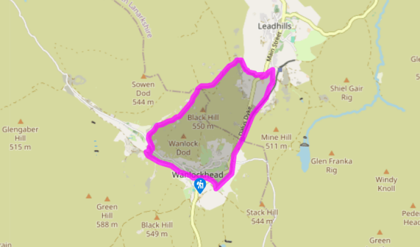
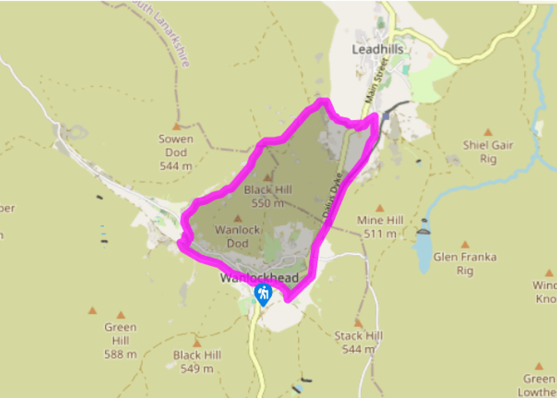
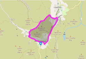
With the museum to your back turn left and join the Southern Upland Way. Head uphill on steps then, at the top, cross to a stone building with a large white door. Turn right on to a rough road, cross the main road and take the public footpath to Enterkine Pass. Follow this to the front of a white house.
Turn left on to the course of an old railway line. Follow this, cross a road then go through a long cutting to reach a fence. Go over a stile to get to Glengonnar Station then follow the narrow path that runs along the left side of the railway tracks from here. Eventually the path runs on to a rough road and in the distance you will see two terraced houses.
At the point where telephone wires intersect the road, turn left at the pole on the left-hand side and follow the line of the fence down to some sheep pens. Turn right at the end of the pens and walk out to the main road.
Turn right then almost immediately left on to a hill road. Walk uphill on this until the road bears sharp right and a dirt track forks off to the left. Turn left on to the track and keep on it until you reach a gate. Cross over, then veer left on to a faint track. Follow the track downhill to the point where it comes close to the corner of a fence on your left.
Cross the fence and go straight ahead on a faint track, picking your way through the heather. Eventually, as the track begins to look more like a path, you will reach a fork. Go to the right here and cross the flank of the hill passing through some disused tips.
The path at this point is little more than a series of sheep tracks and may disappear altogether, but that is not a problem. Ahead of you is a large conical spoil heap and, provided you keep heading towards it, you know you will be going in the right direction.
Towards the end of the hill the track heads left, starts to make its way downhill, then passes behind a row of cottages. Veer right, downhill, after the cottages to join the road. Turn left and continue past Glencrieff cottages, then turn right, leaving the road and heading downhill again. Cross a bridge and climb up on to the Southern Upland Way. Turn left along it and follow this back to the car park.
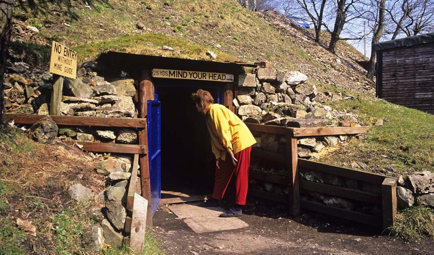
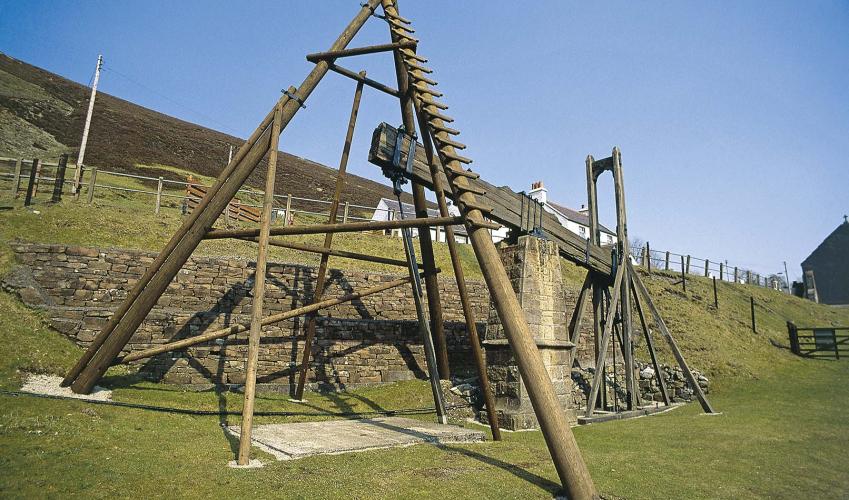
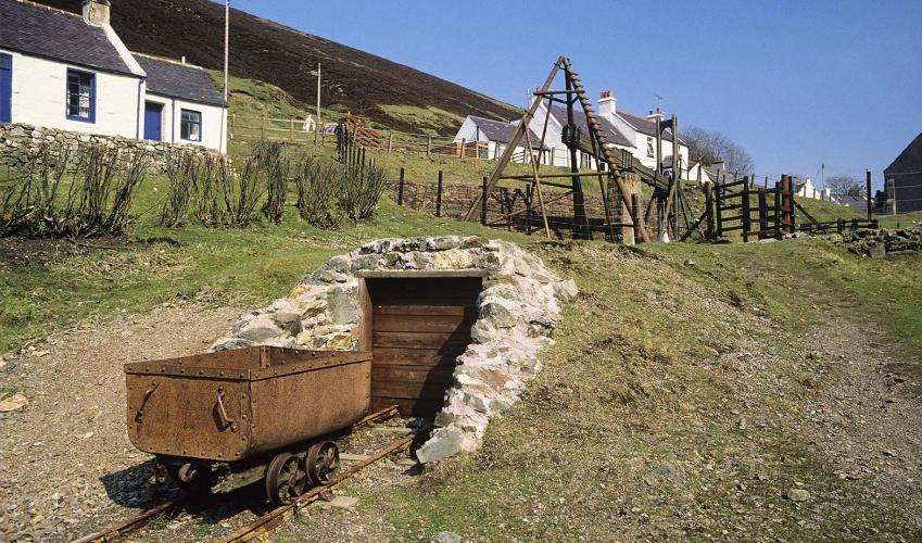
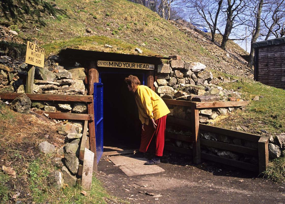
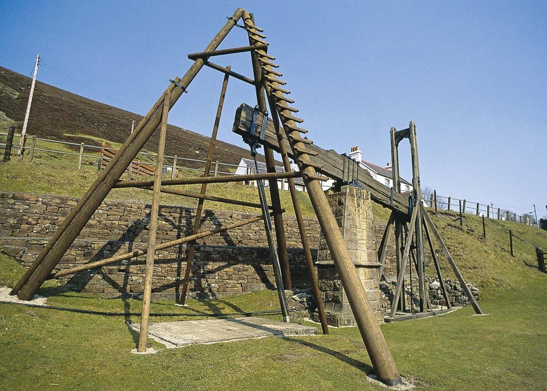
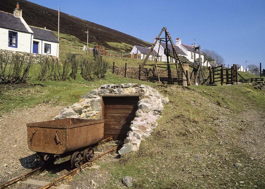
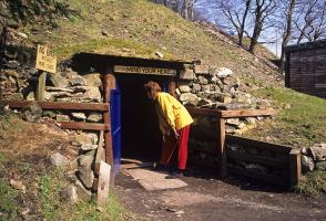
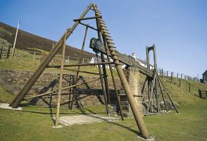
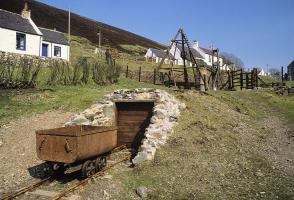
A unique combination of changing pressures within the earth's crust several million years ago led to the formation of rich mineral veins in this part of the Southern Uplands. Everything from gold to zinc and copper has been found locally, but it was the rich deposits of lead that resulted in the... establishment of Scotland's highest village. By the 17th century a permanent, if primitive, settlement was established. Accommodation consisted of one-room cottages with often as many as eight people living in them. They cooked over the open fire in the middle of the room and smoke was vented through a hole in the roof. By the late 19th century, when lead mining was at its peak, some 850 people lived here in much improved cottages. These cottages were bigger, with an attic room and a proper cooking range. In 1871 the miners founded a co-operative society, bought all their supplies there and received a share of the profits. Amazingly this continued until 1971. A Thriving Community The miners valued the little leisure time they had and were very active in forming local clubs and societies. There were curling, bowling and quoiting clubs, a drama group and even a silver band. The Library, the second oldest subscription library in Europe, was founded in 1756 by the minister and a small group of villagers. Wanlockhead fared better than most libraries, with a donation of books from the local landowner the Duke of Buccleuch. He also funded the building of a new school and the salary of the teacher. The miners' children learned to read, write and count and could also take lessons in Latin and Greek. A government inspector visiting in 1842 was so impressed by the standard of learning he concluded that 'the children of the poor labourers of Wanlockhead are under as good, or perhaps better system of intellectual culture than even the middle class children of South Britain generally'. As the price of lead slumped, and mines became exhausted, the miners gradually drifted away. The last of the mines, Glencrieff, closed in 1934 and the village went into decline until only 30 people remained. In the 1960s the local authority offered to re-house them elsewhere but they resolutely refused to leave. Thanks to their determination, an influx of new blood, renovation of houses and the opening of the Museum of Lead Mining, Wanlockhead has survived as a community into the 21st century. But it almost vanished, like countless other mining villages, which are now just names on the map; a few ruins and half-forgotten tales.
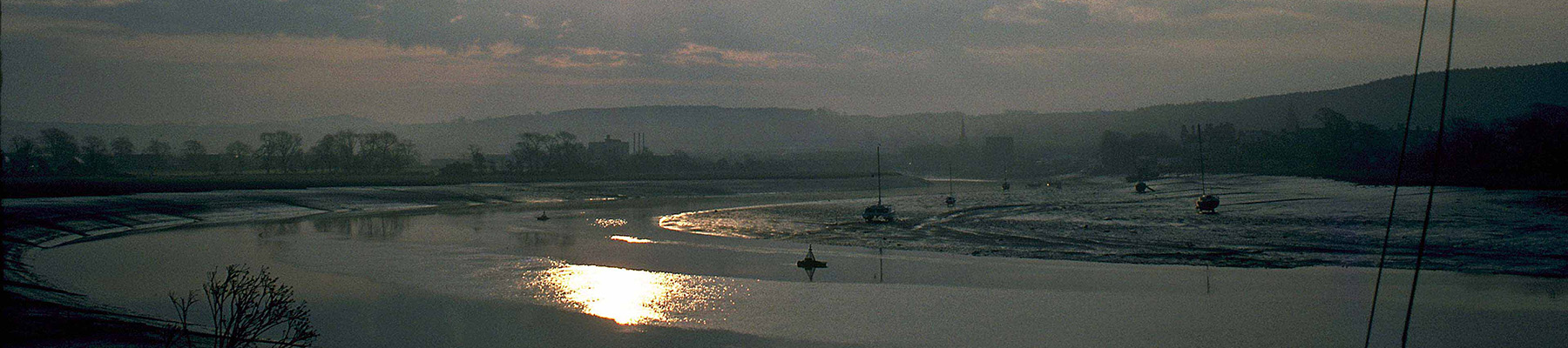
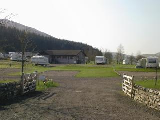
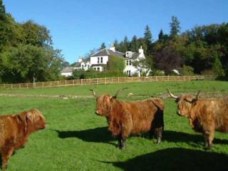
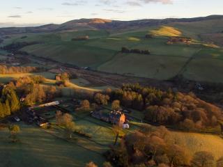
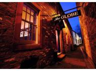
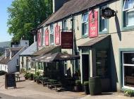
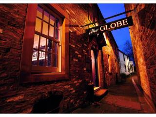
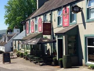
Dumfries and Galloway is a wonderfully undiscovered corner of Scotland – a romantic land of wooded glens, high hills and exposed moorland, haunted by its colourful past and the ghosts of those who fell in fierce and bloody battles. Heading west from Gretna Green you soon reach Dumfries, straddling the River Nith, where you may see red-breasted mergansers in summer.
"Discover the secrets of lead and gold mining in 'God's Treasure House'."
Walk details
3hrs
Difficulty:
Medium
Gradient:
Moderate
Distance:
3.75 miles (6kms)
Ascent:
525ft (160m)
Walk directions
With the museum to your back turn left and join the Southern Upland Way. Head uphill on steps then, at the top, cross to a stone building with a large white door. Turn right on to a rough road, cross the main road and take the public footpath to Enterkine Pass. Follow this to the front of a white house.
1 of 7
Turn left on to the course of an old railway line. Follow this, cross a road then go through a long cutting to reach a fence. Go over a stile to get to Glengonnar Station then follow the narrow path that runs along the left side of the railway tracks from here. Eventually the path runs on to a rough road and in the distance you will see two terraced houses.
2 of 7
At the point where telephone wires intersect the road, turn left at the pole on the left-hand side and follow the line of the fence down to some sheep pens. Turn right at the end of the pens and walk out to the main road.
3 of 7
Turn right then almost immediately left on to a hill road. Walk uphill on this until the road bears sharp right and a dirt track forks off to the left. Turn left on to the track and keep on it until you reach a gate. Cross over, then veer left on to a faint track. Follow the track downhill to the point where it comes close to the corner of a fence on your left.
4 of 7
Cross the fence and go straight ahead on a faint track, picking your way through the heather. Eventually, as the track begins to look more like a path, you will reach a fork. Go to the right here and cross the flank of the hill passing through some disused tips.
5 of 7
The path at this point is little more than a series of sheep tracks and may disappear altogether, but that is not a problem. Ahead of you is a large conical spoil heap and, provided you keep heading towards it, you know you will be going in the right direction.
6 of 7
Towards the end of the hill the track heads left, starts to make its way downhill, then passes behind a row of cottages. Veer right, downhill, after the cottages to join the road. Turn left and continue past Glencrieff cottages, then turn right, leaving the road and heading downhill again. Cross a bridge and climb up on to the Southern Upland Way. Turn left along it and follow this back to the car park.
A unique combination of changing pressures within the earth's crust several million years ago led to the formation of rich mineral veins in this part of the Southern Uplands. Everything from gold to zinc and copper has been found locally, but it was the rich deposits of lead that resulted in the... establishment of Scotland's highest village. By the 17th century a permanent, if primitive, settlement was established. Accommodation consisted of one-room cottages with often as many as eight people living in them. They cooked over the open fire in the middle of the room and smoke was vented through a hole in the roof. By the late 19th century, when lead mining was at its peak, some 850 people lived here in much improved cottages. These cottages were bigger, with an attic room and a proper cooking range. In 1871 the miners founded a co-operative society, bought all their supplies there and received a share of the profits. Amazingly this continued until 1971. A Thriving Community The miners valued the little leisure time they had and were very active in forming local clubs and societies. There were curling, bowling and quoiting clubs, a drama group and even a silver band. The Library, the second oldest subscription library in Europe, was founded in 1756 by the minister and a small group of villagers. Wanlockhead fared better than most libraries, with a donation of books from the local landowner the Duke of Buccleuch. He also funded the building of a new school and the salary of the teacher. The miners' children learned to read, write and count and could also take lessons in Latin and Greek. A government inspector visiting in 1842 was so impressed by the standard of learning he concluded that 'the children of the poor labourers of Wanlockhead are under as good, or perhaps better system of intellectual culture than even the middle class children of South Britain generally'. As the price of lead slumped, and mines became exhausted, the miners gradually drifted away. The last of the mines, Glencrieff, closed in 1934 and the village went into decline until only 30 people remained. In the 1960s the local authority offered to re-house them elsewhere but they resolutely refused to leave. Thanks to their determination, an influx of new blood, renovation of houses and the opening of the Museum of Lead Mining, Wanlockhead has survived as a community into the 21st century. But it almost vanished, like countless other mining villages, which are now just names on the map; a few ruins and half-forgotten tales.
Dumfries and Galloway is a wonderfully undiscovered corner of Scotland – a romantic land of wooded glens, high hills and exposed moorland, haunted by its colourful past and the ghosts of those who fell in fierce and bloody battles. Heading west from Gretna Green you soon reach Dumfries, straddling the River Nith, where you may see red-breasted mergansers in summer.