"A stroll around one of Hampshire’s most fascinating prehistoric sites."
Walk directions
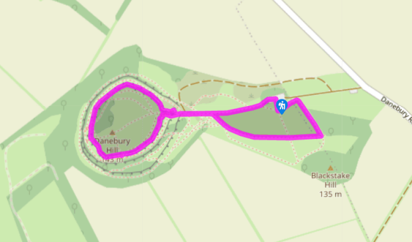
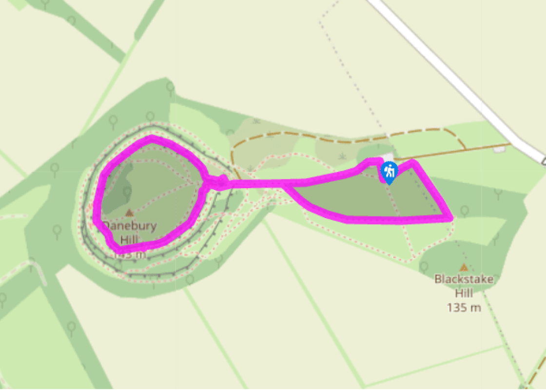
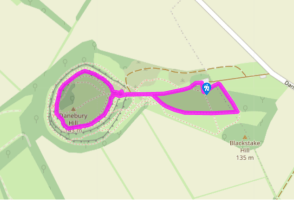
Walk up the gravel path beside the toilet block and go through the wooden gate into the site. Follow the grassy path up the slope, aiming just to the right of the triangulation pillar on the outlying earthworks close to the fort entrance.
Go through the gates at the entrance to the fort and follow the gravel path through the outer bank. Turn right, climb the 17 wooden steps up onto the inner ramparts. The ramparts were constructed by throwing back soil from the outer ditch behind a timber wall. In time the timbers rotted, creating the smoother profile that you’ll see around the earth bank. Turn right along the top of the bank. From here, the circular gravel path leads right around the top of the defences. Drop down the 23 steps leading back to the main entrance. Turn right through the gates and bear right towards the triangulation pillar.
Continue through the kissing gate straight ahead. Bear right, around the edge of this large field, where you may see grazing animals. Simply follow the field-edge around to the left until you reach the water trough and gate near the far corner. From here, follow the field-edge uphill for 100yds (91m) to a kissing gate and steps down into the car park.
Terrain
- Downland grass and gravel paths, two flights of steps
Landscape
- Wooded downs and grazing fields
Dog friendliness
- No dogs inside the hill-fort gates (alternative dog-friendly route circles outside the fort fence); watch out for other colour-coded access areas
Parking
- Hampshire County Council car park
Toilets en route
- At the start (open April–October) or Stockbridge High Street
Danebury Down has been crowned by its hill-fort for some 2,500 years. It stands in a commanding position, with views across the Test Valley to neighbouring Woolbury nearly 4 miles (6.4km) to the east. This short walk offers an enjoyable introduction to the site but do allow extra time to explore... the centre of the ring and its massive outer defences. The community at Danebury Danebury is one of Europe’s most carefully studied hill-forts. Archaeologists believe that a community of three or four hundred people lived here for some five centuries until the Roman invasion in ad43. Their excavations have revealed the remains of 73 circular dwellings, as well as 500 store buildings and several thousand deep storage pits. These were probably used for holding grain, though only a few of the pits would have been used at any one time. Pagan shrines and temples were also found on the high ground near the middle of the fort. Here, offerings and sacrifices would have been made by the priests, who were also the community’s legislators, teachers and medicine men. The Danebury community sheltered their sheep and cattle in the hill-fort and modern aerial surveys have shown up the remains of their prehistoric field systems in the surrounding landscape. Their farmers would have traded leather goods, woollens and grain for necessities such as iron, copper and salt. But life wasn’t always so peaceful and while Danebury’s warriors had helmets, swords and horse-drawn chariots at their disposal, at times everyone would have helped to defend the site. Defending the hill-fort Indeed, the defences are the most obvious legacy of this Iron Age community. As you enter the fort you’ll see the complex earthworks designed to make the enemy vulnerable as he zig-zagged towards the fort’s massive timber gates. A stockpile of 11,000 pebbles found near this spot indicates that men, women and children may all have used slings to pelt their attackers with stones.
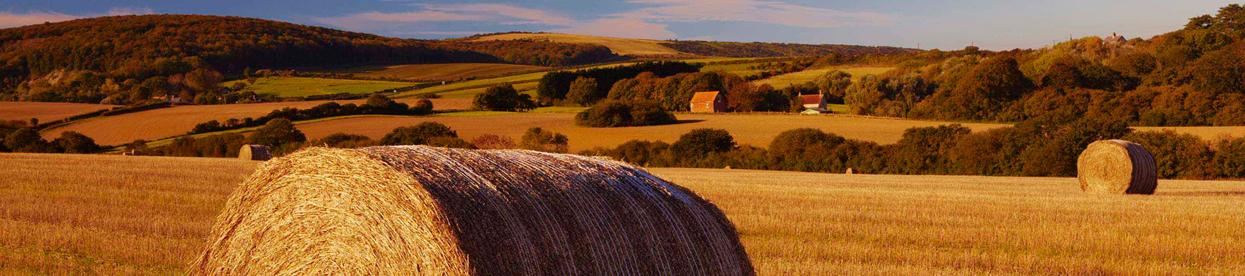
Hampshire’s varied landscape of hills and heaths, downlands and forests, valleys and coast are without rival in southern England. Hike across the chalk downland of the north Hampshire ‘highlands’, meander along peaceful paths through unspoilt river valleys of the Test, Itchen, Avon and Meon, or explore the lonely salt marshes and the beautiful medieval forest and heathland of the New Forest.
"A stroll around one of Hampshire’s most fascinating prehistoric sites."
Walk details
25min
Difficulty:
Medium
Gradient:
Moderate
Distance:
1.25 miles (2kms)
Ascent:
66ft (20m)
Walk directions
Walk up the gravel path beside the toilet block and go through the wooden gate into the site. Follow the grassy path up the slope, aiming just to the right of the triangulation pillar on the outlying earthworks close to the fort entrance.
1 of 3
Go through the gates at the entrance to the fort and follow the gravel path through the outer bank. Turn right, climb the 17 wooden steps up onto the inner ramparts. The ramparts were constructed by throwing back soil from the outer ditch behind a timber wall. In time the timbers rotted, creating the smoother profile that you’ll see around the earth bank. Turn right along the top of the bank. From here, the circular gravel path leads right around the top of the defences. Drop down the 23 steps leading back to the main entrance. Turn right through the gates and bear right towards the triangulation pillar.
2 of 3
Continue through the kissing gate straight ahead. Bear right, around the edge of this large field, where you may see grazing animals. Simply follow the field-edge around to the left until you reach the water trough and gate near the far corner. From here, follow the field-edge uphill for 100yds (91m) to a kissing gate and steps down into the car park.
Terrain
- Downland grass and gravel paths, two flights of steps
Landscape
- Wooded downs and grazing fields
Dog friendliness
- No dogs inside the hill-fort gates (alternative dog-friendly route circles outside the fort fence); watch out for other colour-coded access areas
Parking
- Hampshire County Council car park
Toilets en route
- At the start (open April–October) or Stockbridge High Street
Danebury Down has been crowned by its hill-fort for some 2,500 years. It stands in a commanding position, with views across the Test Valley to neighbouring Woolbury nearly 4 miles (6.4km) to the east. This short walk offers an enjoyable introduction to the site but do allow extra time to explore... the centre of the ring and its massive outer defences. The community at Danebury Danebury is one of Europe’s most carefully studied hill-forts. Archaeologists believe that a community of three or four hundred people lived here for some five centuries until the Roman invasion in ad43. Their excavations have revealed the remains of 73 circular dwellings, as well as 500 store buildings and several thousand deep storage pits. These were probably used for holding grain, though only a few of the pits would have been used at any one time. Pagan shrines and temples were also found on the high ground near the middle of the fort. Here, offerings and sacrifices would have been made by the priests, who were also the community’s legislators, teachers and medicine men. The Danebury community sheltered their sheep and cattle in the hill-fort and modern aerial surveys have shown up the remains of their prehistoric field systems in the surrounding landscape. Their farmers would have traded leather goods, woollens and grain for necessities such as iron, copper and salt. But life wasn’t always so peaceful and while Danebury’s warriors had helmets, swords and horse-drawn chariots at their disposal, at times everyone would have helped to defend the site. Defending the hill-fort Indeed, the defences are the most obvious legacy of this Iron Age community. As you enter the fort you’ll see the complex earthworks designed to make the enemy vulnerable as he zig-zagged towards the fort’s massive timber gates. A stockpile of 11,000 pebbles found near this spot indicates that men, women and children may all have used slings to pelt their attackers with stones.
Hampshire’s varied landscape of hills and heaths, downlands and forests, valleys and coast are without rival in southern England. Hike across the chalk downland of the north Hampshire ‘highlands’, meander along peaceful paths through unspoilt river valleys of the Test, Itchen, Avon and Meon, or explore the lonely salt marshes and the beautiful medieval forest and heathland of the New Forest.