


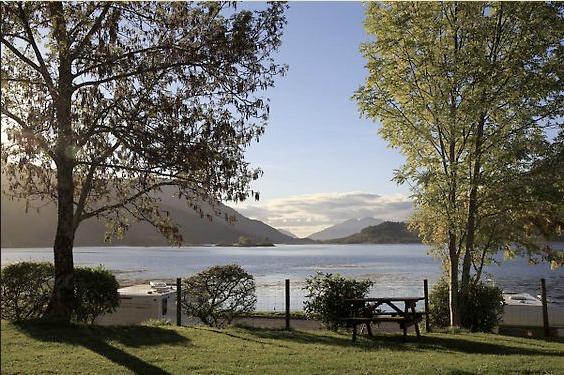
Invercoe Caravan & Camping Park
A level grass site set on the shore of Loch Leven, with excellent mountain views. The area is…

Through the Great Pass to Lochaber
Kinlochleven
7.5 miles (12kms)
On leaving Kinlochleven, there is a definite feeling of entering the last lap of a long journey. If you are using the official guide, you are on the last map section. There may be only 15.5 miles (25km) left, but there is still much to savour.
The old drovers' road came south from Fort William through the Lairig Mor or Great Pass, then by the hill path you see rising above Lairigmor house. It crosses a low hill pass and descends to the narrows of Loch Leven. Here the cattle would be forced to swim, while the drovers crossed by boat. MacIain, chieftain of Glencoe, took the same route from Fort William on the grim night of 30 January 1691. His failing to reach Inveraray by 1 January deadline to sign allegiance to King William was the pretext for the Glencoe Massacre two months later.
The ferry at Ballachulish ran on until 1975, when the present road bridge was opened.
For the fit and ambitious, there are temptations either side which are not easily ignored. To the right is the magnificent Mamore range, containing 10 Munros. Two or three of them can be savoured as a high-level alternative.
The hills to the west should not be discounted just because they are of lower height. Their position apart from the main hill groups makes Beinn na Caillich (‘hill of the old woman’) and Mam na Gualainn (‘pass of the shoulder’) particularly fine viewpoints, looking not just north to the great Lochaber hills but also west, out towards the sea, and across Loch Leven to the Pap of Glencoe (Sgorr na Ciche in Gaelic).
By turning right at Tigh-na-Sleubhaich and climbing steeply (though always on grass) here, the Mamore ridge can be gained at a point where the rock-type changes literally in a step, from grey schist to pinkish granite. By continuing over the easy Munro Mullach nan Coirean (‘summit of the corries’), the West Highland Way can be picked up again lower down. These are for a fine day (but not during the main autumn stalking season). Access is by stalking paths, which you will find on many Scottish hills. Superbly engineered for ponies as well as people, they always take the best line and if you can find one, use it.
From here to Lundavra the route is still on the line of the old military road, and of the long-established right of way, the Lairig Mor, which means ‘the big pass’. Follow the road out of Kinlochleven towards the north side of Loch Leven. At the village edge, the WH Way's wide path turns up to the right, marked by a large waymarker and an old green signpost indicating the right-of-way to Fort William. The path climbs steadily through shady birchwoods, crossing the road up to Mamore Lodge.
Emerging from the trees, the path zigzags on up among white quartzite rock slabs to reach a contouring track. The way follows this, high above Loch Leven, with grand mountain views across it to the Aonach Eagach, or 'notched ridge', and the Pap of Glencoe. The track runs into the wide valley between the pointed Mam na Gualainn and the high Mamores range: this gap is the actual Great Pass (Lairig Mor). It can be a dreich place indeed in rain or mist.
Just over the summit you pass the ruined Tigh-na-Sleubhaich (‘the house by the gully’). The path then passes the ruin of Lairigmor house, where the right of way to Loch Levenside can be seen branching off up left. The valley ahead appears to have no exit; in fact it swings to the right, with the track gently descending.
The track enters clear-felled plantations. Eventually it passes through some surviving trees to reach a forest track, with the minor road at Blar a' Chaorainn just below.
Away on the left lies Lochan Lunn-da-Bhra. The meaning of this name is obscure, but it is one of those lochs said to hold the each uisge, ‘the water-horse’, which came out of the water, tempted young men on to its back, and then galloped under the waves with them.
Clear, wide path and track
Birch woods, then high above sea loch and between great mountains
Good; on lead or under close control if passing cattle
OS Explorer 392 Ben Nevis
At Aluminium Story visitor centre, Kinlochleven; verge parking for one or two cars at Blar a' Chaorainn
Kinlochleven – community run toilets at River Leven bridge, or publicly available at Ice Factor
<p>Seven-day bus service from Kinlochleven to Fort William, or to Glencoe village for buses to Glasgow.</p>
Read our tips to look after yourself and the environment when following this walk.
Discover more than 15,000 professionally rated places to stay, eat and visit from across the UK and Ireland.
Choose a place to stay safe in the knowledge that it has been expertly assessed by trained assessors.
Search by location or the type of place you're visiting to find your next ideal holiday experience.
Read our articles, city guides and recommended things to do for inspiration. We're here to help you explore the UK.


