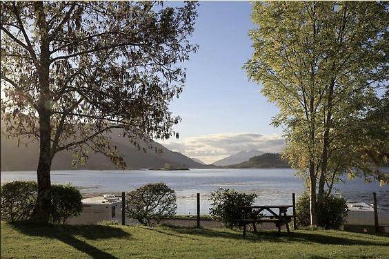


Glen Nevis Caravan & Camping Park
This is a large and very well maintained park, situated in Glen Nevis with easy access to the…

Through the plantations to the foot of Ben Nevis
Lundavra
8 miles (12.8kms)
At Blar a' Chaorainn the walker faces a choice. The WH Way path goes right, climbing up and over the fag end of the Mamore ridge to drop into Glen Nevis. In poor weather, an alternative is simply to continue along the switchback road which leads you straight into Fort William. Either way, you are now faced with the very last section of the long-distance walk.
Fort William was established in the 17th century, and named after King William III. Its Gaelic name, An Gearasdan, is linked, meaning the garrison. The original fort has disappeared, but the importance the town assumed with its strategic location only increased with the building of the Caledonian Canal and later the railway. It is the local administration and shopping centre, a tourist centre, and a rail and bus terminus (or more properly junction, since the separate rail line to Mallaig, one of the finest journeys in Britain, starts from here). As you would expect, there is a wide range of accommodation.
For those going on to climb Ben Nevis, the usual route is from Achintee (grid ref. NN125729), or from the large car park at the Glen Nevis Visitor Centre (grid ref. NN123730). A branch path from the youth hostel joins the main path partway up. The Ben Nevis path is well defined all the way to the top, for it was made when the summit observatory was constructed in the late 19th century (at that time, walking up cost you sixpence; today it is free). The path reaches the half-way plateau behind Meall an t-Suidhe, and doubles back to cross the Red Burn and up the notorious zig-zags before reaching the summit plateau. Here you will find the ruins of the observatory, a variety of cairns, and an emergency shelter. It is not a prepossessing place, but it is the roof of Britain.
The ascent needs preparation at any time of year. It is a long way and a rough one, and many underestimate it simply because there is a path. In mist (very frequent) the summit can be confusing, and it is all too possible to lose the path. There are cliffs on the north and east. Snow comes early and lingers late. The peak is busy all year round, but one notable date is the first Saturday in September, when 400 or so hardy souls tackle the Ben Nevis race to the summit and back (the record, believe it or not, is just under 90 minutes for the round trip). The long and stony descent is just as bad as the climb.
From Blar a’ Chaorainn, across the forest track at an information board, the path climbs to the right. It leaves the clear-felled area by a gate to wander across grassy hillsides, following the line of a fallen dyke (wall).
As the path climbs, more of Ben Nevis comes into view: impressive for its vast bulk rather than for any beauty of form. It hunches its shoulders way above the surrounding hills, rising to its rough plateau at 4,406ft (1,343m).
At another gate the path enters another former plantation, now being allowed to grow back in scrubby birch and goat willow. Here it crosses a charming footbridge below trees. At a third gate the path enters mature forest plantations. It descends steps to cross a stream beside a giant boulder.
Emerging to a felled area, the path bends left (north) and climbs to meet a wide, smooth forest road. In a few steps this crosses the ridgeline to look down over Glen Nevis. Here a side-path on the right is the short diversion up to Dun Deardail, an ancient fortified site possibly dating back to the Iron Age. It is one of many such sites in Scotland, and commands an excellent position above Glen Nevis, which was for long an important through-route on foot between the west coast and the hinterland. The name Deardail may mean ‘fort on the stormy hill’, which would be appropriate given the high rainfall hereabouts.
The forest road gives easy walking down to the glen. Partway down, a branch back to the right leads to the youth hostel and other facilities in the glen itself. The main track leads to a path down on the right to the valley floor. An old burial ground is just to the left, with carved stones from the 18th century below tall beech trees. The path itself meets the Glen Nevis road about a mile (1.6km) from Fort William.
The WH Way follows the pavement into Fort William. Alternatively, you can cross River Nevis at the Nevis Visitor Centre for a wooded riverside path on the right bank, recrossing by a green metal bridge after a mile (1.5km).
Many walkers consider Glen Nevis the appropriate end to the walk. However, the West Highland Way has been extended along the busy and unpleasant A82, then into the town centre and all the way along the pedestrianised High Street. A sculpture (a 'wee man wi' sair feet' according to one local) celebrates the end of the walk.
Clear, wide path, then forest track and roads, no stiles
Open hill slopes, scrubby woodland, plantations
Good through plantations; on lead on roads
OS Explorer 392 Ben Nevis
Verge parking for one or two cars at Blar a' Chaorainn; Glen Nevis Visitor Centre; Fort William sea front at west end of High Street
Glen Nevis Visitor Centre; Fort William High Street
<p>Fort William has trains and buses (Scottish Citylink) to Glasgow and intermediate points on the West Highland Way.</p>
Read our tips to look after yourself and the environment when following this walk.
Discover more than 15,000 professionally rated places to stay, eat and visit from across the UK and Ireland.
Choose a place to stay safe in the knowledge that it has been expertly assessed by trained assessors.
Search by location or the type of place you're visiting to find your next ideal holiday experience.
Read our articles, city guides and recommended things to do for inspiration. We're here to help you explore the UK.