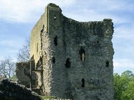

George's Cottage
Awaiting description.

Scale the shapely summit of Win Hill, one of the Peak District’s mini mountains.
Win Hill
4 miles (6.4kms)
It’s an irony of the Peak District that few of its hills have any real angled peaks, like the mountains of the Lake District. It’s thought that the name comes from the Old English peac, meaning hill, although a 7th-century document also refers to the Pecsaetan tribe or ‘settlers of the Peak’. Whatever the origin of the name, there are a few tops that try and live up to our modern understanding of the term – and Win Hill is certainly one of them. It might be only a pointed pimple at the end of a moorland ridge, but the coned summit gives it that elevation that catches the eye from below – and offers 360-degree views once you’ve puffed your way up to the top.
The summit itself is known as Win Hill Pike and although it looks a little precipitous from below, in fact it’s very easy to negotiate, since it forms a short, flat ridge with plenty of good rocky slabs from where you can sit and admire the spectacular views.
There’s a sedate beginning to the walk on the shores of Ladybower Reservoir, constructed between 1935 and 1943 to provide drinking water for Sheffield and the cities of the East Midlands. By the memorial stone erected by the Derwent Valley Water Board to commemorate its opening by King George VI in 1945, you cross the massive dam. When the reservoir is full, it holds back 6.1 billion gallons (27,800 megalitres) of water. Interpretation boards explain some of the peculiar features of this impressive construction, including draw-off towers and bellmouth spillway shafts. There’s also information on the work undertaken in 1998 and 1999 to refurbish Ladybower Dam, which involved quarrying stone from the forested hillside below Win Hill. You can still see the area, since relandscaped and replanted, where the rock was extracted.
The far side of the dam is also the northern terminus of the Thornhill Trail, a 1.5-mile (2.4km) bridleway route, which runs along the former Bamford and Howden railway to link the reservoir with the Hope Valley. It was built in 1901 to carry stone for the construction of the new dams and is an excellent traffic-free link to the railway station and other facilities at Bamford.
Soon you enter the wooded hillside, heading upwards for the open moors and the rocky summit ridge of Win Hill. From the 1,515ft (462m) top the views encompass the broad Dark Peak sweep of Kinder Scout, Bleaklow and the Derwent Moors, with the valleys of woodland and water reaching deep into the upland massif. Over the moors to the east lies Sheffield, while immediately to the southeast are the communities of Bamford and Hathersage, with the Derwent Valley extending into the distance. West lies the Hope Valley, with Castleton and Mam Tor prominent at its head, while no less mistakable is the tall chimney of the Hope cement works.
From the far southern end of the car park walk along the surfaced path past the toilets and picnic shelter towards Ladybower Dam. Follow it down to cross the road by the memorial stone, then walk over the dam to the far side.
Turn right and follow the broad track above the curving shore for just under a mile (1.6km). As you approach a clearing look for a public footpath signpost on the left, beyond the remnants of a fence.
Turn left for an initially steep path that crosses another path and continues more gently up the wooded hillside. Cross one more track, then go through a young plantation to reach the open moor.
At a junction of paths go ahead right for a narrow path up across the heather aiming to the right of the summit. At the ridge at the top turn left for the path to the very top.
Carry on past the summit and head east down a stone pitched path, across open slopes, and into woodland. At a crossroads of tracks go through the gate ahead, signed ‘Yorkshire Bridge’.
In a few paces fork left and at the bottom of this short path turn left on to a broad, gentle track through the plantation. After 0.5 miles (800m) turn sharply right through a small wooden gate for a public footpath down to the shoreline track. Turn right to reach the dam and return to the start.
Hard tracks, moorland and woodland paths, sometimes muddy
Flooded valley surrounded by woodland and open moors
May by off lead on enclosed tracks and in woodland, but on lead around sheep on moors
OS Explorer OL1 Dark Peak
Heatherdene pay car park
At car park
Read our tips to look after yourself and the environment when following this walk.
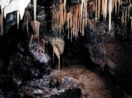
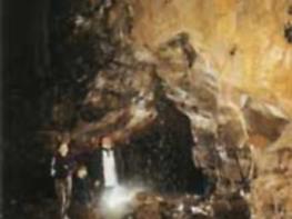
The natural features of this central English county range from the modest heights of the Peak District National Park, where Kinder Scout stands at 2,088 ft (636 m), to the depths of its remarkable underground caverns, floodlit to reveal exquisite Blue John stone. Walkers and cyclists will enjoy the High Peak Trail which extends from the Derwent Valley to the limestone plateau near Buxton, and for many, the spectacular scenery is what draws them to the area.
The county is well endowed with stately homes – most notably Chatsworth, the palatial home of the Duke and Duchess of Devonshire, with its outstanding collections of paintings, statuary and art. Other gems include the well preserved medieval Haddon Hall, the Elizabethan Hardwick Hall, and Kedleston Hall, whose entrance front has been described as the grandest Palladian façade in Britain.
The spa town of Matlock is the county’s administrative centre and other major towns of interest include Derby and the old coal mining town of Chesterfield, with its crooked spire. Around the villages of Derbyshire, look out for the ancient tradition of well dressing, the decorating of springs and wells – the precious sources of life-sustaining water – with pictures formed from flowers.
Discover more than 15,000 professionally rated places to stay, eat and visit from across the UK and Ireland.
Choose a place to stay safe in the knowledge that it has been expertly assessed by trained assessors.
Search by location or the type of place you're visiting to find your next ideal holiday experience.
Read our articles, city guides and recommended things to do for inspiration. We're here to help you explore the UK.