

Long View Cottages
Consisting of two separate buildings, ideal for large groups or intimate getaways. Hill View…

Woolhope
6.5 miles (10.4kms)
There’s an other-worldly atmosphere to this compact area of south Herefordshire. The feeling of remoteness, even isolation, is compounded by the mere handful of lanes that penetrate the woods, fields and orchards here high above the River Wye. Tiny, perfectly formed Woolhope village lies in the heart of a natural amphitheatre. Woolhope Dome is a geological curiosity, a massive upfold of rock uplifted from a tropical seabed some 425 million years ago. Differential erosion has resulted in an almost continual rim of ancient limestone enclosing a hollowed-out saucer of sandstone and shale. Sharp, steep wooded slopes face into the bowl, while longer, gentler scarp slopes face the outside world. There are extraordinary views to the Cotswolds, Shropshire Hills and the Black Mountains from points on this walk; at other points an intimate, closed-in landscape dominates.
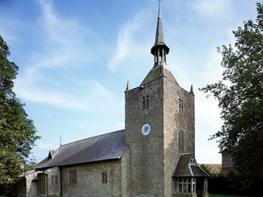
Built in the English Gothic style, St Michael’s Church at secluded Sollers Hope was altered in 1887, when plaster was removed to reveal the well preserved timbers of its barrelled roof. Also discovered was a 13th-century stone coffin lid, showing the coat of arms of the de Solers family, who owned the estate and gave the hamlet its name. According to local tradition, in the 14th century the influential Whittington family lived in a house near the churchyard (only the defensive motte now remains). Robert Whittington was instrumental in rebuilding the early church here; his younger brother Richard, possibly born here, became a wealthy merchant and Lord Mayor of London – Dick Whittington.
Near the end of the walk is enigmatic evidence of our distant ancestors. The first hedgerow bank you come to on a short detour off-route is an earthwork delineating Oldbury’s northern boundary. Some people believe that while forts such as Oldbury functioned as defensive focal points in times of need, they were built to some extent for ‘show’, providing a cultural identity. They also provided Iron Age people protection from wild animals such as wolves, lynx and bears, which roamed the countryside 2,000 years ago.
Walk down the lane for 500yds (457m). A fingerpost at a set-back pair of gates points right, down-field to a large barn. Turn left at this barn to reach Hyde Farm. Bend right but, within 60yds (55m), find a steep, waymarked track back-right into woods.
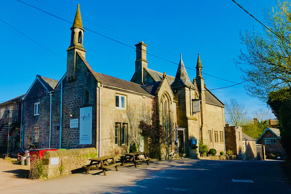
Follow this and ignore a left fork. As the track bends sharp left, cut to a wood-edge stile. Walk ahead across the huge field; at the distant top-left corner join the track into Busland Wood. Walk for 200yds (183m), again using a wood-edge stile where the track turns left. Go ahead for 250yds (229m) to a marker post above a small, dry valley. A few paces past this turn left on the field track; then join the woodland track beyond a gate. Keep down and left; the track becomes tarred before reaching The Butchers Arms pub. Turn left to Woolhope.
Pass The Crown Inn. In 328yds (300m), as the high wall ends, find a fingerpost on the left. Cross two meadows, then, in the third, use a stile in a dip on the right before the corner. Seek out a tree-shaded footbridge ahead; cross and head right past the willow, then left to a stile. Use the stile across the road; then head well right of the field-centre oak to a corner gate onto a lane.
Keep ahead, passing Alfords Mill Cottage. Beyond this, take a gate-side stile and cross the field to a stile. Turn left over it, then cross a footbridge. Follow the right-hand field edge for 130yds (119m) to a stile on the right. Walk the waist of the sloping field for 440yds (400m) to a tree-hidden stile in the dip. Keep ahead along the long pasture, looking for stiles and gates taking you well right of Court Farm to St Michael’s Church at Sollers Hope.
Walk the paved path to the churchyard entrance. Use the handgate 70yds (64m) ahead; then walk right of the modern farm buildings. Past a stile, keep ahead between brook and orchard; then across another meadow aiming right of the stone barn to a lane. Turn left to the bend by the barn. Use the field gate, right, to walk beside a ponded stream; in the next pasture rise to a stile onto a lane. Turn left to the fork; here keep left up a rough woodside track. Keep right at the renovated barn, ascending a tree-lined stony track.
Shortly before the brow are wooden steps and a handgate on the left. To view Oldbury Hill Fort, turn right here, then retrace your steps. Climb the wooden steps and simply go straight along the field-side path for nearly 1.25 miles (2km), passing the radio and television mast and using several stiles/gates. At the lane turn left twice to find the car park.
Country lanes, woodland tracks and fields, many stiles
Hilly, with agriculture and woodland, extensive views
An exciting stretch, but limited off-lead opportunities
OS Explorer 189 Hereford & Ross-on-Wye
At top of Glowson Wood Road
None on route
Read our tips to look after yourself and the environment when following this walk.
Herefordshire is split in two by the River Wye which meanders through the county on its way to the Severn and the sea. Largely rural, with Hereford, Leominster, and Ross-on-Wye the major towns and cities, its countryside and ancient villages are the county’s major asset.
Visitors can take advantage of a number of the trails which will guide them through areas of interest. Those especially interested in historic village life should try the Black and White Village Trail, which takes motorists on a 40-mile drive around timber-framed villages from Leominster to Weobley (established in the 17th century and known as a centre of witchcraft in the 18th), Eardisley (where the church boasts a 12th-century carved font), Kington, Pembridge and others. Other trails include the Mortimer Trail, the Hop Trail and the Hidden Highway, which goes from Ross-on-Wye to Chester. Hereford has a small Norman cathedral, which has a great forest of pink sandstone columns lining the nave. Inside is a chained library, a 13th-century Mappa Mundi (map of the world) and one of only four copies of the 1217 version of the Magna Carta.
Discover more than 15,000 professionally rated places to stay, eat and visit from across the UK and Ireland.
Choose a place to stay safe in the knowledge that it has been expertly assessed by trained assessors.
Search by location or the type of place you're visiting to find your next ideal holiday experience.
Read our articles, city guides and recommended things to do for inspiration. We're here to help you explore the UK.