


Kipling House Barn
Situated in the heart of the Yorkshire Wolds, Kipling House Barn is a converted 200-year-old…

Goodmanham
8.6 miles (13.9kms)
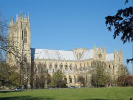
All Saints’ Church, Goodmanham, probably built on the site of a pagan temple, has Norman work with later additions, and an ornate carved font. The pagan temple was destroyed by Coifi, the high priest, after King Edwin of Northumbria was victorious in battle; the king had promised his queen he would become a Christian if he was successful and, true to his word, on Easter Day AD 627 he was baptised in York, on the site of the present York Minster.
Nunburnholme takes its name from a vanished Benedictine nunnery. The church is partly Norman and contains the shaft of an Anglo-Saxon cross. The rector from 1854 to 1893 was Reverend F O Morris, who is famous for writing a six-volume book on British birds.
Follow the Yorkshire Wolds Way as it passes above the church and continues under the former Driffield–Market Weighton railway. The path then climbs to the A163 Bridlington–Selby road at Towthorpe Corner, where there is a large car park and picnic site, with a café just below.
Cross the road and follow a track, then descend into the parkland of Londesborough Hall. Follow well-signed tracks, past a lake then climbing to the village. Turn left, then right after the church. Keep straight on at the crossroads and soon pass a bench and view indicator.
After a mile (1.6km), at the T-junction, turn right, then left through Partridge Hall. Pass above a wood and eventually turn left to descend into Nunburnholme.
Turn left after the church, then right around a field to the road, where you turn left. Fork right up a steep track through Bratt Wood to Wold Farm, cross the Warter–Pocklington road (B1246) and follow a bridleway, with Kilnwick Percy below to the left, to a farm. Follow the access lane to a junction.
To continue into Millington, take the lane ahead. To by-pass the village and continue directly on the Wolds Way, turn right right up a track beside Warrendale Plantation, then left along the wold-top above Millington. For a short while the Yorkshire Wolds Way coincides with the Minster Way, a 51-mile (82km) walk between York and Beverley Minsters.
Mostly on solid farm tracks, some field paths
Mostly on west-facing slopes on edge of the Wolds
Care needed on roads and on farmland
OS Explorer 294
Park with consideration in the small villages at start and finish
None on route
<p>Public Transport: No bus service in Millington but nearby Pocklington has regular services to Market Weighton, Hull, etc (less frequent on Sundays).</p>
Read our tips to look after yourself and the environment when following this walk.
Discover more than 15,000 professionally rated places to stay, eat and visit from across the UK and Ireland.
Choose a place to stay safe in the knowledge that it has been expertly assessed by trained assessors.
Search by location or the type of place you're visiting to find your next ideal holiday experience.
Read our articles, city guides and recommended things to do for inspiration. We're here to help you explore the UK.