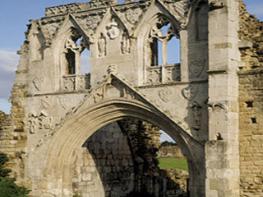


Kilnwick Percy Resort
Set on 180 acres of stunning Yorkshire Wolds countryside, the KP Resort offers a stunning and…

Millington
12.1 miles (19.5kms)
This stage offers quintessential Wolds walking, blending elevated passages across the open uplands with a succession of fine dry valleys. There are many marks of ancient activity in the landscape, though a sharp eye is often needed as most are low, inconspicuous earthworks. These earthworks are something of an enigma: they may have been built to mark boundaries in prehistoric times, and when set at the top of a valley, they would make a defensive mound (especially with a palisade).
The name Holm Dale is all that is left of the vanished village of Holme Archiepiscopi, the seat of a York prebend. In 1295 there was a manor house, chapel and nine tenants and the outline of the row of houses with their garths can be seen on aerial photographs of the fields, but little or nothing is apparent to the walker.
Set in these remote valleys, Thixendale is easily blocked off by winter snowfalls. The church, like the former school, was designed by G E Street at the expense of Sir Tatton Sykes.
Continue east on the Wolds Way.
Cross striking Sylvan Dale then dip into Nettle Dale and climb to turn right along its upper edge. Follow the edge of a wood then contour above Pasture Dale to reach a lane. Turn left to a junction.
Take a path on across the wolds, crossing another road into a track to Glebe Farm. Descend then climb up to a junction of tarmac tracks.
Here the Wolds Way turns left onto another tarmac track. (For the village of Huggate, turn up to the right.) Approaching Northfield Farm turn left over fields to an inconspicuous earthwork running along the top of the valley.
Descend into Horse Dale and turn left almost at once to climb Holm Dale, the name being all that is left of the vanished village of Holme Archiepiscopi, the seat of a York prebend. In 1295 there was a manor house, chapel and nine tenants and the outline of the row of houses with their garths can be seen on aerial photographs of the fields.
At the top, take the central of three tracks into Fridaythorpe. Bear right along the busy A166 York–Bridlington road. There are several buses daily to Driffield.
Go left by the Farmers Arms and follow the Thixendale road for 400yds then fork left by a large industrial building. Soon descend a splendid path into Brubber Dale. A short way down-dale, bear left to climb gradually to Gill's Farm. Cross a farm road and follow a track which soon swings left to descend into a valley, Thixen Dale, arriving at the bottom by a spiral earthwork.
Turn sharp right down the valley, bear right when you reach a lane then go left into Thixendale village.
Field tracks and the perfect turf of the dry valleys; some steps
Becoming more dramatic, with steep-sided dry valleys cutting into the wolds
Ensure dogs do not disturb livestock or trample crops
OS Explorer 294
Park with consideration in the small villages at start and finish
None on route
<p>Public Transport: No bus service in Millington but good services at Pocklington; Thixendale is remote from any public transport.</p>
Read our tips to look after yourself and the environment when following this walk.
Discover more than 15,000 professionally rated places to stay, eat and visit from across the UK and Ireland.
Choose a place to stay safe in the knowledge that it has been expertly assessed by trained assessors.
Search by location or the type of place you're visiting to find your next ideal holiday experience.
Read our articles, city guides and recommended things to do for inspiration. We're here to help you explore the UK.