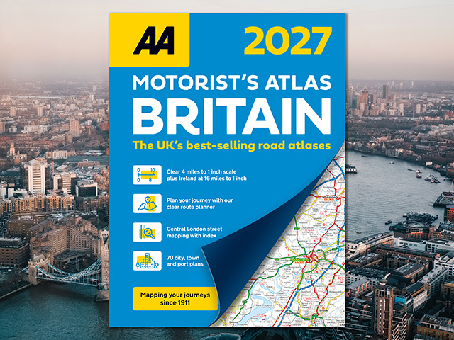
AA Motorist's Atlas Britain 2027
The UK's most up-to-date road atlases*
This fully updated A4 road atlas provides clear mapping and town plans from the experts at the AA. Each page has been titled with its geographical location for ease in locating pages effortlessly and includes district mapping of Birmingham, Glasgow, Manchester, London and Newcastle.
Including 70 city, town and port plans, central London street mapping and wide and minor roads for hard-to-find places, the atlas is an ideal journey companion for trips around Britain. The atlas also includes a comprehensive index with airports, top tourist sites and motorway services, along with National Trust locations, World Heritage sites and caravan and camping sites.
ISBN: 978-0-7495-8460-3
Publication date: 7 May 2026
Pages: 208pp
Dimensions: 294.5 x 218mm (Spiral)
*Nielsen BookScan Total Consumer Market (all road atlases) 1–39 weeks to 30 September 2025.