AA Trucker's Atlas Britain
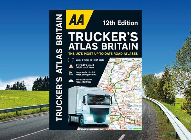
The UK's most up-to-date road atlases*
Fully updated for 2024, the atlas includes truck and freight ferry routes and port plans, a route planner map, quick reference distance chart and an explanatory list of restricted motorway junctions.
The mapping includes information on over 3,600 bridge heights, with the most frequently struck rail bridges highlighted. Roads less than 4 metres wide are distinguished, as well as road tunnels, toll roads, service areas, steep gradients, level crossings and low emission zones.
There's also a special feature, in conjunction with Network Rail’s campaign, that provides useful information how to avoid bridge strikes.
ISBN: 978-0-7495-8358-3
Publication Date: 26/10/2023
Pages: 144
Dimensions: 402 x 285mm (Spiral-bound)
*Nielsen BookScan Total Consumer Market (UK Standard scale atlases) 1–39 weeks to 2 October 2023.