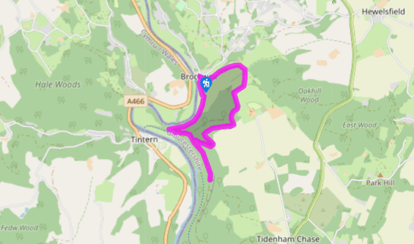
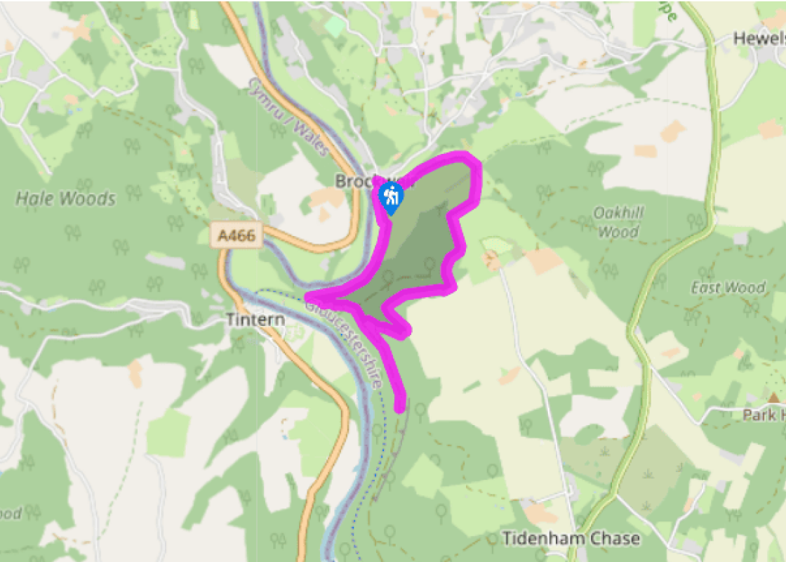
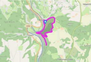
From the lay-by walk down the road for a few paces and turn left. Pass some outbuildings on the left and turn left, signposted ‘Offa’s Dyke’. Keep alongside buildings and barns and continue on the trail. Continue heading uphill to a gate and enter a field. On the right are trees and hedging. Ahead is a large barn.
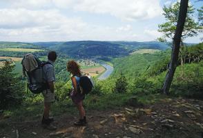
Bear right before it and follow an enclosed path uphill, running to the right of a field. Make for a stile and gate in the top right corner and continue in the next field for several paces to a fork. Keep right and follow the path up the grassy slope towards trees. On reaching them head diagonally up the steep, stony path. At the top, opposite a stile, turn right, following the Offa’s Dyke Path through trees. Stay on the trail, passing over stones and tree roots. At one point a wooded dell can be seen falling away to the right, and to the left fields are visible close by between the trees.
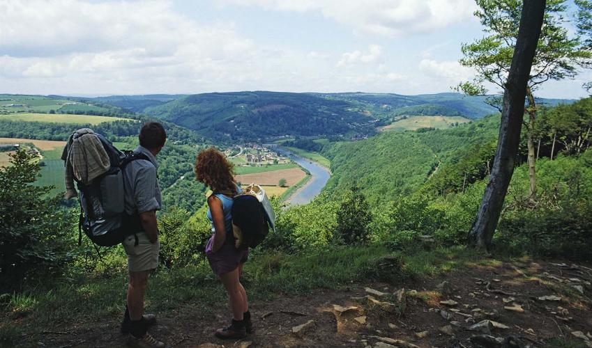
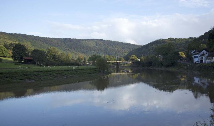
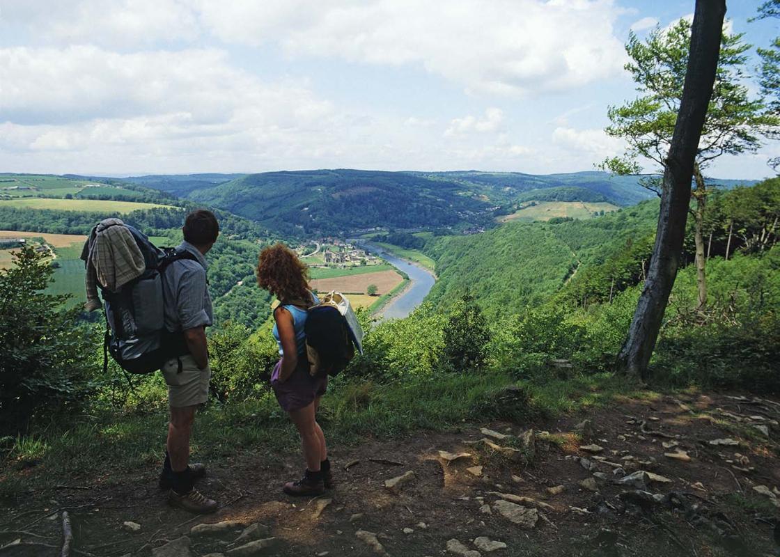
On reaching a path junction you have a choice. To visit the Devil’s Pulpit (a look-out point) 0.5 miles (800m) off, keep ahead and then return to this intersection. The main walk turns right, signposted to Tintern. Descend through the trees to emerge from the cover at a T-junction. Turn right, and within 50yds (46m) bear left, again signed ‘Tintern’. Pick your way down through the trees on a rocky path, and on reaching another T-junction turn right. The foot of the valley is visible through the trees along here. With the sound of traffic audible now, make for a junction with a track alongside a stone parapet.
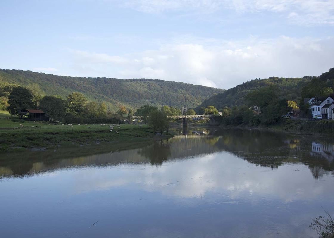
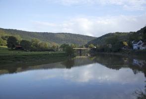
To visit Tintern Abbey and the Old Station turn left here, following the track out of the woods to a bridge, crossing over the River Wye into Wales and turning left, briefly following the A466 in the direction of Chepstow. Otherwise, turn right along the track in the direction of Brockweir. This is a spectacular stretch of the walk, with the meandering River Wye seen and heard through the trees to the left. Continue on the obvious track to the point where the trees give way to grassy slopes and bracken, and along this stretch of the walk a stile can be seen on the left. Cross it and follow the grassy path down towards the river.
As you approach the bank of the Wye, keep right and head towards Brockweir. Make for a stile and follow the path between hedge and fencing, then stone walls. Pass through the grounds of Brockweir’s Moravian Church and return to the lay-by.
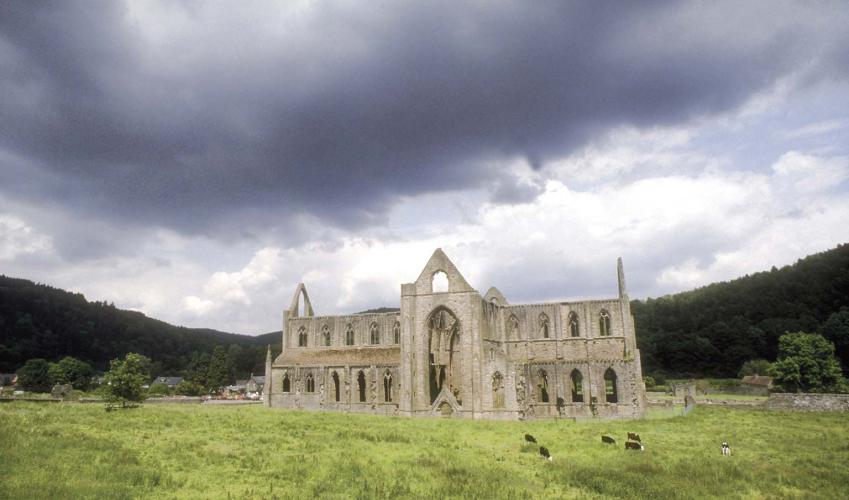
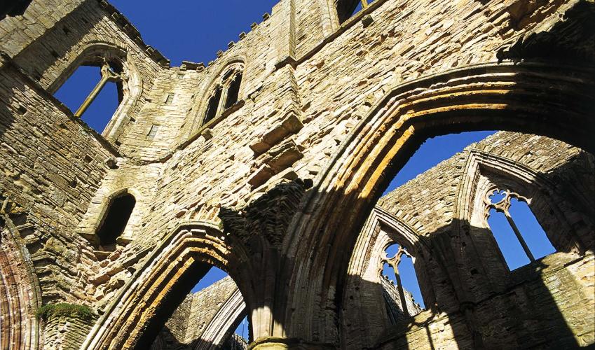
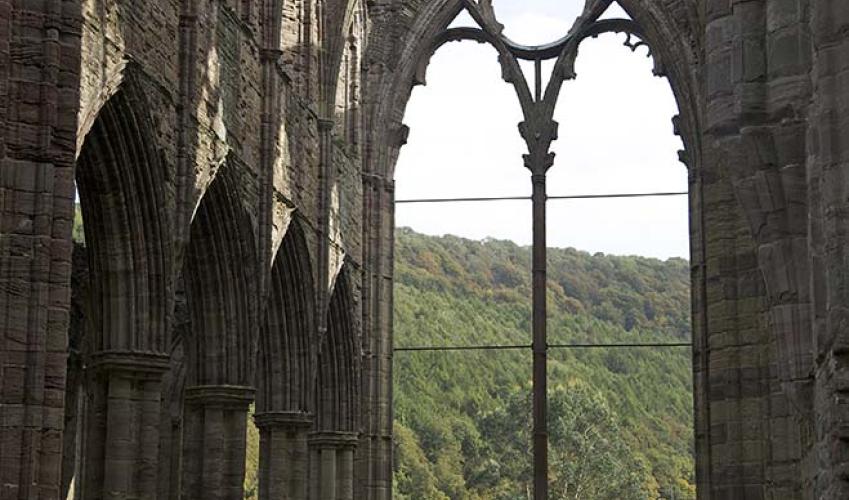
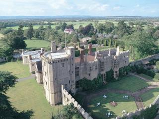
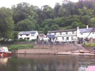
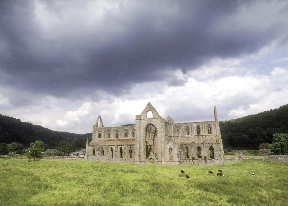
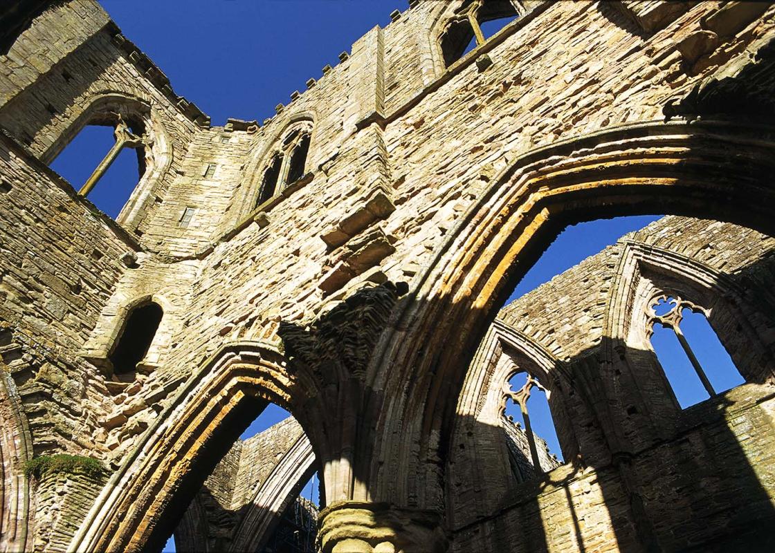
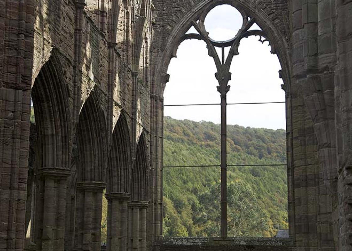
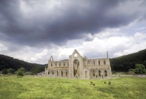
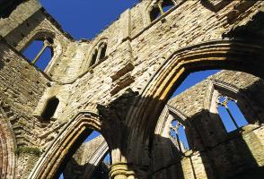
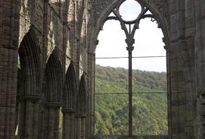
The Cistercian abbey of Tintern is one of the region’s greatest monastic ruins, situated just over the border between Gloucestershire and Wales. Studying it today, a timeless landmark in a timeless, spectacularly beautiful setting on the wooded banks of the River Wye, it is not hard to understand... why William Wordsworth appreciated it so much and how he came to immortalise it in his famous poem, Lines written a few miles above Tintern Abbey. What is left today is the defiantly noble shell of the abbey church, built in English Gothic style between 1270 and 1325. Tintern Abbey was only the second Cistercian foundation in Britain and the first in Wales. It was founded in May 1131 by Walter de Clare, Lord of Chepstow, and it soon prospered – largely thanks to various endowments of land in Gwent and Gloucestershire. Buildings were added, updated and restored thereafter until its dissolution in 1537. Though grand and majestic in appearance, it was never particularly important or significant, and its history was largely quiet and uneventful. The abbey, which was best appreciated from the Wye until a new turnpike road cut through the scenic valley, was eventually purchased by the Crown from the Duke of Beaufort in 1901 for the sum of £15,000. Near to Tintern Abbey is a landmark from more recent history. The Old Station, on the banks of the Wye, is also one of the region’s most popular tourist attractions, and – given our love of steam trains and disused railway lines – it’s not hard to see why. The original railway station, which opened in 1876 and closed to passengers in 1959 and freight in 1964, was purchased by the local council and now operates as a visitor attraction. There are three railway carriages to admire, two of which contain a souvenir and gift shop. The third carriage is smaller and includes railway memorabilia – among the displays are fascinating old photographs of Tintern station in bygone years.
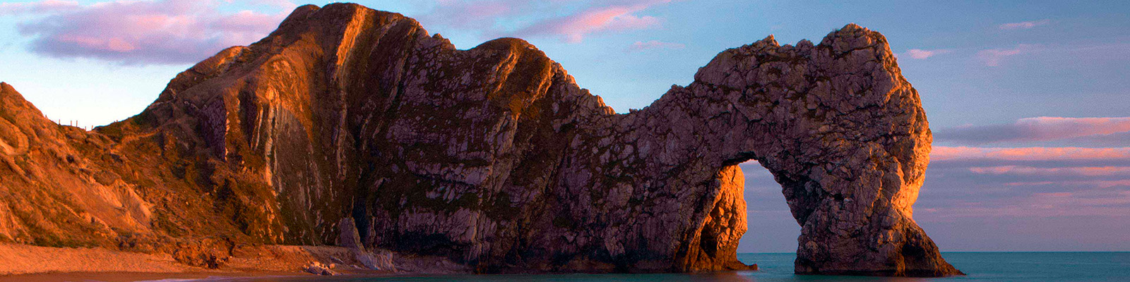
Dorset is made up of rugged coastlines, high chalk downlands and a chain of picturesque villages and seaside towns that make up Britain’s Jurassic Coast, a UNESCO World Heritage Site and Area of Outstanding Natural Beauty, noted for its layers of shale and numerous fossils embedded in the rock. Hidden gems of Dorset can be found down winding, country lanes that lead to snug villages hidden from view.
From the lay-by walk down the road for a few paces and turn left. Pass some outbuildings on the left and turn left, signposted ‘Offa’s Dyke’. Keep alongside buildings and barns and continue on the trail. Continue heading uphill to a gate and enter a field. On the right are trees and hedging. Ahead is a large barn.
1 of 5
Bear right before it and follow an enclosed path uphill, running to the right of a field. Make for a stile and gate in the top right corner and continue in the next field for several paces to a fork. Keep right and follow the path up the grassy slope towards trees. On reaching them head diagonally up the steep, stony path. At the top, opposite a stile, turn right, following the Offa’s Dyke Path through trees. Stay on the trail, passing over stones and tree roots. At one point a wooded dell can be seen falling away to the right, and to the left fields are visible close by between the trees.
2 of 5
On reaching a path junction you have a choice. To visit the Devil’s Pulpit (a look-out point) 0.5 miles (800m) off, keep ahead and then return to this intersection. The main walk turns right, signposted to Tintern. Descend through the trees to emerge from the cover at a T-junction. Turn right, and within 50yds (46m) bear left, again signed ‘Tintern’. Pick your way down through the trees on a rocky path, and on reaching another T-junction turn right. The foot of the valley is visible through the trees along here. With the sound of traffic audible now, make for a junction with a track alongside a stone parapet.
3 of 5
To visit Tintern Abbey and the Old Station turn left here, following the track out of the woods to a bridge, crossing over the River Wye into Wales and turning left, briefly following the A466 in the direction of Chepstow. Otherwise, turn right along the track in the direction of Brockweir. This is a spectacular stretch of the walk, with the meandering River Wye seen and heard through the trees to the left. Continue on the obvious track to the point where the trees give way to grassy slopes and bracken, and along this stretch of the walk a stile can be seen on the left. Cross it and follow the grassy path down towards the river.
4 of 5
As you approach the bank of the Wye, keep right and head towards Brockweir. Make for a stile and follow the path between hedge and fencing, then stone walls. Pass through the grounds of Brockweir’s Moravian Church and return to the lay-by.
The Cistercian abbey of Tintern is one of the region’s greatest monastic ruins, situated just over the border between Gloucestershire and Wales. Studying it today, a timeless landmark in a timeless, spectacularly beautiful setting on the wooded banks of the River Wye, it is not hard to understand... why William Wordsworth appreciated it so much and how he came to immortalise it in his famous poem, Lines written a few miles above Tintern Abbey. What is left today is the defiantly noble shell of the abbey church, built in English Gothic style between 1270 and 1325. Tintern Abbey was only the second Cistercian foundation in Britain and the first in Wales. It was founded in May 1131 by Walter de Clare, Lord of Chepstow, and it soon prospered – largely thanks to various endowments of land in Gwent and Gloucestershire. Buildings were added, updated and restored thereafter until its dissolution in 1537. Though grand and majestic in appearance, it was never particularly important or significant, and its history was largely quiet and uneventful. The abbey, which was best appreciated from the Wye until a new turnpike road cut through the scenic valley, was eventually purchased by the Crown from the Duke of Beaufort in 1901 for the sum of £15,000. Near to Tintern Abbey is a landmark from more recent history. The Old Station, on the banks of the Wye, is also one of the region’s most popular tourist attractions, and – given our love of steam trains and disused railway lines – it’s not hard to see why. The original railway station, which opened in 1876 and closed to passengers in 1959 and freight in 1964, was purchased by the local council and now operates as a visitor attraction. There are three railway carriages to admire, two of which contain a souvenir and gift shop. The third carriage is smaller and includes railway memorabilia – among the displays are fascinating old photographs of Tintern station in bygone years.
Dorset is made up of rugged coastlines, high chalk downlands and a chain of picturesque villages and seaside towns that make up Britain’s Jurassic Coast, a UNESCO World Heritage Site and Area of Outstanding Natural Beauty, noted for its layers of shale and numerous fossils embedded in the rock. Hidden gems of Dorset can be found down winding, country lanes that lead to snug villages hidden from view.