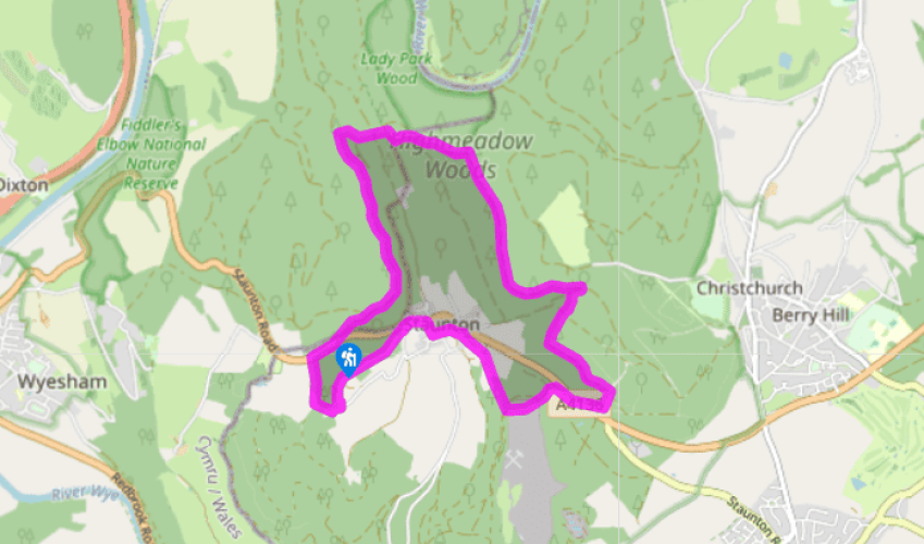
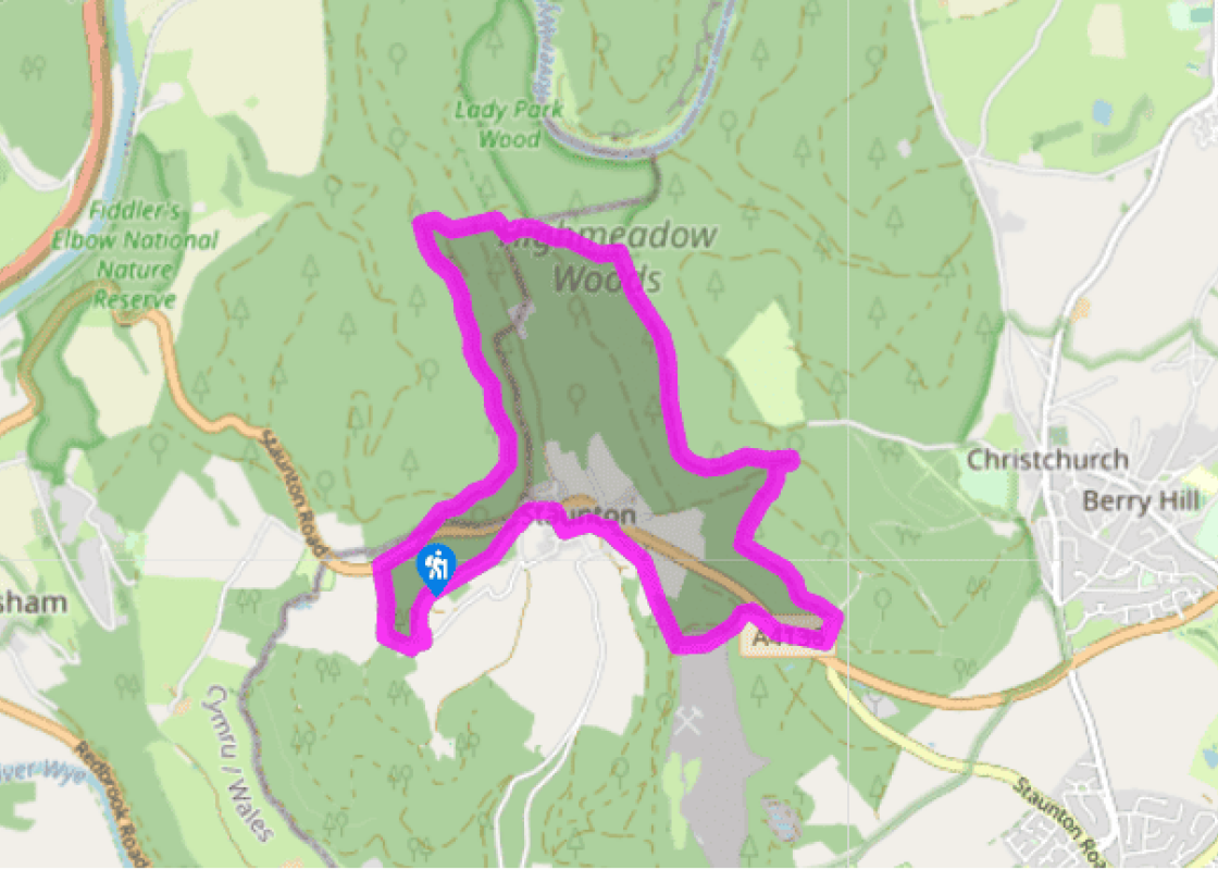
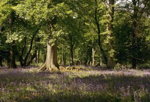
From the parking area, head along a track into the woods. Where the track curves sharp left, keep right to join another track. Follow this for just under 0.75 miles (1.2km), until you see large boulders on your right. Turn right to follow a waymarked path steeply up the slope, passing first the Suck Stone and then, at the top, Near Hearkening Rock (not the smaller slab to the left). These are just two of the many giant stones that you will pass on this walk.
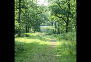
Go up behind Near Hearkening Rock and, with your back to it, follow an initially graveled path through the trees for 150yds (137m) to a forest track. Turn left and immediately right, onto a path. Follow it through trees to a track. Keep right and take the next left path. Go right at a fork to reach a forest track. Cross this diagonally to walk with a high wire fence on your left. When the fence turns left veer right, following a path steeply to the valley bottom.
Turn right for just under 1 mile (1.6km). At a crossroads, by a sign on the left for campsites, turn right. After 100yds (91m), just before a telegraph pole, turn left onto a rising path, which you follow. Cross a major path and keep ahead to a track at a bend. You will hear traffic to your right. Turn left and follow this for 550yds (503m). At another crossways of tracks turn right onto a grassy path (signed ‘Highmeadow Trail’) for 120yds (110m). Turn right along a path and continue to the Long Stone beside the A4136.
Turn right for a few paces and then cross the road to enter the woods on another path. Follow this to emerge at a junction of forest tracks. Turn left to follow the rising track. Bear right onto another track as you approach gates prohibiting public access, and keep ahead until just before the next intersection of tracks.
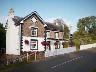
Turn sharp right to follow a broad path down to a farm track and onwards to Staunton. At a junction turn left, away from the main road, and go through the old village. Bend right, up to the White Horse Inn, and turn left along the pavement. Take the curving ‘No Through Road’ on the left, and at the stile and ‘15mph’ sign ascend to follow a climbing path towards the Buck Stone.
Pass it and keep the wall closely on your right. Emerge left of Buckstone Lodge after 150yds (137m). Go down to a track and turn right, keeping right again on a falling path. Where the path divides, just before a telegraph pole, go right at a fork in front of you. Descend, passing a path running in from the left, and take the next left path alongside a fenced plantation. At the road turn right to return to the start.
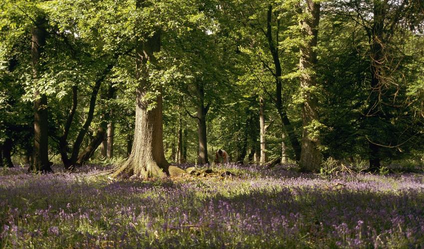
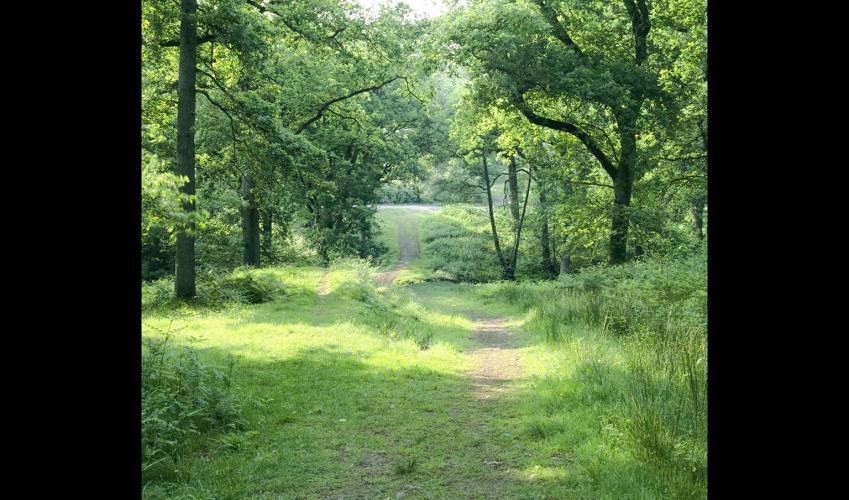
The Forest of Dean is all that remains of the primeval woodland that sprouted at the end of the ice age. It stands on a roughly a triangular plateau, bounded by the River Wye to the west and north, the River Severn to the south and Gloucester to the east. Clearance began in about 4000 bc, as... farmers established settlements. By the Iron Age the Forest had become an important source of minerals. The Romans mined here and evidence of these so-called ‘scowles’ can sometimes be discovered beneath small green mounds. Before 1066 a large area of the forest was designated a royal hunting ground, and it remained the second largest Crown forest in England. In the 17th century the Forest was opened to private individuals and soon there were only a few hundred oaks left. Charles II ordered 11,000 acres (4,455ha) of oak to be planted and the Court of Verderers was set up to manage them. There are now some 27,000 acres (10,935ha) of oak, chestnut and other native trees. Today, the people who reside hereabouts are known as Foresters, and they maintain and preserve the ancient customs and privileges. Several giant stones can be found on this spectacular walk. Composed of a quartz conglomerate – a mixture of quartz and Old Red Sandstone – they have mostly been formed by natural weathering over millions of years. The Suck Stone is thought to be one of the largest single boulders in the country, with estimates of its weight varying from 4,000 to 14,000 tons. From Near Hearkening Rock, keen-eared listeners are supposed to be able to hear messages whispered from the Buck Stone, which can be seen later in the walk. The Buck Stone used to be celebrated as the ‘rocking stone’, poised on its 3ft (90cm) apex, but in 1885 some lads heaved it over. The Long Stone is artificial, and probably created during the Bronze Age – some 7ft (2.1m) high, it is thought to have been part of an ancient cemetery.
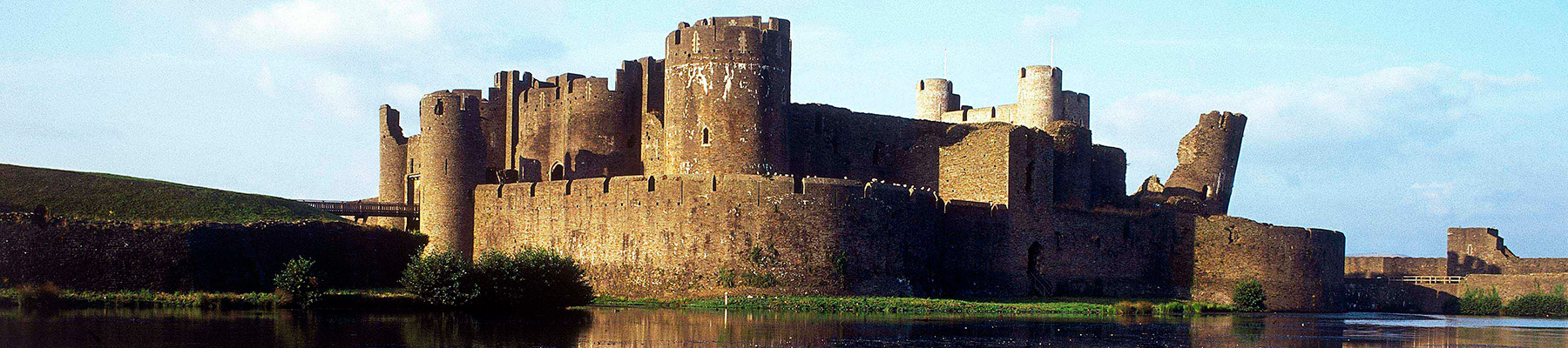
In their bid to control the borderlands of Monmouthshire – also known as the Marches – the Normans built a triangle of castles: Grosmont, Skenfrith and White. At first, they were simple wooden structures strengthened by earthworks, but when the lively Welsh refused to stop attacking them, it was decided more permanent fortresses were needed.
From the parking area, head along a track into the woods. Where the track curves sharp left, keep right to join another track. Follow this for just under 0.75 miles (1.2km), until you see large boulders on your right. Turn right to follow a waymarked path steeply up the slope, passing first the Suck Stone and then, at the top, Near Hearkening Rock (not the smaller slab to the left). These are just two of the many giant stones that you will pass on this walk.
1 of 6
Go up behind Near Hearkening Rock and, with your back to it, follow an initially graveled path through the trees for 150yds (137m) to a forest track. Turn left and immediately right, onto a path. Follow it through trees to a track. Keep right and take the next left path. Go right at a fork to reach a forest track. Cross this diagonally to walk with a high wire fence on your left. When the fence turns left veer right, following a path steeply to the valley bottom.
2 of 6
Turn right for just under 1 mile (1.6km). At a crossroads, by a sign on the left for campsites, turn right. After 100yds (91m), just before a telegraph pole, turn left onto a rising path, which you follow. Cross a major path and keep ahead to a track at a bend. You will hear traffic to your right. Turn left and follow this for 550yds (503m). At another crossways of tracks turn right onto a grassy path (signed ‘Highmeadow Trail’) for 120yds (110m). Turn right along a path and continue to the Long Stone beside the A4136.
3 of 6
Turn right for a few paces and then cross the road to enter the woods on another path. Follow this to emerge at a junction of forest tracks. Turn left to follow the rising track. Bear right onto another track as you approach gates prohibiting public access, and keep ahead until just before the next intersection of tracks.
4 of 6
Turn sharp right to follow a broad path down to a farm track and onwards to Staunton. At a junction turn left, away from the main road, and go through the old village. Bend right, up to the White Horse Inn, and turn left along the pavement. Take the curving ‘No Through Road’ on the left, and at the stile and ‘15mph’ sign ascend to follow a climbing path towards the Buck Stone.
5 of 6
Pass it and keep the wall closely on your right. Emerge left of Buckstone Lodge after 150yds (137m). Go down to a track and turn right, keeping right again on a falling path. Where the path divides, just before a telegraph pole, go right at a fork in front of you. Descend, passing a path running in from the left, and take the next left path alongside a fenced plantation. At the road turn right to return to the start.
The Forest of Dean is all that remains of the primeval woodland that sprouted at the end of the ice age. It stands on a roughly a triangular plateau, bounded by the River Wye to the west and north, the River Severn to the south and Gloucester to the east. Clearance began in about 4000 bc, as... farmers established settlements. By the Iron Age the Forest had become an important source of minerals. The Romans mined here and evidence of these so-called ‘scowles’ can sometimes be discovered beneath small green mounds. Before 1066 a large area of the forest was designated a royal hunting ground, and it remained the second largest Crown forest in England. In the 17th century the Forest was opened to private individuals and soon there were only a few hundred oaks left. Charles II ordered 11,000 acres (4,455ha) of oak to be planted and the Court of Verderers was set up to manage them. There are now some 27,000 acres (10,935ha) of oak, chestnut and other native trees. Today, the people who reside hereabouts are known as Foresters, and they maintain and preserve the ancient customs and privileges. Several giant stones can be found on this spectacular walk. Composed of a quartz conglomerate – a mixture of quartz and Old Red Sandstone – they have mostly been formed by natural weathering over millions of years. The Suck Stone is thought to be one of the largest single boulders in the country, with estimates of its weight varying from 4,000 to 14,000 tons. From Near Hearkening Rock, keen-eared listeners are supposed to be able to hear messages whispered from the Buck Stone, which can be seen later in the walk. The Buck Stone used to be celebrated as the ‘rocking stone’, poised on its 3ft (90cm) apex, but in 1885 some lads heaved it over. The Long Stone is artificial, and probably created during the Bronze Age – some 7ft (2.1m) high, it is thought to have been part of an ancient cemetery.
In their bid to control the borderlands of Monmouthshire – also known as the Marches – the Normans built a triangle of castles: Grosmont, Skenfrith and White. At first, they were simple wooden structures strengthened by earthworks, but when the lively Welsh refused to stop attacking them, it was decided more permanent fortresses were needed.