Additional information
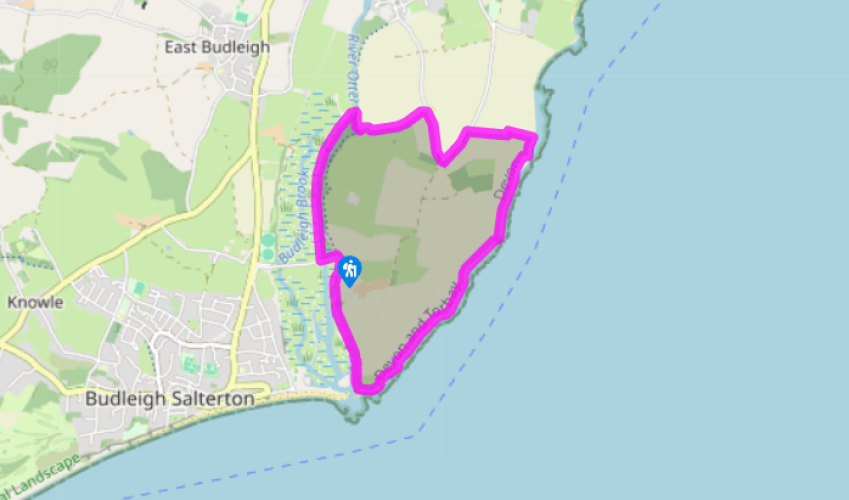
Terrain
- Good level paths, coastal section and lanes
Landscape
- River meadow, cliffs and undulating farmland
Dog friendliness
- Keep on lead near livestock and unfenced cliffs
Parking
- By side of broad, quiet lane near entrance to South Farm
Toilets en route
- Behind Otterton Mill
About the walk
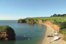
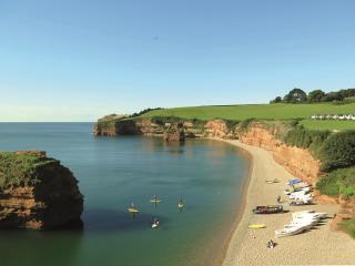
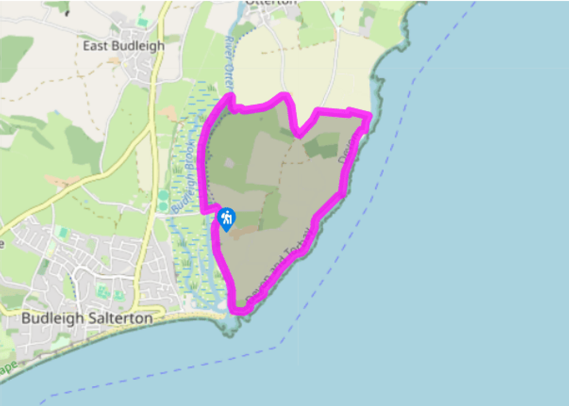
Peaceful, tranquil, lush, idyllic – these are all words that could easily be applied to this stroll along the banks of the River Otter. The river wends its way to meet the sea just east of Budleigh Salterton, its lower reaches a haven for a wealth of birdlife. In contrast to this, the walk... continues along the top of the red sandstone cliffs typical of this area – but the coast path here is not in any way heart-thumpingly strenuous. The combination of the serene river meadows and the glorious coastal scenery – and then, perhaps, tea at Otterton Mill – make this an ideal family walk. The Nature Reserve, south of White Bridge, is a SSSI and nationally important wildlife habitat, one of the smallest in the South West. The estuary was much more extensive in the past, and 500 years ago cargo ships could travel upriver as far as Otterton. Today, the estuary provides a haven for all kinds of birdlife, best seen between October and March. Oystercatchers, dunlins and other wading birds come to feed here; large flocks of waders and ducks, such as wigeons and teal, attract peregrine falcons, sparrowhawks and mink. Three-quarters of the estuary has been colonised by saltmarsh, which is also home to warblers in the summer months, linnets and greenfinches all year round, and kingfishers in winter. To catch the action, about 0.25 miles (400m) from the start of the main walk take a small path right towards the river to a birding hide. The coastal section runs along part of the 95-mile (153km) Jurassic Coast, England’s first natural UNESCO World Heritage Site, designated in 2001. Quartzite pebbles on the beach at Budleigh Salterton date from Triassic times. Point 4 crosses Brandy Head, named on account of historic smuggling activity, and home to a World War II range observation post; from 1940 to 1946 Exeter airport was the most important RAF station in the West Country. The mid-section of the walk brings us within sight of Otterton, a large, pleasant village, with many traditional cob and thatch buildings. St Michael and All Angels church is most impressive. There was a Saxon church here before the Norman Conquest, rebuilt by Benedictine monks when they established a priory in the 12th century. The main monastery building lay on the north side of the church, and part of it – probably the guests’ hall – remains today. After Henry VIII’s Dissolution of the Monasteries, in 1539, the church gradually fell into disrepair until it was totally rebuilt in the 1870s. The west tower is constructed of the Old Red Sandstone seen in the cliffs earlier in the walk.
Read more
Devon
Devon sums up all that is best about the British landscape, with its magnificent coastlines, two historic cities, the world-famous Dartmoor National Park and south Devon’s glorious English Riviera. A fashionable and much-loved holiday destination, hiking and cycling in the National Parks is extremely popular among visitors, with a great choice of off-road routes.