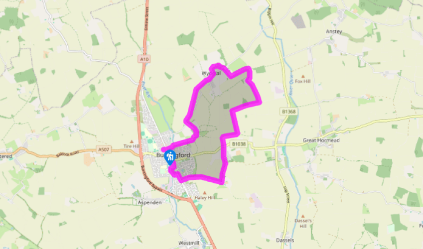
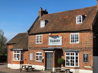
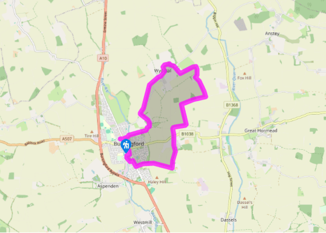
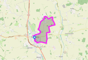
From the High Street car park, pass the toilet block, cross the road and turn into Church Street. Descend past the Fox and Duck pub. Go left into Wyddial Road, then right across the River Rib ford into The Causeway. The lane leaves the town and becomes a winding rural lane. Pass to the right of the churchyard and a few paces further on turn left.
The former St Bartholomew's Church, now a house, is on the right. Continue along the green lane downhill to the road. Turn right and follow the road uphill. At a bend go left at the bridleway sign, the path being a grassy baulk between arable fields. On reaching a road go straight on and wind through Wyddial to the parish church (St Giles').
From the churchyard (from where you can see Wyddial Hall) continue along the road to a bend. Turn right, by a footpath sign, to walk along the right side of a hedge. Cross a footbridge and then turn left. Continue east, first on the right-hand side of the hedge, then via a footbridge on the left, to a farm access road. Turn right along this and walk to Beauchamps.
The route passes to the left of Beauchamps, initially alongside a neat hedge, then bears left off the concrete track on to a grassy track, with poplars on the right. Continue to a track at the brow of the hill and turn right. Past Beauchamp's Wood the track gradually descends to the valley floor before turning left and gently ascending to the next crest. Turn right beside a concrete hardstanding. Descending gradually, follow the metalled track to the left.
At a road cross on to the drive to Alswick Hall. Pass a pond and farm buildings, then the hall itself. The route now follows a green lane to Owles Hall.
Beyond Owles Hall turn right on to a lane. Descend westwards, to cross the valley of the Haley Hill Ditch. Next, ascend towards Buntingford, with the large warehouse buildings of Sainsbury's supermarket distribution centre to the left. At the end of Owles Lane turn right to walk along the course of Roman Ermine Street.
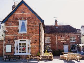
Turn left into Aspenden Road, then go right into Luynes Rise. At a footpath sign go right, the tarmac path winding beside the River Rib, with modern housing on the left. Keep right at a fork and beyond some cottages the path emerges into the High Street. Turn left, passing St Peter's Church and the Seth Ward Almshouses and The Crown pub, to the start.
Buntingford grew up where Ermine Street crosses the River Rib, which is little more than a large stream here. It is also where the Baldock to Newport and Saffron Walden road crossed Ermine Street. Earlier attempts to establish a market town further north along Ermine Street foundered, first at... Chipping in 1252 ('cheping' means 'market') and then at Buckland in 1258. There was a hamlet at Buntingford by 1158 and it obviously prospered at the crossroads. In 1360 Elizabeth de Burgh, the then lady of the manor of Pope's Hall, saw that Chipping could not compete and bowed to the inevitable, transferring her chartered market to Buntingford. The parish church remained at Layston, 0.5 miles (800m) to the east, but everything else leached to the market town. Buntingford marketplace was laid out in a stretch of the widened High Street. The Hare Street road junction was moved to the south, which meant that all through traffic had to cross the marketplace, and so pay market tolls. The character of Buntingford is very much that of a prosperous, mainly Georgian, market town with some fine brick fronts. However, behind many of these are earlier, timber-framed 16th- and 17th-century buildings. At the south end is St Peter's Church, an unusual brick one with a Greek Cross plan built around 1615 as a chapel of ease to Layston's parish church. To its left is Bishop Ward's Hospital, a superb set of almshouses for four men and four women. Built of brick with stone dressings and a pedimented centre bay, they were founded in 1684 by Seth Ward. He was a local boy made good – an astronomer and mathematician, as well as Bishop of Exeter and later Bishop of Salisbury. St Bartholomew's Church, the sole survivor of the deserted medieval village of Layston, is no longer functional and has been converted into a private house. Wyddial's St Giles' Church, on the other hand, is still in use and has several important features, including a brick north aisle and north chancel chapel, built in 1532 at the expense of George Canon. It also retains some fine Jacobean screens separating the chapel from the rest of the church. Further on you pass other mansions, including Beauchamps, which was the moated manor house of a vanished village. The Beauchamp family owned it from the 13th to the 15th centuries.
As Hertfordshire is so close to London, many of its towns have become commuter havens. St Albans, less than 19 miles (30km) from the capital, has retained its distinctive character, along with many historic remains.
From the High Street car park, pass the toilet block, cross the road and turn into Church Street. Descend past the Fox and Duck pub. Go left into Wyddial Road, then right across the River Rib ford into The Causeway. The lane leaves the town and becomes a winding rural lane. Pass to the right of the churchyard and a few paces further on turn left.
1 of 7
The former St Bartholomew's Church, now a house, is on the right. Continue along the green lane downhill to the road. Turn right and follow the road uphill. At a bend go left at the bridleway sign, the path being a grassy baulk between arable fields. On reaching a road go straight on and wind through Wyddial to the parish church (St Giles').
2 of 7
From the churchyard (from where you can see Wyddial Hall) continue along the road to a bend. Turn right, by a footpath sign, to walk along the right side of a hedge. Cross a footbridge and then turn left. Continue east, first on the right-hand side of the hedge, then via a footbridge on the left, to a farm access road. Turn right along this and walk to Beauchamps.
3 of 7
The route passes to the left of Beauchamps, initially alongside a neat hedge, then bears left off the concrete track on to a grassy track, with poplars on the right. Continue to a track at the brow of the hill and turn right. Past Beauchamp's Wood the track gradually descends to the valley floor before turning left and gently ascending to the next crest. Turn right beside a concrete hardstanding. Descending gradually, follow the metalled track to the left.
4 of 7
At a road cross on to the drive to Alswick Hall. Pass a pond and farm buildings, then the hall itself. The route now follows a green lane to Owles Hall.
5 of 7
Beyond Owles Hall turn right on to a lane. Descend westwards, to cross the valley of the Haley Hill Ditch. Next, ascend towards Buntingford, with the large warehouse buildings of Sainsbury's supermarket distribution centre to the left. At the end of Owles Lane turn right to walk along the course of Roman Ermine Street.
6 of 7
Turn left into Aspenden Road, then go right into Luynes Rise. At a footpath sign go right, the tarmac path winding beside the River Rib, with modern housing on the left. Keep right at a fork and beyond some cottages the path emerges into the High Street. Turn left, passing St Peter's Church and the Seth Ward Almshouses and The Crown pub, to the start.
Buntingford grew up where Ermine Street crosses the River Rib, which is little more than a large stream here. It is also where the Baldock to Newport and Saffron Walden road crossed Ermine Street. Earlier attempts to establish a market town further north along Ermine Street foundered, first at... Chipping in 1252 ('cheping' means 'market') and then at Buckland in 1258. There was a hamlet at Buntingford by 1158 and it obviously prospered at the crossroads. In 1360 Elizabeth de Burgh, the then lady of the manor of Pope's Hall, saw that Chipping could not compete and bowed to the inevitable, transferring her chartered market to Buntingford. The parish church remained at Layston, 0.5 miles (800m) to the east, but everything else leached to the market town. Buntingford marketplace was laid out in a stretch of the widened High Street. The Hare Street road junction was moved to the south, which meant that all through traffic had to cross the marketplace, and so pay market tolls. The character of Buntingford is very much that of a prosperous, mainly Georgian, market town with some fine brick fronts. However, behind many of these are earlier, timber-framed 16th- and 17th-century buildings. At the south end is St Peter's Church, an unusual brick one with a Greek Cross plan built around 1615 as a chapel of ease to Layston's parish church. To its left is Bishop Ward's Hospital, a superb set of almshouses for four men and four women. Built of brick with stone dressings and a pedimented centre bay, they were founded in 1684 by Seth Ward. He was a local boy made good – an astronomer and mathematician, as well as Bishop of Exeter and later Bishop of Salisbury. St Bartholomew's Church, the sole survivor of the deserted medieval village of Layston, is no longer functional and has been converted into a private house. Wyddial's St Giles' Church, on the other hand, is still in use and has several important features, including a brick north aisle and north chancel chapel, built in 1532 at the expense of George Canon. It also retains some fine Jacobean screens separating the chapel from the rest of the church. Further on you pass other mansions, including Beauchamps, which was the moated manor house of a vanished village. The Beauchamp family owned it from the 13th to the 15th centuries.
As Hertfordshire is so close to London, many of its towns have become commuter havens. St Albans, less than 19 miles (30km) from the capital, has retained its distinctive character, along with many historic remains.